Category:Stationsweg 6, Terborg
Jump to navigation
Jump to search
| Object location | | View all coordinates using: OpenStreetMap |
|---|
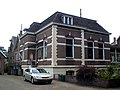
house in Oude IJsselstreek, Netherlands  | |||||
| Upload media | |||||
| Instance of | |||||
|---|---|---|---|---|---|
| Part of | |||||
| Location | Terborg, Gelderland, Netherlands | ||||
| Street address |
| ||||
| Located on street |
| ||||
| Heritage designation |
| ||||
 | |||||
Nederlands: Slagerij, Fabriek
|
This is a category about rijksmonumentcomplex number 515471
|
|
This is a category about rijksmonument number 515472
|
|
This is a category about rijksmonument number 515473
|
| Address |
|
Media in category "Stationsweg 6, Terborg"
The following 4 files are in this category, out of 4 total.
-
 Koetshuis met worstmakerij annex spekslagerij.JPG 2,292 × 1,828; 858 KB
-

-

-
 Worstmakerij annex spekslagerij en bijbehorend woonhuis.JPG 3,072 × 2,304; 1.63 MB


