Category:Stawell, Somerset
Jump to navigation
Jump to search
English: Stawell is a village and civil parish north west of Moorlinch, in the Sedgemoor district of Somerset, England.
village and parish in Somerset, England  | |||||
| Upload media | |||||
| Instance of | |||||
|---|---|---|---|---|---|
| Location | Sedgemoor, Somerset, South West England, England | ||||
| Different from | |||||
 | |||||
Subcategories
This category has the following 2 subcategories, out of 2 total.
S
Media in category "Stawell, Somerset"
The following 101 files are in this category, out of 101 total.
-
 A39 junction with Holy Well Road - geograph.org.uk - 5475688.jpg 1,600 × 1,198; 697 KB
-
 A39 near Chilton Polden - geograph.org.uk - 3801990.jpg 640 × 480; 292 KB
-
 A39, Bath Road near Catcott - geograph.org.uk - 3801995.jpg 640 × 480; 301 KB
-
 A39, Cock Hill - geograph.org.uk - 3801993.jpg 640 × 480; 307 KB
-
 Arable land, Sutton Hams - geograph.org.uk - 2521982.jpg 640 × 480; 94 KB
-
 Box pews in Sutton Mallet church - geograph.org.uk - 4634878.jpg 3,456 × 2,304; 1.21 MB
-
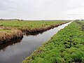
 Cattle and the King's Sedgemoor Drain - geograph.org.uk - 2990069.jpg 640 × 480; 131 KB
-
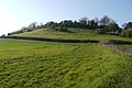
 Cattle on Socombe Hill - geograph.org.uk - 5034521.jpg 1,024 × 768; 212 KB
-
 Chilton Priory - geograph.org.uk - 5475694.jpg 1,600 × 1,279; 817 KB
-
 Chilton Priory on Cock Hill - geograph.org.uk - 2628507.jpg 800 × 600; 401 KB
-
 Church and steps into churchyard, Sutton Mallet - geograph.org.uk - 4735689.jpg 1,920 × 2,560; 1,008 KB
-
 Churchyard flowers, Sutton Mallet - geograph.org.uk - 4735677.jpg 2,340 × 2,862; 912 KB
-
 Churchyard, Sutton Mallet - geograph.org.uk - 4735824.jpg 1,920 × 1,424; 571 KB
-
 Cossington Right Rhyne - geograph.org.uk - 2529194.jpg 640 × 480; 162 KB
-
 Cottage at Nino's Dairy Farm - geograph.org.uk - 5034501.jpg 1,024 × 768; 205 KB
-
 Cottage on Stawell Road - geograph.org.uk - 5034388.jpg 1,024 × 865; 182 KB
-
 Cottages on Moor Road - geograph.org.uk - 5034504.jpg 1,024 × 768; 193 KB
-
 Crook Hill - geograph.org.uk - 4464780.jpg 640 × 428; 68 KB
-
 Crossroads at Righton's Grave - geograph.org.uk - 1628215.jpg 640 × 480; 102 KB
-
 Crossroads on Moor Road - geograph.org.uk - 5034512.jpg 1,024 × 768; 200 KB
-
 Elm Tree Farm - geograph.org.uk - 5034393.jpg 1,024 × 870; 267 KB
-

-
 Farmland near Sutton Mallet - geograph.org.uk - 4455675.jpg 1,920 × 970; 335 KB
-
 Field at Flichett - geograph.org.uk - 4464803.jpg 640 × 428; 76 KB
-
 Footbridge on Moor Road - geograph.org.uk - 5034433.jpg 1,024 × 768; 259 KB
-
 From the churchyard, Stawell - geograph.org.uk - 4446811.jpg 1,920 × 1,440; 769 KB
-
 House at Stawell - geograph.org.uk - 4464832.jpg 640 × 428; 75 KB
-
 House on Moor Road - geograph.org.uk - 5034497.jpg 1,024 × 768; 225 KB
-
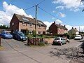 Houses on Church Road - geograph.org.uk - 5034441.jpg 1,024 × 768; 179 KB
-
 Junction on Roman Road - geograph.org.uk - 5034526.jpg 1,024 × 768; 172 KB
-
 King's Sedgemoor Drain - geograph.org.uk - 2529198.jpg 640 × 359; 90 KB
-
 King's Sedgemoor Drain - geograph.org.uk - 2529211.jpg 640 × 359; 58 KB
-
 King's Sedgemoor Drain - geograph.org.uk - 5034350.jpg 1,024 × 768; 318 KB
-
 King's Sedgemoor Drain - geograph.org.uk - 5053503.jpg 1,024 × 768; 242 KB
-
 King's Sedgemoor Drain - geograph.org.uk - 5053506.jpg 1,024 × 833; 229 KB
-
 King's Sedgemoor Drain - geograph.org.uk - 5229517.jpg 4,160 × 2,340; 2.67 MB
-
 King's Sedgemoor Drain - geograph.org.uk - 5283614.jpg 1,024 × 783; 200 KB
-
 King's Sedgemoor Drain at Parchey Bridge - geograph.org.uk - 4455665.jpg 2,105 × 2,726; 1.02 MB
-

-
 Lane across the flat landscape - geograph.org.uk - 5499339.jpg 640 × 480; 155 KB
-
 Lane junction - geograph.org.uk - 5499347.jpg 640 × 480; 162 KB
-
 Lane junction - geograph.org.uk - 5499352.jpg 640 × 480; 162 KB
-
 Little Godfreys - geograph.org.uk - 5034438.jpg 1,024 × 851; 255 KB
-
 Looking across the moors from Cock Hill - geograph.org.uk - 2628494.jpg 800 × 600; 363 KB
-

-
 Looking towards Billicombe Wood - geograph.org.uk - 5034539.jpg 1,024 × 768; 209 KB
-
 Manor Farm - geograph.org.uk - 5034390.jpg 1,024 × 768; 207 KB
-
 Manor, Stawell - geograph.org.uk - 4455762.jpg 2,784 × 1,648; 687 KB
-
 Moor Road - geograph.org.uk - 4455677.jpg 1,920 × 1,227; 543 KB
-
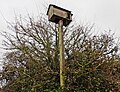 Nesting Box, beside King's Sedgemoor Drain - geograph.org.uk - 5283605.jpg 1,024 × 783; 313 KB
-
 Path across Stawell Moor - geograph.org.uk - 1628196.jpg 640 × 480; 93 KB
-
 Path to Sutton Mallett - geograph.org.uk - 5053507.jpg 1,024 × 768; 223 KB
-
 Pendon Hill - geograph.org.uk - 1628192.jpg 640 × 480; 99 KB
-
 Pendon Hill - geograph.org.uk - 4446799.jpg 1,920 × 1,210; 452 KB
-
 Pendon Hill - geograph.org.uk - 4465005.jpg 640 × 428; 87 KB
-
 Pendon Hill - geograph.org.uk - 4735828.jpg 1,920 × 1,333; 677 KB
-
 Pendon Hill - geograph.org.uk - 5034383.jpg 1,024 × 768; 295 KB
-
 Please walk slowly - geograph.org.uk - 2521970.jpg 640 × 480; 125 KB
-
 Rhyne on West Moor, near Parchey - geograph.org.uk - 1456926.jpg 640 × 480; 127 KB
-
 Rhyne, east of King's Sedgemoor Drain - geograph.org.uk - 5284135.jpg 1,024 × 768; 179 KB
-
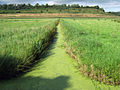
 Rhyne, Moor Road - geograph.org.uk - 2521987.jpg 640 × 480; 114 KB
-
 Rhyne, West Moor - geograph.org.uk - 2529167.jpg 640 × 497; 106 KB
-
 River and tree near Chedzoy - geograph.org.uk - 1978979.jpg 640 × 480; 164 KB
-
 Road across West Moor - geograph.org.uk - 4455672.jpg 2,726 × 1,815; 852 KB
-
 Roadside drainage ditch on West Moor - geograph.org.uk - 1628200.jpg 640 × 480; 109 KB
-
 Roller beneath the Polden Hills - geograph.org.uk - 2521928.jpg 640 × 480; 119 KB
-
 Samaritan's Way South West - geograph.org.uk - 4634882.jpg 2,304 × 3,456; 2.09 MB
-
 Sedgemoor , Grassy Field - geograph.org.uk - 2997730.jpg 4,288 × 2,848; 4.65 MB
-
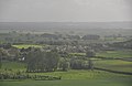 Sedgemoor , Stawell Scenery - geograph.org.uk - 2997731.jpg 4,218 × 2,740; 3.72 MB
-
 Sharp bend on Moor Road - geograph.org.uk - 5034434.jpg 1,024 × 768; 263 KB
-
 Sluice on Rhyne, West Moor - geograph.org.uk - 5283597.jpg 1,024 × 786; 220 KB
-
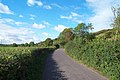
 Somerset country lane - geograph.org.uk - 1306925.jpg 640 × 480; 175 KB
-
 Somerset country lane - geograph.org.uk - 1306930.jpg 640 × 480; 172 KB
-
 Stawell. View from Chilton Priory, Chilton Polden, Somerset.jpg 4,876 × 2,470; 2.12 MB
-
 Sutton Mallet Church - geograph.org.uk - 5034445.jpg 1,024 × 768; 193 KB
-
 Sutton Moor - geograph.org.uk - 2521975.jpg 640 × 480; 95 KB
-
 The east end of Pendon Hill - geograph.org.uk - 5499343.jpg 640 × 480; 187 KB
-
 The edge of Stawell - geograph.org.uk - 5499349.jpg 640 × 480; 182 KB
-
 The King's Sedgemoor Drain - geograph.org.uk - 1456943.jpg 640 × 480; 118 KB
-
 The King's Sedgemoor Drain - geograph.org.uk - 1456948.jpg 640 × 480; 127 KB
-

-
 The Olive Mill restaurant - geograph.org.uk - 5475699.jpg 1,600 × 1,200; 776 KB
-
 The road through Stawell, looking east - geograph.org.uk - 5499344.jpg 640 × 480; 168 KB
-
 Tower Road seen from the A39 and valley below - geograph.org.uk - 5475697.jpg 1,600 × 962; 597 KB
-
 Track to Moorlinch - geograph.org.uk - 5284142.jpg 1,024 × 741; 275 KB
-
 Turning for Innsmead Lane - geograph.org.uk - 5034514.jpg 1,024 × 768; 206 KB
-
 Turning for Priory Road - geograph.org.uk - 4907851.jpg 1,024 × 834; 236 KB
-
 View south from Cock Hill - geograph.org.uk - 1012284.jpg 640 × 480; 80 KB
-
 Village Street, Stawell - geograph.org.uk - 4735862.jpg 1,920 × 1,440; 610 KB
-
 Ward Lane and rhyne - geograph.org.uk - 2529177.jpg 640 × 451; 100 KB
-
 West Moor - geograph.org.uk - 2529182.jpg 640 × 480; 128 KB
-
 West Moor - geograph.org.uk - 2529186.jpg 640 × 480; 97 KB
-
 West Moor - geograph.org.uk - 4440909.jpg 640 × 480; 133 KB
-
 West Moor - geograph.org.uk - 4735670.jpg 2,112 × 2,816; 1.38 MB
-
 Wheat field below Pendon Hill - geograph.org.uk - 5034385.jpg 1,024 × 768; 267 KB
-
 An abundance of mauve and white violets - geograph.org.uk - 1012278.jpg 640 × 480; 158 KB
-
 Billicombe Lane, Moorlinch - geograph.org.uk - 253059.jpg 640 × 425; 85 KB
-
 Field from A39 - geograph.org.uk - 191053.jpg 640 × 426; 114 KB
-
 Pendon Hill - geograph.org.uk - 191066.jpg 640 × 426; 95 KB
-
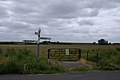 Signpost on West Moor - geograph.org.uk - 191063.jpg 640 × 426; 99 KB
-
 The Polden Hills - geograph.org.uk - 253062.jpg 640 × 425; 66 KB


