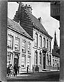
Category:Steenstraat 30, Hulst
Jump to navigation
Jump to search
| Object location | | View all coordinates using: OpenStreetMap |
|---|
building in Hulst, Netherlands  | |||||
| Upload media | |||||
| Instance of | |||||
|---|---|---|---|---|---|
| Location | Hulst, Zeeland, Netherlands | ||||
| Street address |
| ||||
| Located on street | |||||
| Heritage designation |
| ||||
 | |||||
|
This is a category about rijksmonument number 22785
|
| Address |
|
Media in category "Steenstraat 30, Hulst"
The following 9 files are in this category, out of 9 total.
-
 En ingangspartij - Hulst - 20118946 - RCE.jpg 1,007 × 1,200; 319 KB
-
 En ingangspartij - Hulst - 20118947 - RCE.jpg 971 × 1,200; 257 KB
-
 Hulst - rijksmonument 22785 - Steenstraat 30 20120714.jpg 800 × 569; 197 KB
-
 Inrijpoort - Hulst - 20118944 - RCE.jpg 1,200 × 808; 270 KB
-
 Koetshuis - Hulst - 20118945 - RCE.jpg 1,200 × 808; 280 KB
-
 N2 Houses-Hulst-002.jpg 1,200 × 1,600; 169 KB
-
 Overzicht voorgevels - Hulst - 20352993 - RCE.jpg 1,181 × 1,200; 289 KB
-
 Voorgevel - Hulst - 20118943 - RCE.jpg 814 × 1,200; 223 KB
-
 Voorgevels - Hulst - 20118948 - RCE.jpg 943 × 1,200; 269 KB


