Category:Stevenston (civil parish)
Jump to navigation
Jump to search
Scottish parish in North Ayrshire, Scotland, UK | |||||
| Upload media | |||||
| Instance of | |||||
|---|---|---|---|---|---|
| Part of |
| ||||
| Named after | |||||
| Location |
| ||||
| Population |
| ||||
| Area |
| ||||
 | |||||
Media in category "Stevenston (civil parish)"
The following 200 files are in this category, out of 584 total.
(previous page) (next page)-
 "The Big Idea" Irvine - geograph.org.uk - 6597565.jpg 2,976 × 1,984; 1.94 MB
-
 "The Big Idea" Irvine - geograph.org.uk - 6597681.jpg 2,976 × 1,984; 2.99 MB
-
 "The Big Idea", Irvine - geograph.org.uk - 6597562.jpg 2,976 × 1,984; 2.31 MB
-
 A Minor Road at Saltcoats - geograph.org.uk - 4907754.jpg 1,920 × 1,280; 1.16 MB
-
 A retail park in Stevenston - geograph.org.uk - 5278605.jpg 1,024 × 682; 109 KB
-
 A.W. Blair ^ Sons - Saltcoats - geograph.org.uk - 5928725.jpg 1,600 × 1,067; 1.19 MB
-
 A1 Fast Fit Ltd - Stevenston - geograph.org.uk - 6041493.jpg 1,600 × 1,067; 1.32 MB
-
 A78 lay by near Greenhead - geograph.org.uk - 3069570.jpg 640 × 467; 37 KB
-
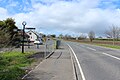
 A78 near Stevenston - geograph.org.uk - 6342807.jpg 800 × 533; 564 KB
-
 A78 roundabout from A738 - geograph.org.uk - 3069557.jpg 640 × 440; 64 KB
-
 A78 Stevenstone by pass - geograph.org.uk - 3069562.jpg 640 × 392; 32 KB
-
 Abandoned Building, Ardeer Peninsula - geograph.org.uk - 3773281.jpg 1,600 × 1,067; 467 KB
-
 Abandoned Structure, Ardeer Peninsula - geograph.org.uk - 3773230.jpg 5,184 × 3,456; 7.24 MB
-
 Abandoned Structure, Ardeer Peninsula - geograph.org.uk - 3773239.jpg 5,184 × 3,456; 7.68 MB
-
 Adelaide College, Saltcoats - geograph.org.uk - 3379067.jpg 5,184 × 3,456; 6.11 MB
-
 Adelaide College, Saltcoats - geograph.org.uk - 3570692.jpg 5,184 × 3,456; 7.53 MB
-
 Afton Road, Stevenston - geograph.org.uk - 4934994.jpg 1,920 × 1,280; 1.48 MB
-
 Albion Bar - Saltcoats - geograph.org.uk - 5776837.jpg 1,600 × 1,067; 1.3 MB
-

-
 Alfred Nobel explosives factory, Ardeer - geograph.org.uk - 3424397.jpg 640 × 390; 114 KB
-
-

-

-
 Allure - Stevenston - geograph.org.uk - 6115916.jpg 1,600 × 1,066; 1.14 MB
-
 Amanda's Tanning ^ Beauty - Saltcoats - geograph.org.uk - 5792686.jpg 1,600 × 1,200; 1.38 MB
-
 Amusement arcade by Saltcoats Harbour - geograph.org.uk - 6441946.jpg 2,048 × 1,536; 2.15 MB
-
 Anchor at Iceland - geograph.org.uk - 4908503.jpg 1,920 × 1,280; 1.46 MB
-
 Anchor on the Promenade - geograph.org.uk - 4908513.jpg 1,920 × 1,280; 1.25 MB
-
 Anchor Sculpture, Saltcoats - geograph.org.uk - 4910117.jpg 1,920 × 1,280; 1.76 MB
-
 Ancient farm track and ford - geograph.org.uk - 2982465.jpg 1,600 × 1,200; 459 KB
-
 Approaching A738 roundabout - geograph.org.uk - 3998388.jpg 640 × 431; 37 KB
-
 Approaching Lundholm Road, Stevenston - geograph.org.uk - 4934710.jpg 1,920 × 1,280; 1.19 MB
-
 Approaching Saltcoats - geograph.org.uk - 4907660.jpg 1,920 × 1,280; 1.38 MB
-
 Approaching Sharphill roundabout - geograph.org.uk - 3069571.jpg 640 × 474; 39 KB
-
 Approaching Stevenston roundabout - geograph.org.uk - 1860419.jpg 640 × 480; 44 KB
-
 Approaching the A738 - geograph.org.uk - 5269764.jpg 2,592 × 1,728; 2.41 MB
-
 Arable Land at Stevenston - geograph.org.uk - 4934841.jpg 1,920 × 1,280; 1.54 MB
-
 Arable Land at Stevenston - geograph.org.uk - 4934843.jpg 1,920 × 1,280; 1.66 MB
-
 Archies Turkish Barbers - Saltcoats - geograph.org.uk - 5792691.jpg 900 × 1,200; 844 KB
-
 Archway to Stevenston High Kirk - geograph.org.uk - 4933622.jpg 1,873 × 1,201; 562 KB
-
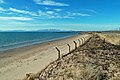
 Ardeer Beach - geograph.org.uk - 5232075.jpg 2,026 × 1,522; 275 KB
-
 Ardeer Beach - Stevenston - geograph.org.uk - 5665915.jpg 4,207 × 3,218; 4.94 MB
-
 Ardeer Beach - Stevenston - geograph.org.uk - 5666086.jpg 4,139 × 3,155; 3.72 MB
-
 Ardeer Beach - The Stevenston Ironworks - geograph.org.uk - 5668943.jpg 4,320 × 3,240; 2.24 MB
-
 Ardeer Beach - The Stevenston Ironworks - geograph.org.uk - 5668961.jpg 4,073 × 3,119; 2.21 MB
-
 Ardeer Beach View - geograph.org.uk - 5718356.jpg 640 × 426; 91 KB
-
 Ardeer Beach View - geograph.org.uk - 5718382.jpg 640 × 417; 89 KB
-
 Ardeer Beach ^ Dunes - geograph.org.uk - 3832449.jpg 1,600 × 1,067; 406 KB
-
 Ardeer Beach ^ Sea Defence Erosion - geograph.org.uk - 3832253.jpg 1,600 × 1,067; 413 KB
-
 Ardeer Beach ^ Sea Defence Erosion - geograph.org.uk - 3832270.jpg 1,600 × 1,067; 462 KB
-
 Ardeer Beach ^ Sea Defences - geograph.org.uk - 3832262.jpg 5,184 × 3,456; 7.67 MB
-
 Ardeer Beach ^ Sea Defences - geograph.org.uk - 3832276.jpg 1,600 × 1,067; 539 KB
-
 Ardeer Beach ^ Sea Defences - geograph.org.uk - 3832440.jpg 1,600 × 1,067; 462 KB
-
 Ardeer Beach, Sea Defences ^ Dunes - geograph.org.uk - 3832466.jpg 5,184 × 3,456; 7.49 MB
-
 Ardeer Golf Club - geograph.org.uk - 2404383.jpg 640 × 358; 81 KB
-
 Ardeer Halls, Stevenston - geograph.org.uk - 3510728.jpg 5,184 × 3,456; 6.85 MB
-
 Ardeer Halls, Stevenston - geograph.org.uk - 4933972.jpg 1,868 × 1,197; 326 KB
-
 Ardeer Halls, Stevenston - geograph.org.uk - 4933983.jpg 1,920 × 1,280; 1.25 MB
-
 Ardeer Industrial Site - geograph.org.uk - 5718348.jpg 640 × 432; 93 KB
-
 Ardeer Mains - geograph.org.uk - 5718444.jpg 640 × 414; 110 KB
-
 Ardeer Parish Church Tower, Stevenston - geograph.org.uk - 4933995.jpg 1,280 × 1,920; 1.16 MB
-
 Ardeer Parish Church Tower, Stevenston - geograph.org.uk - 4934005.jpg 1,188 × 1,827; 294 KB
-
 Ardeer Parish Church, Stevenston - geograph.org.uk - 3510379.jpg 5,184 × 3,456; 7.75 MB
-
 Ardeer Parish Church, Stevenston - geograph.org.uk - 4933987.jpg 1,873 × 1,203; 422 KB
-
 Ardeer Parish Church, Stevenston - geograph.org.uk - 4933989.jpg 1,860 × 1,181; 502 KB
-
 Ardeer Parish Church, Stevenston - geograph.org.uk - 4934002.jpg 1,920 × 1,280; 1.53 MB
-
 Ardeer Parish Church, Stevenston - geograph.org.uk - 4934003.jpg 1,852 × 1,225; 326 KB
-
 Ardeer Park, Stevenston - geograph.org.uk - 3773201.jpg 1,600 × 1,067; 924 KB
-
 Ardeer Picnic - geograph.org.uk - 5718336.jpg 640 × 387; 90 KB
-
 Ardeer Quarry - geograph.org.uk - 5718506.jpg 640 × 416; 80 KB
-
 Ardeer Quarry View - geograph.org.uk - 5718510.jpg 640 × 432; 100 KB
-
 Ardeer Sandhills - geograph.org.uk - 3773268.jpg 1,600 × 1,067; 429 KB
-
 Ardeer Sandhills ^ Woodland - geograph.org.uk - 3832674.jpg 5,184 × 3,456; 7.41 MB
-
 Ardeer Sandhills ^ Woodland - geograph.org.uk - 3832682.jpg 5,184 × 3,456; 6.31 MB
-
 Ardeer Sandhills ^ Woodland - geograph.org.uk - 3832711.jpg 5,184 × 3,456; 7.5 MB
-
 Ardeer Sea Defences ^ Dunes - geograph.org.uk - 3832463.jpg 1,600 × 1,067; 563 KB
-
 Ardeer Stadium, Stevenston - geograph.org.uk - 3510458.jpg 1,600 × 1,067; 830 KB
-
 Ardeer View - geograph.org.uk - 5718341.jpg 640 × 370; 89 KB
-
 Ardoch Crescent, Stevenston - geograph.org.uk - 4934674.jpg 1,920 × 1,280; 1.66 MB
-
 Arriving at Stevenston - geograph.org.uk - 5269790.jpg 2,592 × 1,728; 2.48 MB
-
 Ashgrove Loch Crannog - geograph.org.uk - 1820032.jpg 640 × 479; 85 KB
-
 At Ardeer Quarry - geograph.org.uk - 5718515.jpg 640 × 424; 133 KB
-
 Auchenharvie Driving Range - Stevenston - geograph.org.uk - 6131324.jpg 1,600 × 1,200; 1.27 MB
-
 Auchenharvie Park - geograph.org.uk - 5277691.jpg 4,228 × 3,228; 1.54 MB
-
 Ayrshire Alloys - Saltcoats - geograph.org.uk - 5928627.jpg 1,600 × 1,067; 1.14 MB
-
 Ayrshire Coastal Path - geograph.org.uk - 4934799.jpg 1,920 × 1,280; 1.23 MB
-
 B P I Visqueen Industrial-Ardeer - geograph.org.uk - 5666382.jpg 4,320 × 3,240; 3.59 MB
-
 B752 approaching Kilwinning Road - geograph.org.uk - 4934833.jpg 1,920 × 1,280; 1.57 MB
-
 B752 at Stevenston - geograph.org.uk - 4934739.jpg 1,920 × 1,280; 1.05 MB
-
 B752 at Stevenston - geograph.org.uk - 4934758.jpg 1,920 × 1,280; 1.58 MB
-
 B752 at Stevenston - geograph.org.uk - 4934816.jpg 1,920 × 1,280; 1.86 MB
-
 B752 at Stevenston - geograph.org.uk - 4934839.jpg 1,920 × 1,280; 1.61 MB
-
 B752 at Stevenston - geograph.org.uk - 4934865.jpg 1,920 × 1,280; 1.77 MB
-
 B752 to the A738 - geograph.org.uk - 4934735.jpg 1,920 × 1,280; 1.13 MB
-
 B752 to the A738 - geograph.org.uk - 4934747.jpg 1,920 × 1,280; 1.34 MB
-
 B752 to the A738 - geograph.org.uk - 4934774.jpg 1,920 × 1,280; 1.3 MB
-
 B752 to the A738 - geograph.org.uk - 4934790.jpg 1,920 × 1,280; 1.42 MB
-
 Baba's Babywear, Gifts ^ Cards - Saltcoats - geograph.org.uk - 5776863.jpg 800 × 1,200; 761 KB
-
 Barnett Crescent, Saltcoats - geograph.org.uk - 4907734.jpg 1,920 × 1,280; 1.12 MB
-
 Barrhead Travel - Saltcoats - geograph.org.uk - 5776320.jpg 1,600 × 1,067; 1.32 MB
-
 Beanstalk - Saltcoats - geograph.org.uk - 5776824.jpg 800 × 1,200; 760 KB
-
 Bell Tower, Livingstone Parish Church, Stevenston - geograph.org.uk - 4933765.jpg 1,280 × 1,920; 837 KB
-
 Best Hand Car Wash ^ Valeting Centre - Saltcoats - geograph.org.uk - 6204653.jpg 1,600 × 1,067; 1.08 MB
-
 Big Idea ^ Bridge of Scottish Invention - geograph.org.uk - 3832610.jpg 5,184 × 3,456; 7.36 MB
-
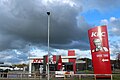 Black Sky over KFC - geograph.org.uk - 5269796.jpg 2,592 × 1,728; 1.55 MB
-
 Blondie's Bar, Stevenston - geograph.org.uk - 3510376.jpg 5,184 × 3,456; 7.7 MB
-
 Bluebells, Stevenston - geograph.org.uk - 4933636.jpg 1,920 × 1,280; 2.86 MB
-
 Bobby Lennox statue - geograph.org.uk - 6011822.jpg 640 × 853; 207 KB
-
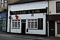
 Bobby's Bar - Saltcoats - geograph.org.uk - 5735984.jpg 1,600 × 1,067; 1.16 MB
-
 Bobby's Bar, Saltcoats - geograph.org.uk - 4910111.jpg 1,920 × 1,280; 1.05 MB
-
 Bobby's Bar, Saltcoats - geograph.org.uk - 6012347.jpg 608 × 853; 152 KB
-
 Boglemart Street, Stevenston - geograph.org.uk - 3510525.jpg 5,184 × 3,456; 6.41 MB
-
 Boglemart Street, Stevenston - geograph.org.uk - 3510672.jpg 1,600 × 1,067; 439 KB
-
 Boglemart Street, Stevenston - geograph.org.uk - 6043937.jpg 2,976 × 1,984; 882 KB
-
 Bombay Blue - Saltcoats - geograph.org.uk - 5776892.jpg 1,600 × 1,067; 1.18 MB
-
 Bonnie Lesley Memorial - Stevenston - geograph.org.uk - 5895758.jpg 2,627 × 3,503; 4.26 MB
-
 BPI Visqueen Industrial-Ardeer - geograph.org.uk - 5666147.jpg 4,320 × 3,240; 6.16 MB
-
 Bradshaw Nursery, Saltcoats - geograph.org.uk - 3379069.jpg 5,184 × 3,456; 6.78 MB
-
 Bradshaw Street at Quay Street - geograph.org.uk - 6012329.jpg 853 × 790; 205 KB
-
 Bridge of Scottish Invention - geograph.org.uk - 3832593.jpg 1,600 × 1,067; 477 KB
-
 Bridge of Scottish Invention - The Big Idea - Irvine - geograph.org.uk - 5668300.jpg 4,320 × 3,240; 4.93 MB
-
 Bridge over River Garnock - geograph.org.uk - 3773253.jpg 1,600 × 1,067; 505 KB
-
 Bridge over River Garnock - geograph.org.uk - 3773258.jpg 1,600 × 1,067; 477 KB
-

-

-
 Bridge over the River Garnock - geograph.org.uk - 3792594.jpg 4,608 × 3,456; 4.12 MB
-
 Broom Farm Riding School, Stevenston - geograph.org.uk - 3773214.jpg 1,600 × 1,067; 634 KB
-

-
 Bus Stops and Shelters, Stevenston - geograph.org.uk - 4935063.jpg 1,920 × 1,280; 1.39 MB
-
 B^m at Hawkhill Retail Park, Stevenston - geograph.org.uk - 6043931.jpg 2,976 × 1,984; 2.43 MB
-
 B^M Superstore - geograph.org.uk - 5510712.jpg 1,600 × 1,067; 1.05 MB
-
 B^Q at Hawkhill Retail Park, Stevenston - geograph.org.uk - 6043928.jpg 2,976 × 1,984; 2.5 MB
-
 B^Q at Hawkhill Retail Park, Stevenston - geograph.org.uk - 6043930.jpg 2,976 × 1,984; 2.47 MB
-
 B^Q DIY Superstore - geograph.org.uk - 5510717.jpg 1,600 × 1,067; 1.05 MB
-
 Cafe at the Station - geograph.org.uk - 4910129.jpg 1,854 × 1,200; 400 KB
-
 Caledonian Road, Stevenston - geograph.org.uk - 4933999.jpg 1,920 × 1,280; 1.57 MB
-
 Caledonian Road, Stevenston - geograph.org.uk - 4934658.jpg 1,920 × 1,280; 1.47 MB
-
 Caledonian Road, Stevenston - geograph.org.uk - 4934664.jpg 1,920 × 1,280; 1.36 MB
-
 Caledonian Road, Stevenston - geograph.org.uk - 4934692.jpg 1,920 × 1,280; 1.3 MB
-
 Caledonian Road, Stevenston - geograph.org.uk - 4934700.jpg 1,920 × 1,280; 1.3 MB
-
 Caledonian Road, Stevenston - geograph.org.uk - 4934723.jpg 1,920 × 1,280; 1.13 MB
-
 Campbell Avenue - geograph.org.uk - 4235870.jpg 640 × 480; 44 KB
-
 Canal Crescent, Stevenston - geograph.org.uk - 4933821.jpg 1,920 × 1,280; 1.38 MB
-
 Canal Street, Saltcoats - geograph.org.uk - 4907737.jpg 1,920 × 1,280; 1.11 MB
-
 Capped Deep Shank Pit, Stevenston Burn, North Ayrshire.jpg 4,896 × 2,752; 5.02 MB
-
 Car Park at The Red Squirrel, Stevenston - geograph.org.uk - 5269802.jpg 2,592 × 1,728; 2.04 MB
-
 Car Park at The Red Squirrel, Stevenston - geograph.org.uk - 5269803.jpg 2,592 × 1,728; 1.83 MB
-
 Card Factory - Saltcoats - geograph.org.uk - 5776362.jpg 1,600 × 1,067; 1.38 MB
-
 Carment Drive, Stevenston - geograph.org.uk - 4934651.jpg 1,920 × 1,280; 1.39 MB
-
 Church of St John the Evangelist - Stevenston - geograph.org.uk - 5792718.jpg 1,600 × 1,200; 1.19 MB
-
 Clock Tower, Stevenston High Kirk - geograph.org.uk - 4933620.jpg 1,920 × 1,280; 865 KB
-
 Coastal Erosion at Ardeer - geograph.org.uk - 5718374.jpg 640 × 394; 69 KB
-
 Costa Coffee - geograph.org.uk - 5510698.jpg 1,600 × 1,067; 977 KB
-
 Cottages on Moorpark Road East, Stevenston - geograph.org.uk - 3510446.jpg 1,600 × 1,067; 495 KB
-
 Countess Amusements - Saltcoats at Night - geograph.org.uk - 5735986.jpg 1,600 × 1,067; 1.25 MB
-
 Countess Street, Saltcoats - geograph.org.uk - 4910124.jpg 1,920 × 1,280; 1.38 MB
-
 Dead Elm tree festooned with crown galls, Stevenston, North Ayrshire.jpg 4,896 × 2,752; 3.37 MB
-
 Dead wood, Stevenston Burn - geograph.org.uk - 822708.jpg 480 × 640; 191 KB
-
 Debra Charity Shop - Stevenston - geograph.org.uk - 6188279.jpg 1,200 × 900; 301 KB
-
 Derelict building - geograph.org.uk - 3791913.jpg 4,608 × 3,456; 4.75 MB
-
 Derelict building - geograph.org.uk - 4263641.jpg 640 × 426; 76 KB
-
 Derelict building - geograph.org.uk - 4263646.jpg 640 × 426; 97 KB
-
 Derelict Cottage, Stevenston - geograph.org.uk - 4933625.jpg 1,920 × 1,280; 2.41 MB
-
 Derelict Power Station - geograph.org.uk - 4263651.jpg 640 × 426; 43 KB
-
 Disused Power Station Ardeer - geograph.org.uk - 3798244.jpg 2,048 × 1,536; 814 KB
-
 Domino's Pizza - geograph.org.uk - 5885464.jpg 1,600 × 1,067; 1.11 MB
-
 Dual Carriageway - geograph.org.uk - 4365558.jpg 640 × 480; 46 KB
-
 Dunes above Ardeer Beach, Ayrshire - geograph.org.uk - 6515083.jpg 1,946 × 1,116; 646 KB
-
 Dunes and Beach at Ardeer - geograph.org.uk - 5718365.jpg 640 × 412; 97 KB
-
 Elm tree with crown galls, Stevenston, North Ayrshire.jpg 4,896 × 2,752; 3 MB
-
 End of the Pier, Saltcoats - geograph.org.uk - 4907858.jpg 1,920 × 1,280; 1.28 MB
-
 Entrance into KFC Car Park - geograph.org.uk - 5269761.jpg 2,592 × 1,728; 1.93 MB
-
 Entrance to Hawkhill Cemetery - geograph.org.uk - 4934879.jpg 1,920 × 1,280; 1.48 MB
-
 Entrance to Lidl Car Park, Stevenston - geograph.org.uk - 6043940.jpg 2,976 × 1,984; 2.54 MB
-
 Evolution Skatepark - Saltcoats - geograph.org.uk - 6137788.jpg 1,600 × 1,067; 1.16 MB
-
 Exit from Schoolwell Street Car Park - geograph.org.uk - 4935086.jpg 1,920 × 1,280; 1.36 MB
-
 Farmfoods - Saltcoats - geograph.org.uk - 5792648.jpg 1,600 × 1,200; 1.61 MB
-
 Farmland at Middlepart - geograph.org.uk - 4907652.jpg 1,920 × 1,280; 1.4 MB
-
 Farmland at Middlepart - geograph.org.uk - 4907654.jpg 1,920 × 1,280; 1.4 MB
-
 Farmland at Middlepart - geograph.org.uk - 4907656.jpg 1,920 × 1,280; 1.52 MB
-
 Farmland at Middlepart - geograph.org.uk - 4907662.jpg 1,920 × 1,280; 1.25 MB
-
 Farmland at Saltcoats - geograph.org.uk - 4907663.jpg 1,920 × 1,280; 1.29 MB
-
 Farmland near Greenhead - geograph.org.uk - 3492955.jpg 1,920 × 1,280; 1.08 MB
-
 Farmland, near Stevenston - geograph.org.uk - 823556.jpg 640 × 480; 66 KB
-
 Fields beside the A78 - geograph.org.uk - 4951247.jpg 3,504 × 2,336; 3.37 MB
-
 Fiery sky, Stevenston - geograph.org.uk - 823527.jpg 640 × 480; 67 KB
-
 Findlay's Brae, Saltcoats - geograph.org.uk - 4907759.jpg 1,920 × 1,280; 1.22 MB
-
 Footbridge to Seaview Road - geograph.org.uk - 4907732.jpg 1,920 × 1,280; 1.25 MB
-
 Former Museum,The Big Idea, Irvine - geograph.org.uk - 3785567.jpg 640 × 480; 79 KB
-
 Former Museum,The Big Idea, Irvine - geograph.org.uk - 3785573.jpg 640 × 480; 80 KB
-

-
 Former Security Fencing at Ardeer - geograph.org.uk - 5718388.jpg 640 × 426; 103 KB
-
 Former Stevenston Free Church - geograph.org.uk - 3510510.jpg 5,184 × 3,456; 6.78 MB
-
 Fraser's Travel - Saltcoats - geograph.org.uk - 5776329.jpg 1,600 × 1,067; 1.18 MB
-
 Gallagher Pharmacy - Saltcoats - geograph.org.uk - 5776357.jpg 1,600 × 1,067; 1.22 MB
-
 Gallery 57 - Saltcoats - geograph.org.uk - 5776332.jpg 1,600 × 1,067; 1.19 MB
-
 Garden City Blinds - Saltcoats - geograph.org.uk - 5928617.jpg 1,600 × 1,067; 1.25 MB
-
 Garnock Road, Stevenston - geograph.org.uk - 4934949.jpg 1,920 × 1,280; 2.16 MB
-
 Garven Road, Stevenston - geograph.org.uk - 4934685.jpg 1,920 × 1,280; 1.31 MB
-
 Gate into a field - geograph.org.uk - 4951279.jpg 3,504 × 2,336; 3.88 MB


_-_Stevenston_-_geograph.org.uk_-_6131311.jpg)


&filefrom=Gateway+to+Hawkhill+Cemetery+-+geograph.org.uk+-+4934882.jpg#mw-category-media)