Category:Stift Steterburg
Jump to navigation
Jump to search
| Object location | | View all coordinates using: OpenStreetMap |
|---|
| Upload media | |||||
| Instance of |
| ||||
|---|---|---|---|---|---|
| Location | Salzgitter, Lower Saxony, Germany | ||||
| Dissolved, abolished or demolished date |
| ||||
 | |||||
Deutsch: Das ehemalige lutherische Damenstift Steterburg, 1938 aufgelöst.
Media in category "Stift Steterburg"
The following 25 files are in this category, out of 25 total.
-
 Braunschweig Lüneburg (Merian) 302.jpg 2,000 × 2,995; 1.2 MB
-
 Salzgitter-Thiede - Stift Steterburg - Wohnhaus der Äbtissin 2015-07.jpg 4,995 × 3,330; 10.04 MB
-
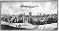 Steterburg (Merian).jpg 1,532 × 820; 280 KB
-
 Steterburg historisch.JPG 4,608 × 3,456; 4.64 MB
-
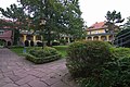
 Stift Steterburg in Thiede (Salzgitter) IMG 2678.jpg 3,001 × 2,000; 2.28 MB
-
 Stift Steterburg in Thiede (Salzgitter) IMG 2680.jpg 3,000 × 2,000; 3.29 MB
-
 Stift Steterburg in Thiede (Salzgitter) IMG 2681.jpg 3,003 × 2,000; 2.47 MB
-
 Stift Steterburg in Thiede (Salzgitter) IMG 2682.jpg 2,000 × 3,000; 2.22 MB
-
 Stift Steterburg in Thiede (Salzgitter) IMG 2683.jpg 2,000 × 3,000; 1.9 MB
-
 Stift Steterburg in Thiede (Salzgitter) IMG 2684.jpg 2,000 × 2,540; 1.82 MB
-
 Stift Steterburg in Thiede (Salzgitter) IMG 2685.jpg 3,005 × 2,000; 2.51 MB
-
 Stift Steterburg in Thiede (Salzgitter) IMG 2686.jpg 2,999 × 2,000; 2.46 MB
-
 Stift Steterburg in Thiede (Salzgitter) IMG 2687.jpg 3,000 × 2,000; 2.45 MB
-
 Stift Steterburg in Thiede (Salzgitter) IMG 2689.jpg 3,000 × 2,000; 2.41 MB
-
 Stift Steterburg in Thiede (Salzgitter) IMG 2690.jpg 2,000 × 3,000; 2.48 MB
-
 Stift Steterburg in Thiede (Salzgitter) IMG 2691.jpg 3,002 × 2,000; 2.24 MB
-
 Stift Steterburg in Thiede (Salzgitter) IMG 2692.jpg 3,000 × 2,000; 2.83 MB
-
 Stift Steterburg in Thiede (Salzgitter) IMG 2693.jpg 3,000 × 2,000; 2.1 MB
-
 Stift Steterburg in Thiede (Salzgitter) IMG 2694.jpg 2,000 × 3,000; 2.13 MB
-
 Stift Steterburg in Thiede (Salzgitter) IMG 2696.jpg 2,602 × 2,000; 1.88 MB
-
 Stift Steterburg in Thiede (Salzgitter) IMG 2697.jpg 2,000 × 2,561; 1.66 MB
-
 Stift Steterburg in Thiede (Salzgitter) IMG 2699.jpg 3,000 × 2,000; 1.92 MB
-
 Stift Steterburg in Thiede (Salzgitter) IMG 2700.jpg 2,455 × 2,000; 1.39 MB
-
 Stift Steterburg in Thiede (Salzgitter) IMG 2702.jpg 3,000 × 2,000; 2.1 MB
-
 Stift Steterburg in Thiede (Salzgitter) IMG 2704.jpg 3,000 × 2,000; 2.85 MB
_302.jpg)

.jpg)

_IMG_2678.jpg)
_IMG_2680.jpg)
_IMG_2681.jpg)
_IMG_2682.jpg)
_IMG_2683.jpg)
_IMG_2684.jpg)
_IMG_2685.jpg)
_IMG_2686.jpg)
_IMG_2687.jpg)
_IMG_2689.jpg)
_IMG_2690.jpg)
_IMG_2691.jpg)
_IMG_2692.jpg)
_IMG_2693.jpg)
_IMG_2694.jpg)
_IMG_2696.jpg)
_IMG_2697.jpg)
_IMG_2699.jpg)
_IMG_2700.jpg)
_IMG_2702.jpg)
_IMG_2704.jpg)