Category:Stoke-by-Nayland
Jump to navigation
Jump to search
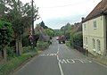
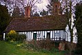
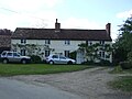
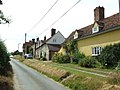
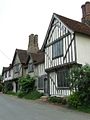
English: Stoke-by-Nayland in the English county of Suffolk, lies close to the border with Essex in what is sometimes referred to as Constable Country. It contains a church, St Mary, which remains much as it was rebuilt in the fifteenth century. The village, located within Babergh district, contains many cottages and timber framed houses and all surround a large recreation field which makes up the centre of the village. The population of the Stoke-by-Nayland civil parish at the 2001 census was 703, comprising 341 males and 362 females. Two schools, a primary and a middle school, are in the village, as are two public houses, The Angel Inn and The Crown. Stoke by Nayland is about 1.5 miles from Nayland and stands on a ridge overlooking the Stour and Box valleys. Immediately to the north of the village lies the hamlet of Scotland Street.
Norsk bokmål: Stoke-by-Nayland er en landsby i Suffolk i England. Den ligger ved grensen til Essex, i området som kalles «Constable Country».

village and civil parish in Suffolk, United Kingdom  | |||||
| Upload media | |||||
| Instance of | |||||
|---|---|---|---|---|---|
| Location | Babergh, Suffolk, East of England, England | ||||
| official website | |||||
 | |||||
Subcategories
This category has the following 14 subcategories, out of 14 total.
A
C
- The Crown, Stoke-by-Nayland (4 F)
G
- Giffords Hall (8 F)
M
O
S
- Scotland Street, Suffolk (12 F)
- Stoke-by-Nayland Golf Club (18 F)
T
- Tendring arms (4 F)
- Tendring Hall (7 F)
- Stoke Tye (3 F)
W
Media in category "Stoke-by-Nayland"
The following 200 files are in this category, out of 206 total.
(previous page) (next page)-
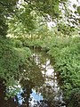
 A small lake, close to Stoke by Nayland - geograph.org.uk - 2339410.jpg 3,648 × 2,736; 2.27 MB
-
 A tree in springtime - geograph.org.uk - 2437784.jpg 1,536 × 1,152; 1.86 MB
-
 A view of the countryside near Polstead - geograph.org.uk - 2339407.jpg 3,648 × 2,736; 1.65 MB
-
 A Winters View - geograph.org.uk - 1709603.jpg 1,067 × 1,600; 449 KB
-
 Allotment Flowers - geograph.org.uk - 2576823.jpg 3,648 × 2,736; 3.92 MB
-
 Arable land near the River Box, Stoke Tye - geograph.org.uk - 4677458.jpg 3,648 × 2,432; 3.44 MB
-
 Area of woodland - geograph.org.uk - 1265560.jpg 640 × 474; 120 KB
-
 B1068 at the junction with Marsh Road - geograph.org.uk - 4141304.jpg 3,072 × 2,304; 735 KB
-
 B1068 crosses Higham Bridge - geograph.org.uk - 3581464.jpg 3,522 × 2,479; 1.29 MB
-
 B1068 junction with Marsh Road - geograph.org.uk - 3581468.jpg 3,571 × 2,512; 810 KB
-
 B1068 junction with Mill Lane - geograph.org.uk - 3581474.jpg 3,648 × 2,736; 1.59 MB
-
 B1068 junction with Wick Road - geograph.org.uk - 3581548.jpg 3,548 × 2,675; 1.25 MB
-
 B1068 near Topcroft House - geograph.org.uk - 4635813.jpg 1,240 × 930; 417 KB
-
 B1068 Park Street, Stoke By Nayland - geograph.org.uk - 4142190.jpg 3,072 × 2,304; 1.06 MB
-
 B1068 Park Street, Stoke By Nayland - geograph.org.uk - 4142215.jpg 2,304 × 3,072; 1.85 MB
-
 B1068 Polstead Street, Stoke By Nayland - geograph.org.uk - 4142222.jpg 3,072 × 2,304; 1.76 MB
-
 B1068 southwest of Valley Farm - geograph.org.uk - 3581732.jpg 3,293 × 2,484; 1.24 MB
-
 B1068 Sudbury Road, Stoke By Nayland - geograph.org.uk - 4142228.jpg 3,072 × 2,304; 1,021 KB
-
 B1068 Sudbury Road, Stoke By Nayland - geograph.org.uk - 4142418.jpg 3,072 × 2,304; 960 KB
-
 B1068 Sudbury Road, Stoke By Nayland - geograph.org.uk - 4143796.jpg 3,072 × 2,304; 1.85 MB
-
 B1068 Sudbury Road, Stoke By Nayland - geograph.org.uk - 4143803.jpg 3,072 × 2,304; 1.89 MB
-
 B1068 Sudbury Road, Stoke By Nayland - geograph.org.uk - 4143816.jpg 3,072 × 2,304; 1.75 MB
-
 B1068 Sudbury Road, Stoke By Nayland - geograph.org.uk - 4143834.jpg 3,072 × 2,304; 1.95 MB
-
 B1068 Thorington Street - geograph.org.uk - 4141337.jpg 3,049 × 2,290; 858 KB
-
 B1068 west of Valley Farm - geograph.org.uk - 3581744.jpg 3,168 × 2,348; 1.33 MB
-
 Barn - geograph.org.uk - 3739536.jpg 1,024 × 771; 200 KB
-
 Barn near Grove Farm, Stoke-by-Nayland - geograph.org.uk - 4463124.jpg 3,648 × 2,432; 2.65 MB
-
 Barns, Oak Farm - geograph.org.uk - 5604844.jpg 640 × 428; 123 KB
-
-
 Brett Valley from Stour Valley Path - geograph.org.uk - 6209380.jpg 1,600 × 1,200; 676 KB
-
 Bridge and lodge on the road south of Stoke-by-Nayland - geograph.org.uk - 5743063.jpg 1,600 × 1,064; 522 KB
-
 Bridleway - geograph.org.uk - 2876354.jpg 768 × 1,024; 420 KB
-
 Bridleway Notice - geograph.org.uk - 2876356.jpg 768 × 1,024; 281 KB
-
 By Chapel Lane - geograph.org.uk - 1265494.jpg 640 × 445; 94 KB
-
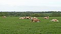
 Cattle - geograph.org.uk - 2876316.jpg 1,024 × 768; 301 KB
-
 CHERRYWOOD.jpg 3,888 × 2,592; 5.85 MB
-
 CHERRYWOOD2.jpg 2,592 × 3,888; 5.99 MB
-
 Chimneys and church tower - geograph.org.uk - 6261465.jpg 3,301 × 4,952; 2.39 MB
-
 Church Lane Almshouses (geograph 7477163).jpg 1,024 × 683; 193 KB
-

-
 Colourful Cottages - geograph.org.uk - 2377487.jpg 3,888 × 2,592; 3.5 MB
-
 Constable. Suffolk.JPG 480 × 356; 80 KB
-

-
 Country Lane - geograph.org.uk - 2879494.jpg 768 × 1,024; 391 KB
-
 Country lane - geograph.org.uk - 4792262.jpg 640 × 480; 191 KB
-
 Country lane - geograph.org.uk - 4792277.jpg 640 × 480; 168 KB
-
 Country road - geograph.org.uk - 803238.jpg 640 × 480; 136 KB
-
 Cows in field, Gravel Hill, Stoke-by-Nayland - geograph.org.uk - 4463112.jpg 1,024 × 576; 143 KB
-
 Crop field and hedgerow - geograph.org.uk - 5374474.jpg 640 × 480; 78 KB
-
 Crop field near Round House Farm - geograph.org.uk - 5374476.jpg 640 × 480; 79 KB
-
 Crop under cover - geograph.org.uk - 5374533.jpg 640 × 480; 65 KB
-
 Crossroads to Stoke Priory at The Howe - geograph.org.uk - 4635814.jpg 1,240 × 930; 770 KB
-
 Drain off Wick Road - geograph.org.uk - 5374536.jpg 480 × 640; 143 KB
-
 Drainage - geograph.org.uk - 3739228.jpg 1,024 × 768; 183 KB
-
 Elizabeth II postbox on Hudsons Lane, Thorington Street - geograph.org.uk - 5387404.jpg 2,145 × 1,722; 793 KB
-
 Entering Stoke By Nayland - geograph.org.uk - 4141343.jpg 2,897 × 2,182; 806 KB
-
 Entering Stoke By Nayland on the B1068 Sudbury Road - geograph.org.uk - 4143808.jpg 3,072 × 2,304; 1.91 MB
-
 Entering Thorington Street on the B1068 - geograph.org.uk - 4141315.jpg 2,888 × 2,170; 785 KB
-
 Entrance drive - geograph.org.uk - 803277.jpg 640 × 480; 125 KB
-
 Fallen Tree - geograph.org.uk - 3739197.jpg 1,024 × 768; 294 KB
-
 Farm building on Marsh Road, Higham - geograph.org.uk - 4635820.jpg 1,240 × 930; 488 KB
-
 Farm Track - geograph.org.uk - 3739533.jpg 1,024 × 768; 260 KB
-
 Farm track, Green Farm - geograph.org.uk - 5374480.jpg 640 × 480; 85 KB
-
 Farmland And Footpath - geograph.org.uk - 3630544.jpg 1,024 × 768; 185 KB
-
 Field entrance off Hudsons Lane - geograph.org.uk - 5374489.jpg 640 × 480; 108 KB
-
 Field Of Wheat - geograph.org.uk - 3612073.jpg 1,024 × 768; 202 KB
-
 Field south of Stoke-by-Nayland - geograph.org.uk - 5743051.jpg 1,600 × 1,064; 158 KB
-
 Footpath - geograph.org.uk - 2876313.jpg 768 × 1,024; 318 KB
-
 Footpath - geograph.org.uk - 2879493.jpg 1,024 × 768; 288 KB
-
 Footpath - geograph.org.uk - 3630644.jpg 1,024 × 768; 218 KB
-
 Footpath - geograph.org.uk - 3748292.jpg 1,024 × 768; 269 KB
-
 Footpath along arable field boundary, Stoke Tye - geograph.org.uk - 4677474.jpg 3,648 × 2,736; 3.9 MB
-
 Footpath sign off the B1068 Sudbury Road - geograph.org.uk - 4143822.jpg 2,128 × 2,850; 1.43 MB
-
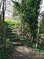 Footpath Steps - geograph.org.uk - 2876362.jpg 768 × 1,024; 405 KB
-
 Footpath ^ entrance to Steps Farm - geograph.org.uk - 4143828.jpg 3,072 × 2,304; 1.83 MB
-
 Ford And Footbridge - geograph.org.uk - 3739523.jpg 1,024 × 768; 299 KB
-
 Ford at Homey Bridge - geograph.org.uk - 4792295.jpg 640 × 480; 207 KB
-
 Ford at Homey Bridge, Polstead - geograph.org.uk - 3217147.jpg 3,872 × 2,592; 2.41 MB
-
 Frosty lane, Stoke by Nayland - geograph.org.uk - 3257371.jpg 640 × 427; 108 KB
-

-
 Gate and meadow - geograph.org.uk - 2879498.jpg 1,024 × 768; 255 KB
-

-
 Gravel Hill - geograph.org.uk - 4792251.jpg 640 × 480; 177 KB
-
 Grazing off Wick Road - geograph.org.uk - 5374518.jpg 640 × 480; 80 KB
-
 Grazing towards Mark Wood - geograph.org.uk - 5374465.jpg 640 × 480; 107 KB
-

-
 Higham village entrance sign - geograph.org.uk - 2280107.jpg 640 × 480; 53 KB
-
-

-
 Houses And Cottages - geograph.org.uk - 3630627.jpg 1,024 × 768; 203 KB
-
 Houses in Hudsons Lane, Thorington Street - geograph.org.uk - 4210479.jpg 4,320 × 3,240; 4.32 MB
-
 Hudsons Lane - geograph.org.uk - 5604866.jpg 640 × 480; 235 KB
-

-
 Hudsons Lane, Thorington Street - geograph.org.uk - 5604856.jpg 640 × 480; 130 KB
-
 Interesting and Old Water Tap - geograph.org.uk - 2314571.jpg 4,752 × 3,168; 7.1 MB
-
 Keepers Lane, Stoke By Nayland - geograph.org.uk - 4143203.jpg 3,072 × 2,304; 1.76 MB
-
 Kissing Gate - geograph.org.uk - 3612077.jpg 768 × 1,024; 311 KB
-
 L.S. Eaves Ltd Service Station - geograph.org.uk - 4143902.jpg 2,983 × 2,169; 865 KB
-
 Lane at Higham - geograph.org.uk - 1288300.jpg 480 × 640; 68 KB
-
 Lane climbing out of valley west of Stoke-by-Nayland - geograph.org.uk - 5743024.jpg 1,600 × 1,064; 492 KB
-
 Lane near Round House Farm - geograph.org.uk - 5374477.jpg 640 × 480; 73 KB
-
 Lane passing Gifford's Hall Park - geograph.org.uk - 1265479.jpg 640 × 480; 109 KB
-
 Lane towards Hadleigh - geograph.org.uk - 5604874.jpg 640 × 428; 114 KB
-
 Laneside display of Greater Stitchwort - geograph.org.uk - 1265512.jpg 523 × 640; 165 KB
-

-

-
 Long Road - geograph.org.uk - 2879501.jpg 1,024 × 768; 265 KB
-
 Looking down on Scotland Place - geograph.org.uk - 2437857.jpg 1,536 × 1,152; 1.97 MB
-
 Looking south along Polstead Street - geograph.org.uk - 2576846.jpg 3,648 × 2,736; 2.45 MB
-

-
 Lower Barn - geograph.org.uk - 3739222.jpg 1,024 × 768; 242 KB
-
 Marsh Lane, Higham - geograph.org.uk - 2104505.jpg 640 × 483; 186 KB
-
 Marsh Road near Marsh Farm, Higham - geograph.org.uk - 4635818.jpg 1,240 × 930; 509 KB
-
 Marsh Road, Higham - geograph.org.uk - 4141306.jpg 3,072 × 2,304; 817 KB
-
 Marsh Road, Higham - geograph.org.uk - 4635821.jpg 1,240 × 930; 421 KB
-
 Marsh Road, Higham Marsh - geograph.org.uk - 4497493.jpg 3,648 × 2,432; 2.92 MB
-
 Marten's Lane - geograph.org.uk - 5374469.jpg 640 × 480; 130 KB
-
 Meadow near Tendring Hall Farm, Stoke by Nayland - geograph.org.uk - 4514974.jpg 3,648 × 2,736; 4.53 MB
-
 Meadow near the River Box, Stoke Tye - geograph.org.uk - 4677448.jpg 3,002 × 2,001; 2.73 MB
-
 Mill Lane west of Stoke Priory - geograph.org.uk - 3581759.jpg 3,452 × 2,675; 1.57 MB
-
 Mill Lane west of The Howe - geograph.org.uk - 3581766.jpg 3,234 × 2,592; 1.43 MB
-
 Mill Lane, Thorington Street - geograph.org.uk - 5374496.jpg 640 × 480; 141 KB
-
 Minor Road - geograph.org.uk - 2879491.jpg 768 × 1,024; 275 KB
-
 Minor road near Green Farm - geograph.org.uk - 5374482.jpg 640 × 480; 67 KB
-
 Minor road near Mark Wood - geograph.org.uk - 5374467.jpg 640 × 480; 109 KB
-
 No 222696 601153 - geograph.org.uk - 3739205.jpg 1,024 × 768; 297 KB
-
 No through road - geograph.org.uk - 803787.jpg 480 × 640; 115 KB
-
 Now Repaired - geograph.org.uk - 3630673.jpg 1,024 × 768; 311 KB
-
 Old Barn - geograph.org.uk - 3630558.jpg 1,024 × 768; 276 KB
-
 Old barn - geograph.org.uk - 4210461.jpg 4,320 × 3,240; 4.18 MB
-
 Old cottages - geograph.org.uk - 803774.jpg 480 × 640; 74 KB
-
 On the Stour Valley Path near Higham - geograph.org.uk - 2714442.jpg 1,600 × 1,297; 946 KB
-
 Ores Barn Cottage, Thorington Street - geograph.org.uk - 4210469.jpg 4,138 × 2,982; 3.55 MB
-
 Park Road (B1068) - geograph.org.uk - 5374513.jpg 640 × 480; 85 KB
-

-
 Plough Lane, Stoke By Nayland - geograph.org.uk - 4143798.jpg 3,072 × 2,304; 1.09 MB
-
 Polstead Street in Winter - geograph.org.uk - 2377507.jpg 3,372 × 2,280; 3.23 MB
-
 Poplar Farm - geograph.org.uk - 2876348.jpg 1,024 × 768; 329 KB
-
 Poplar Farmhouse - geograph.org.uk - 5743043.jpg 1,600 × 1,064; 452 KB
-
 River Box at Thorington Street - geograph.org.uk - 4463134.jpg 3,648 × 2,432; 3.99 MB
-
 River Box, Stoke by Nayland - geograph.org.uk - 233783.jpg 480 × 640; 164 KB
-
 River Box, Thorington Street - geograph.org.uk - 5374493.jpg 640 × 480; 110 KB
-
 River Brett at Higham Bridge - geograph.org.uk - 4141301.jpg 3,072 × 2,304; 1.79 MB
-
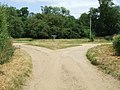 Road Junction - geograph.org.uk - 3630660.jpg 1,024 × 767; 258 KB
-

-
 Round Barn - geograph.org.uk - 2377441.jpg 3,657 × 2,472; 6.22 MB
-
 Rural Road, Stoke by Nayland - geograph.org.uk - 4463080.jpg 3,648 × 2,736; 3.48 MB
-
 School Street sign - geograph.org.uk - 4143896.jpg 2,907 × 2,187; 1.42 MB
-
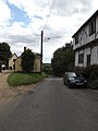
 School Street, Stoke By Nayland - geograph.org.uk - 4143885.jpg 2,304 × 3,072; 1.89 MB
-
 School Street, Stoke By Nayland - geograph.org.uk - 4143887.jpg 2,304 × 3,072; 1.87 MB
-
 School STREET.jpg 691 × 1,037; 93 KB
-
 Seat with a view - geograph.org.uk - 802868.jpg 480 × 640; 112 KB
-
 Signs - geograph.org.uk - 3630716.jpg 768 × 1,024; 264 KB
-
 Stoke by Nayland from the East - geograph.org.uk - 1087314.jpg 640 × 480; 120 KB
-
 Stoke By Nayland Post Office George VI Postbox - geograph.org.uk - 4142209.jpg 2,304 × 3,072; 1.7 MB
-
 Stoke By Nayland Post Office ^ George VI Postbox - geograph.org.uk - 4142212.jpg 3,072 × 2,304; 1.84 MB
-
 Stoke By Nayland Post Office ^ George VI Postbox - geograph.org.uk - 4143916.jpg 2,304 × 3,072; 1.79 MB
-
 Stoke By Nayland Village Name sign - geograph.org.uk - 4141346.jpg 3,072 × 2,304; 1.91 MB
-
 Stoke By Nayland Village Name sign - geograph.org.uk - 4143811.jpg 2,270 × 3,030; 1.37 MB
-

-

-
 Stoke-by-Nayland MET DP164805.jpg 3,911 × 3,077; 3.38 MB
-
 Stoke-by-Nayland's village hall - geograph.org.uk - 846480.jpg 640 × 480; 69 KB
-
 Stour Valley Path , Stoke by Nayland bus stop. - panoramio.jpg 1,600 × 1,200; 631 KB
-
 Stour Valley Path east of Stoke by Nayland - panoramio.jpg 1,600 × 1,200; 799 KB
-
 Stour Valley scene near Grove Farm, Stoke by Nayland - geograph.org.uk - 4463129.jpg 3,648 × 2,736; 4.43 MB
-
 Suffolk country lane - geograph.org.uk - 1265528.jpg 640 × 415; 62 KB
-

-
 Teapot Corner - geograph.org.uk - 3739539.jpg 1,024 × 768; 284 KB
-

-
 Thatched Building - geograph.org.uk - 3630607.jpg 1,024 × 768; 254 KB
-
 The farmhouse at Scotland Place - geograph.org.uk - 2339419.jpg 3,637 × 2,221; 1.03 MB
-
 The Old Bakehouse Stoke by Nayland - geograph.org.uk - 1752669.jpg 1,067 × 1,600; 282 KB
-
 The Old Bakehouse, Stoke by Nayland - geograph.org.uk - 1752683.jpg 993 × 1,600; 251 KB
-

-
 The Tendring Estate, Estate Office and Cottages - geograph.org.uk - 1752645.jpg 3,672 × 2,428; 4.5 MB
-
 Thorington Street bridge, Bridge Street - geograph.org.uk - 4509661.jpg 1,024 × 768; 376 KB
-
 Thorington Street under a cloudless sky - geograph.org.uk - 4635824.jpg 1,240 × 930; 420 KB
-

-
 Thorington Street Village name sign - geograph.org.uk - 4141316.jpg 2,277 × 3,039; 1.37 MB
-
 Thorington Street Village name sign - geograph.org.uk - 4141351.jpg 3,072 × 2,304; 1.57 MB
-
 Through the arch of trees - geograph.org.uk - 803247.jpg 480 × 640; 116 KB
-
 Through The Barley - geograph.org.uk - 3630693.jpg 1,024 × 768; 272 KB
-
 Towards the end of Chapel Lane - geograph.org.uk - 1265484.jpg 526 × 640; 112 KB
-
 Track (footpath) to Weylands Farm - geograph.org.uk - 5374490.jpg 640 × 480; 78 KB
-
 Track - geograph.org.uk - 2876333.jpg 1,024 × 768; 237 KB
-
 Track - geograph.org.uk - 2876336.jpg 1,024 × 768; 304 KB
-
 Track to Tendring Hall Farm, Stoke-by-Nayland - geograph.org.uk - 4463076.jpg 3,648 × 2,736; 3.57 MB
-
 Track to the trees, Stoke Tye - geograph.org.uk - 4677442.jpg 3,648 × 2,736; 4.15 MB
-
 Tram Lines In The Barley - geograph.org.uk - 3630684.jpg 768 × 1,024; 282 KB
-
 Tree in arable field, near Bobwrights Farm, Stoke by Nayland - geograph.org.uk - 4463150.jpg 3,648 × 2,432; 2.41 MB
-
 Trees on boggy ground - geograph.org.uk - 5374523.jpg 640 × 480; 104 KB
-
 Vicarage, Stoke by Nayland - geograph.org.uk - 233725.jpg 640 × 480; 105 KB
-
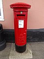
 Victorian postbox, Green Farm, Withermarsh Green - geograph.org.uk - 5387399.jpg 2,848 × 2,136; 1.48 MB
-
 Village Cottages - geograph.org.uk - 1922812.jpg 3,888 × 2,592; 2.97 MB
-
 Wall And Gate - geograph.org.uk - 3630622.jpg 1,024 × 768; 217 KB
-
 Wheat field margin near sewage works, Stoke by Nayland - geograph.org.uk - 4514979.jpg 3,648 × 2,736; 2.59 MB
-
 Wick Road - geograph.org.uk - 3630578.jpg 1,024 × 768; 205 KB
-
 Wick Road - geograph.org.uk - 5374530.jpg 640 × 480; 64 KB
-
 Wick Road - geograph.org.uk - 5374534.jpg 640 × 480; 139 KB


.jpg)


_-_Near_Stoke-by-Nayland_-_N02649_-_National_Gallery.jpg)


_-_geograph.org.uk_-_5374513.jpg)


_to_Weylands_Farm_-_geograph.org.uk_-_5374490.jpg)


