Category:Stoke Gabriel
Jump to navigation
Jump to search
English: Stoke Gabriel is a village and parish in Devon, England, situated on a creek of the River Dart. The village is a popular tourist destination in the South Hams and is famous for its mill pond and crab fishing (known colloquially as crabbing). It is equidistant from Paignton, Dartmouth and Totnes, and has a population of approximately 1,200.
village and civil parish in Devon, England, UK  | |||||
| Upload media | |||||
| Instance of | |||||
|---|---|---|---|---|---|
| Location | South Hams, Devon, South West England, England | ||||
 | |||||
Subcategories
This category has the following 4 subcategories, out of 4 total.
Media in category "Stoke Gabriel"
The following 200 files are in this category, out of 499 total.
(previous page) (next page)-

-
 A group of fine young men - geograph.org.uk - 378375.jpg 640 × 480; 85 KB
-
 Above Stoke Gabriel - geograph.org.uk - 6206252.jpg 3,264 × 1,832; 1.13 MB
-
 Across Ham Reach on the River Dart - geograph.org.uk - 161614.jpg 640 × 480; 107 KB
-
 Aish Road - geograph.org.uk - 5407913.jpg 2,048 × 3,072; 1.4 MB
-
 Aish Road - geograph.org.uk - 5998573.jpg 4,288 × 2,848; 2.37 MB
-
 Aish Road - geograph.org.uk - 6416034.jpg 2,713 × 2,106; 744 KB
-
 Aish Road - geograph.org.uk - 6416037.jpg 3,867 × 2,584; 1 MB
-
 Aish Road, Stoke Gabriel - geograph.org.uk - 5926421.jpg 1,598 × 2,031; 509 KB
-
 Alpaca manure for sale - geograph.org.uk - 1141894.jpg 640 × 480; 129 KB
-

-
 Arable field by Broadley Lane - geograph.org.uk - 5407441.jpg 3,072 × 2,048; 1.48 MB
-
 As of Faustina II (FindID 84429).jpg 670 × 747; 50 KB
-
 As of Faustina II (FindID 84429-47407).jpg 670 × 747; 46 KB
-
 Ashprington Point - geograph.org.uk - 2344488.jpg 640 × 389; 65 KB
-
 Ashprington Point - geograph.org.uk - 2444190.jpg 3,959 × 1,471; 2.29 MB
-
 Bank of the river Dart - geograph.org.uk - 5099049.jpg 640 × 480; 143 KB
-
 Banks of the Dart near Pighole Point - geograph.org.uk - 2444139.jpg 3,969 × 1,947; 2.89 MB
-
 Banks of The Dart near Waddeton - geograph.org.uk - 2444088.jpg 3,944 × 2,464; 3.27 MB
-
 Baptist Church, Stoke Gabriel - geograph.org.uk - 6381910.jpg 3,824 × 2,623; 1.28 MB
-
 Baptist Church, Stoke Gabriel - geograph.org.uk - 6381987.jpg 3,672 × 2,523; 950 KB
-
 Bare tree in Waddeton Road near Sandridge - geograph.org.uk - 3396732.jpg 769 × 1,024; 161 KB
-
 Barn Park, Stoke Gabriel - geograph.org.uk - 5999482.jpg 4,256 × 2,752; 1.76 MB
-
 Barn Park, Stoke Gabriel - geograph.org.uk - 5999532.jpg 4,057 × 2,510; 781 KB
-
 Barn Wood on Stoke Gabriel Road - geograph.org.uk - 3397120.jpg 1,024 × 768; 268 KB
-
 Beech leaves near Byter Mill - geograph.org.uk - 6206218.jpg 2,848 × 4,288; 2.23 MB
-
 Beehives, Galmpton Crrek - geograph.org.uk - 368811.jpg 480 × 640; 98 KB
-
 Beside the Mill Pool at Stoke Gabriel - geograph.org.uk - 4887334.jpg 640 × 427; 102 KB
-
 Black headed gull in winter plumage - geograph.org.uk - 2129534.jpg 1,042 × 783; 308 KB
-
 Boat house on the Dart estuary - geograph.org.uk - 5973705.jpg 640 × 360; 126 KB
-
 Boat on the Dart at Duncannon - geograph.org.uk - 2344694.jpg 480 × 640; 72 KB
-
 Boathouse in East Wood - geograph.org.uk - 2444055.jpg 4,000 × 3,000; 4.15 MB
-
 Boathouse near Sandridge - geograph.org.uk - 5099125.jpg 640 × 480; 126 KB
-
 Boats on the river Dart - geograph.org.uk - 5099137.jpg 640 × 480; 79 KB
-
 Boats on the river Dart near Duncannon - geograph.org.uk - 5099061.jpg 640 × 480; 137 KB
-
 Boot-washing possibilities near Aish (geograph 6738129).jpg 4,275 × 2,667; 2.43 MB
-
 Bovine drinking, Yalberton Stream - geograph.org.uk - 5405809.jpg 2,091 × 1,376; 778 KB
-
 Bow Creek - geograph.org.uk - 3150154.jpg 640 × 480; 59 KB
-
 Broadland Barn - geograph.org.uk - 1170123.jpg 640 × 480; 96 KB
-
 Broadleigh Farm - geograph.org.uk - 5407404.jpg 3,072 × 2,048; 1.28 MB
-
 Broadleigh Farm Caravan Park - geograph.org.uk - 5407429.jpg 3,072 × 2,048; 1.23 MB
-
 Broadleigh Farm Caravan Park - geograph.org.uk - 5407433.jpg 3,044 × 1,814; 1.21 MB
-
 Broadley Lane ^1 - geograph.org.uk - 5406955.jpg 2,048 × 3,072; 1.4 MB
-
 Broadley Lane ^10 - geograph.org.uk - 5407431.jpg 2,048 × 3,072; 1.32 MB
-
 Broadley Lane ^11 - geograph.org.uk - 5407438.jpg 2,048 × 3,072; 1.72 MB
-
 Broadley Lane ^2 - geograph.org.uk - 5407195.jpg 2,710 × 1,911; 1.26 MB
-
 Broadley Lane ^3 - geograph.org.uk - 5407215.jpg 3,072 × 2,048; 1.71 MB
-
 Broadley Lane ^4 - geograph.org.uk - 5407326.jpg 3,072 × 2,048; 1.44 MB
-
 Broadley Lane ^5 - geograph.org.uk - 5407377.jpg 3,056 × 1,931; 1.32 MB
-
 Broadley Lane ^6 - geograph.org.uk - 5407383.jpg 3,072 × 2,048; 1.31 MB
-
 Broadley Lane ^7 - geograph.org.uk - 5407410.jpg 2,048 × 3,072; 1.46 MB
-
 Broadley Lane ^8 - geograph.org.uk - 5407414.jpg 2,048 × 3,072; 1.52 MB
-
 Broadley Lane ^9 - geograph.org.uk - 5407426.jpg 3,072 × 2,048; 1.68 MB
-
 Building Kings Orchard, Stoke Gabriel - geograph.org.uk - 6442181.jpg 1,324 × 632; 140 KB
-
 Byter Mill - geograph.org.uk - 191207.jpg 640 × 480; 134 KB
-
 Byter Mill - geograph.org.uk - 6206192.jpg 4,288 × 2,848; 1.58 MB
-
 Byter Mill - geograph.org.uk - 6206212.jpg 3,264 × 1,832; 1,004 KB
-
 Byter Mill - geograph.org.uk - 6440750.jpg 2,775 × 3,700; 1.67 MB
-
 Byter Mill Lane - geograph.org.uk - 2863955.jpg 1,024 × 768; 391 KB
-
 Byter Mill Lane - geograph.org.uk - 6440754.jpg 4,288 × 2,848; 1.63 MB
-
 Byter Mill Lane - geograph.org.uk - 6440826.jpg 2,795 × 4,025; 1.88 MB
-
 Byter Mill Lane - geograph.org.uk - 6440836.jpg 2,848 × 4,288; 2.22 MB
-
 Byter Mill Lane - geograph.org.uk - 6440952.jpg 1,818 × 3,127; 930 KB
-
 Byter Mill Lane - geograph.org.uk - 6441003.jpg 4,288 × 2,848; 1.72 MB
-
 Byter Mill Lane and houses, Stoke Gabriel - geograph.org.uk - 2129648.jpg 3,344 × 2,508; 1.7 MB
-
 Byter Mill Lane, Stoke Gabriel - geograph.org.uk - 6441315.jpg 2,848 × 4,288; 2.33 MB
-
 Carving on Stoke Gabriel church - geograph.org.uk - 2342052.jpg 469 × 640; 90 KB
-
 Cattle by Whitehill Lane - geograph.org.uk - 6205537.jpg 3,133 × 1,764; 990 KB
-
 Cattle by Whitehill Lane - geograph.org.uk - 6205576.jpg 1,291 × 1,657; 1.21 MB
-
 Cattle by Whitehill Lane - geograph.org.uk - 6440746.jpg 2,072 × 1,007; 475 KB
-
 Cattle near Stoke Gabriel - geograph.org.uk - 5999387.jpg 4,254 × 2,345; 1.13 MB
-
 Cattle pasture by Yalberton Stream - geograph.org.uk - 6205553.jpg 3,161 × 1,748; 982 KB
-
 Cattle pasture near Aish - geograph.org.uk - 3756830.jpg 1,920 × 1,440; 566 KB
-
 Chain and shadow, Duncannon - geograph.org.uk - 2344814.jpg 456 × 640; 132 KB
-
 Chemical waste point by Broadley Lane - geograph.org.uk - 5407221.jpg 3,072 × 2,048; 1.16 MB
-
 Church House Inn, Stoke Gabriel (33296184541).jpg 6,000 × 4,000; 6.95 MB
-
 Church House Inn, Stoke Gabriel (33296221401).jpg 6,000 × 4,000; 7.29 MB
-
 Church House Inn, Stoke Gabriel - geograph.org.uk - 2343282.jpg 640 × 480; 71 KB
-
 Church of St Mary and St Gabriel - geograph.org.uk - 4887342.jpg 640 × 427; 77 KB
-
 Church of St Mary ^ St Gabriel - geograph.org.uk - 6396077.jpg 1,200 × 820; 1.06 MB
-
 Converted farm buildings, Aish - geograph.org.uk - 6020858.jpg 2,766 × 3,662; 1.63 MB
-
 Coombe House Cross - geograph.org.uk - 5998584.jpg 4,256 × 2,438; 1.38 MB
-
 Coombe House Lane - geograph.org.uk - 5407469.jpg 1,886 × 2,372; 1.13 MB
-
 Coombe House Lane - geograph.org.uk - 5407518.jpg 2,048 × 3,072; 1.76 MB
-
 Coombe House Lane - geograph.org.uk - 5407541.jpg 2,032 × 2,564; 1.02 MB
-
 Coombe House Lane - geograph.org.uk - 5407547.jpg 3,072 × 2,048; 1.58 MB
-
 Coombe House Lane - geograph.org.uk - 5407851.jpg 3,072 × 2,048; 1.33 MB
-
 Coombe Shute from Byter Mill Lane - geograph.org.uk - 4887357.jpg 640 × 427; 108 KB
-
 Coombe Shute, Stoke Gabriel - geograph.org.uk - 787451.jpg 320 × 480; 132 KB
-
 Corner of Hoyle Copse - geograph.org.uk - 5999181.jpg 4,288 × 2,848; 2.43 MB
-
 Cottages at Pords Bridge - geograph.org.uk - 6205709.jpg 1,806 × 2,474; 554 KB
-
 Cottages at Port Bridge - geograph.org.uk - 1050310.jpg 463 × 640; 118 KB
-
 Cottages in Stoke Gabriel - geograph.org.uk - 191199.jpg 640 × 480; 111 KB
-

-
 Cottages on Coombe Shute, Stoke Gabriel - geograph.org.uk - 6441352.jpg 1,622 × 3,012; 401 KB
-
 Country view nr Sandridge - geograph.org.uk - 3014432.jpg 640 × 407; 69 KB
-
 Countryside around Hoile Lane - geograph.org.uk - 5921044.jpg 2,824 × 1,544; 803 KB
-
 Countryside by Hoile Lane - geograph.org.uk - 2864028.jpg 1,024 × 768; 232 KB
-
 Countryside east of Stoke Gabriel - geograph.org.uk - 6442050.jpg 4,284 × 2,672; 1.34 MB
-
 Countryside east of Totnes - geograph.org.uk - 50538.jpg 640 × 480; 145 KB
-
 Countryside near Waddeton - geograph.org.uk - 1170147.jpg 640 × 480; 85 KB
-
 Countryside west of Hoyle Copse - geograph.org.uk - 5927413.jpg 4,277 × 2,434; 1.43 MB
-
 Crownley Lane - geograph.org.uk - 5998558.jpg 4,261 × 2,542; 1.65 MB
-
 Crownley Lane - geograph.org.uk - 5998563.jpg 2,848 × 4,288; 1.78 MB
-
 Dam View - geograph.org.uk - 3265745.jpg 800 × 600; 157 KB
-
 Dam, Stoke Gabriel - geograph.org.uk - 2343020.jpg 640 × 480; 87 KB
-
 Dam, Stoke Gabriel - geograph.org.uk - 2343113.jpg 640 × 480; 81 KB
-
 Dart at Ashprington Point - geograph.org.uk - 2344701.jpg 640 × 480; 61 KB
-
 Dart at Sandridge - geograph.org.uk - 5337527.jpg 2,048 × 1,536; 658 KB
-
 Dart Estuary at Stoke Gabriel - geograph.org.uk - 37888.jpg 640 × 480; 125 KB
-
 Dart meander (2) - geograph.org.uk - 1061953.jpg 640 × 460; 82 KB
-
 Dart meander - geograph.org.uk - 1061927.jpg 640 × 480; 100 KB
-
 Dartside Quay, Galmpton Creek - geograph.org.uk - 368685.jpg 640 × 480; 98 KB
-
 Disused and Overgrown Quarry - geograph.org.uk - 2863922.jpg 1,024 × 768; 469 KB
-
 Dittisham Mill Creek with Higher Dittisham Beyond - geograph.org.uk - 2444116.jpg 3,939 × 2,469; 3.41 MB
-
 Double bend sign, Whitehill Lane - geograph.org.uk - 5406162.jpg 3,072 × 2,048; 1.43 MB
-
 Double bend sign, Whitehill Lane - geograph.org.uk - 6205701.jpg 4,288 × 2,848; 2.48 MB
-
 Double stile by Paignton Road - geograph.org.uk - 6206607.jpg 2,671 × 3,898; 1.84 MB
-
 Dry mortar silos, Stoke Gabriel - geograph.org.uk - 6442564.jpg 4,097 × 2,208; 1.16 MB
-
 Duncannon - geograph.org.uk - 2344646.jpg 640 × 480; 124 KB
-
 Duncannon - geograph.org.uk - 3148513.jpg 640 × 480; 77 KB
-
 Duncannon - geograph.org.uk - 361340.jpg 640 × 426; 111 KB
-
 Duncannon Lane - geograph.org.uk - 2344264.jpg 640 × 484; 135 KB
-
 Duncannon Lane - geograph.org.uk - 2344423.jpg 640 × 480; 89 KB
-
 Duncannon Lane - geograph.org.uk - 2344450.jpg 480 × 640; 146 KB
-
 Duncannon on the banks of the river Dart - geograph.org.uk - 5099056.jpg 640 × 480; 129 KB
-
 Duncannon, Devon - geograph.org.uk - 1881590.jpg 1,600 × 1,200; 337 KB
-
 Dunncannon - geograph.org.uk - 2444181.jpg 3,727 × 2,567; 3.47 MB
-
 East Farm, Waddeton - geograph.org.uk - 1169914.jpg 640 × 480; 76 KB
-
 East Farm, Waddeton - geograph.org.uk - 3295856.jpg 2,512 × 1,795; 2.52 MB
-
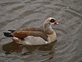 Egyptian Goose at Stoke Gabriel - geograph.org.uk - 457668.jpg 640 × 480; 76 KB
-
 Elephant on tombstone, Stoke Gabriel - geograph.org.uk - 2342895.jpg 541 × 640; 106 KB
-
 Embarking from the pontoon, Stoke Gabriel - geograph.org.uk - 2129549.jpg 3,648 × 2,736; 2.8 MB
-
 End of lane, Higher Aish Farm - geograph.org.uk - 6040847.jpg 3,645 × 2,826; 1.65 MB
-
 End of the green lane - geograph.org.uk - 1061923.jpg 480 × 640; 137 KB
-
 Entrance to holiday park, Waddeton Road - geograph.org.uk - 5406507.jpg 3,072 × 2,048; 1.3 MB
-

-
 Farm buildings, Higher Well Farm - geograph.org.uk - 5406381.jpg 2,823 × 1,843; 1.23 MB
-

-
 Farmland by Hoyle Copse - geograph.org.uk - 5999183.jpg 4,288 × 2,848; 2.16 MB
-
 Farmland near Pords Bridge - geograph.org.uk - 6205826.jpg 3,580 × 2,394; 1.86 MB
-
 Farmland near Stoke Gabriel - geograph.org.uk - 6206560.jpg 4,288 × 2,848; 1.45 MB
-
 Farmland near Waddeton - geograph.org.uk - 79792.jpg 640 × 425; 142 KB
-
 Farmland on Windmill Hill - geograph.org.uk - 5407572.jpg 3,072 × 2,048; 1.33 MB
-
 Farmland on Windmill Hill - geograph.org.uk - 5407684.jpg 3,060 × 1,875; 1.24 MB
-
 Farmland on Windmill Hill - geograph.org.uk - 5407824.jpg 2,973 × 1,677; 880 KB
-
 Fence, Galmpton Creek - geograph.org.uk - 368807.jpg 640 × 480; 117 KB
-

-
 Field above the Dart - geograph.org.uk - 1061945.jpg 640 × 480; 120 KB
-
 Field below Windmill Hill - geograph.org.uk - 1050365.jpg 640 × 480; 59 KB
-

-
 Field boundary by Lembury Road - geograph.org.uk - 5998566.jpg 3,851 × 2,590; 1.66 MB
-
 Field boundary by Waddeton Road - geograph.org.uk - 5163515.jpg 2,994 × 1,915; 1.4 MB
-
 Field by Broadley Lane - geograph.org.uk - 5407349.jpg 3,072 × 2,048; 1.48 MB
-
 Field by Duncannon Lane - geograph.org.uk - 2344833.jpg 640 × 465; 76 KB
-
 Field by Paignton Road - geograph.org.uk - 5406753.jpg 3,072 × 2,048; 1.52 MB
-
 Field by the lane to Millcombe Barn - geograph.org.uk - 1062486.jpg 640 × 480; 102 KB
-
 Field by Waddeton Road - geograph.org.uk - 1049240.jpg 640 × 480; 78 KB
-
 Field by Waddeton Road - geograph.org.uk - 5406512.jpg 3,072 × 2,048; 1.65 MB
-
 Field by Waddeton Road - geograph.org.uk - 5406660.jpg 2,901 × 1,798; 1.21 MB
-
 Field by Waddeton Road - geograph.org.uk - 5406667.jpg 3,056 × 1,774; 1.33 MB
-
 Field by Waddeton Road - geograph.org.uk - 5406735.jpg 3,072 × 1,682; 1.15 MB
-
 Field by Yalberton Stream - geograph.org.uk - 6205830.jpg 3,801 × 2,655; 1.89 MB
-
 Field edge beside Waddeton Road - geograph.org.uk - 191158.jpg 480 × 640; 76 KB
-
 Field near Aish - geograph.org.uk - 5998750.jpg 4,288 × 2,378; 1.3 MB
-
 Field near Ham Barn (west) - geograph.org.uk - 1061922.jpg 640 × 480; 144 KB
-
 Field near Ham Barn - geograph.org.uk - 1061810.jpg 640 × 480; 85 KB
-
 Field near Ham Barn - geograph.org.uk - 1061818.jpg 640 × 480; 84 KB
-
 Field near Rowes Farm - geograph.org.uk - 6396091.jpg 1,200 × 809; 1.19 MB
-
 Field near Windmill Hill - geograph.org.uk - 1050431.jpg 640 × 471; 109 KB
-
 Field north of Hoyle Copse - geograph.org.uk - 5999306.jpg 4,282 × 2,473; 2.04 MB
-
 Field southeast of Aish - geograph.org.uk - 5998631.jpg 4,271 × 2,630; 1.72 MB
-
 Field, Stoke Gabriel - geograph.org.uk - 6441731.jpg 1,826 × 2,931; 777 KB
-
 Fields by Hoyle Copse - geograph.org.uk - 5999161.jpg 2,848 × 4,288; 2.34 MB
-
 Fields near Hoyle Copse - geograph.org.uk - 5927086.jpg 4,270 × 2,611; 1.85 MB
-
 Fields near Hoyle Copse - geograph.org.uk - 5927388.jpg 3,584 × 2,003; 794 KB
-
 Fields near Hoyle Copse - geograph.org.uk - 5999293.jpg 4,279 × 2,607; 1.42 MB
-
 Fields on slopes of Windmill Hill - geograph.org.uk - 5408070.jpg 3,072 × 2,048; 1.25 MB
-
 First Stoke Gabriel Scout Group hut - geograph.org.uk - 2129618.jpg 3,648 × 2,736; 3.13 MB
-
 Flood Street, Stoke Gabriel - geograph.org.uk - 5999432.jpg 2,723 × 3,058; 1,015 KB
-
 Flood Street, Stoke Gabriel - geograph.org.uk - 5999470.jpg 4,270 × 2,430; 2.05 MB
-
 Footpath from Stoke Gabriel - geograph.org.uk - 6441889.jpg 4,288 × 2,848; 2.09 MB
-
 Footpath through New Wood Trees - geograph.org.uk - 5999333.jpg 4,288 × 2,848; 2.32 MB
-
 Footpath through tree nursery, Stoke Gabriel - geograph.org.uk - 5927433.jpg 4,288 × 2,848; 2.33 MB
-
 Footpath to Galmpton Creek - geograph.org.uk - 3397130.jpg 1,024 × 768; 238 KB
-
 Footpath to Stoke Gabriel - geograph.org.uk - 6442016.jpg 3,264 × 1,832; 1.14 MB
-
 Footpath up to field, Galmpton Creek - geograph.org.uk - 368746.jpg 480 × 640; 107 KB
-
 Footpath, Stoke Gabriel - geograph.org.uk - 6382007.jpg 4,288 × 2,848; 2.22 MB
-
 Forbidden stile near Stoke Gabriel - geograph.org.uk - 5999378.jpg 4,288 × 2,848; 1.78 MB
-
 Ford at Aish - geograph.org.uk - 3691687.jpg 3,872 × 2,592; 1.27 MB
-
 Ford Way, Stoke Gabriel - geograph.org.uk - 6382106.jpg 4,271 × 2,434; 1.5 MB
-
 Four Cross Lanes - geograph.org.uk - 5406726.jpg 3,000 × 1,812; 1.01 MB
-
 Four Cross, Stoke Gabriel - geograph.org.uk - 376677.jpg 640 × 480; 87 KB
-
 Fritillaries, Duncannon - geograph.org.uk - 2344678.jpg 505 × 640; 62 KB
-
 Galmpton Creek - geograph.org.uk - 368738.jpg 640 × 474; 74 KB
-
-
 Galmpton Creek, River Dart - geograph.org.uk - 3946548.jpg 1,024 × 694; 120 KB
-
 Garden wall of Waddeton Court - geograph.org.uk - 3397112.jpg 1,024 × 765; 203 KB
-
 Garden, Gabriel Court Hotel - geograph.org.uk - 457702.jpg 640 × 480; 138 KB
-
 Gate and trough by Waddeton Road - geograph.org.uk - 5169004.jpg 2,048 × 3,072; 1.54 MB


.jpg)
.jpg)


.jpg)


.jpg)
.jpg)


_-_geograph.org.uk_-_1061953.jpg)


_-_geograph.org.uk_-_1061922.jpg)


