Category:Stone Avenue underpass (Tucson, Arizona)
Jump to navigation
Jump to search
| Object location | | View all coordinates using: OpenStreetMap |
|---|
_from_S_2.JPG) | |||||
| Upload media | |||||
| Instance of | |||||
|---|---|---|---|---|---|
| Location | Tucson, Pima County, Arizona | ||||
| Heritage designation |
| ||||
| Inception |
| ||||
| Length |
| ||||
 | |||||
Media in category "Stone Avenue underpass (Tucson, Arizona)"
The following 7 files are in this category, out of 7 total.
-
 Lake Elmira Plaque .jpg 2,048 × 1,536; 463 KB
-
 Stone Avenue underpass (Tucson) emblem.JPG 1,517 × 1,472; 809 KB
-
 Stone Avenue underpass (Tucson) from S 1.JPG 2,560 × 1,027; 926 KB
-
 Stone Avenue underpass (Tucson) from S 2.JPG 2,560 × 1,176; 1.15 MB
-
 Stone Avenue underpass (Tucson) from S 3.JPG 2,175 × 660; 552 KB
-
 Stone Avenue underpass (Tucson) from S 4.JPG 2,411 × 1,399; 986 KB
-
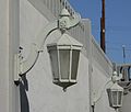 Stone Avenue underpass (Tucson) lamp.JPG 2,015 × 1,719; 1,018 KB

_emblem.JPG)
_from_S_4.JPG)
_lamp.JPG)
_from_S_1.JPG)
_from_S_3.JPG)
Categories:
- Concrete bridges in Arizona
- Concrete frame bridges
- Concrete railway bridges
- Railway bridges in Arizona
- Underpasses in the United States
- 1930s bridges in Arizona
- Built in Arizona in 1936
- Bridges in the United States completed in 1936
- Union Pacific Railroad bridges
- Southern Pacific Railroad bridges
- Bridges in the United States less than 0.1 kilometers
- Downtown Tucson, Arizona
- Stone Avenue (Tucson, Arizona)
- National Register of Historic Places in Tucson, Arizona
- Gila Subdivision