Category:Stone Cross, Tunbridge Wells
Jump to navigation
Jump to search
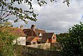
English: Stone Cross is a hamlet located on the A264 road east of Ashurst. There are few houses and no shops. Burrswood, a building designed by Decimus Burton is located between the hamlet and Groombridge it in commercial use by a Christian charity.
village in Kent, England, UK  | |||||
| Upload media | |||||
| Instance of | |||||
|---|---|---|---|---|---|
| Location | Speldhurst, Tunbridge Wells, Kent, South East England, England | ||||
 | |||||
Media in category "Stone Cross, Tunbridge Wells"
The following 34 files are in this category, out of 34 total.
-
 Access track in Newpark Woods - geograph.org.uk - 1735673.jpg 3,072 × 2,304; 3.24 MB
-
 Burrs Wood - geograph.org.uk - 807610.jpg 640 × 480; 155 KB
-
-
 Entrance to Stone cross Oast House - geograph.org.uk - 1550380.jpg 640 × 430; 197 KB
-
 Further Hawthey Field - geograph.org.uk - 1767285.jpg 1,024 × 768; 180 KB
-
 Groombridge Road in Newpark Wood - geograph.org.uk - 1735661.jpg 3,072 × 2,304; 2.94 MB
-
 Horse at sunset - geograph.org.uk - 419224.jpg 640 × 480; 196 KB
-
 Horses, Stone Cross - geograph.org.uk - 1550382.jpg 640 × 430; 156 KB
-
 Junction of Felderland Lane and A258 - geograph.org.uk - 388422.jpg 640 × 480; 51 KB
-
 Keeper's Cottage - geograph.org.uk - 1735664.jpg 3,072 × 2,304; 2.33 MB
-
 Old Wesleyan Chapel - geograph.org.uk - 385965.jpg 640 × 480; 230 KB
-
 Paddock at Stone Cross - geograph.org.uk - 1550377.jpg 640 × 430; 137 KB
-
 Sandwich Technology School - geograph.org.uk - 583680.jpg 640 × 480; 41 KB
-
 Stone Cross Farmhouse, Stone Cross - geograph.org.uk - 1550384.jpg 640 × 430; 163 KB
-
 Stone Cross House - geograph.org.uk - 1735377.jpg 3,072 × 2,304; 1.81 MB
-
 Stone Cross House from the Wealdway - geograph.org.uk - 1550378.jpg 640 × 430; 157 KB
-
 Stone Cross Lodge - geograph.org.uk - 1550374.jpg 640 × 430; 150 KB
-
 SW end of Dover Road - geograph.org.uk - 943470.jpg 640 × 480; 210 KB
-
 View north of Newpark Wood - geograph.org.uk - 861884.jpg 640 × 480; 137 KB
-
 View towards Newpark Wood - geograph.org.uk - 1550385.jpg 640 × 430; 140 KB
-
 Early Bluebells in Dicker`s Wood - geograph.org.uk - 405669.jpg 500 × 640; 411 KB
-
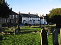
 Entrance to Boatman's Hill Cemetery - geograph.org.uk - 681850.jpg 640 × 480; 202 KB
-
 Farm buildings - geograph.org.uk - 419206.jpg 640 × 480; 194 KB
-
 Farmhouse - geograph.org.uk - 419195.jpg 640 × 480; 251 KB
-

-
-
 Lane North of Bliby Crossroads - geograph.org.uk - 21585.jpg 640 × 205; 28 KB
-

-
 Path through Boatman's Hill cemetery - geograph.org.uk - 683271.jpg 640 × 480; 183 KB
-
 Pollution in Dicker`s Wood - geograph.org.uk - 405663.jpg 640 × 480; 379 KB
-
 Potato harvest near Delf Farm Shop - geograph.org.uk - 583682.jpg 640 × 480; 54 KB
-
 Raspberry canes - geograph.org.uk - 82487.jpg 640 × 480; 95 KB
-

-
 View along Sandwich Road - geograph.org.uk - 683303.jpg 640 × 480; 149 KB


