Category:Stone Street (Kent)
Jump to navigation
Jump to search
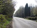
English: Stone Street was a Roman road in England, which ran south for some 12 miles from Watling Street at Canterbury (the Roman Durovernum) to Lympne (Lemanis) at the western edge of the Romney Marsh. Most of it is now the current B2068 road that runs from the M20 motorway to Canterbury.
Subcategories
This category has only the following subcategory.
F
Media in category "Stone Street (Kent)"
The following 7 files are in this category, out of 7 total.
-
 Approaching Stone Street from the East - geograph.org.uk - 857441.jpg 640 × 430; 112 KB
-
 Path junction on Greensand Way - geograph.org.uk - 1321631.jpg 640 × 480; 122 KB
-
 Stone Street - a Roman road - geograph.org.uk - 441537.jpg 640 × 405; 326 KB
-
 Wilmot Cottage - geograph.org.uk - 1362594.jpg 640 × 430; 187 KB
-
 Looking N along the Stone Street - geograph.org.uk - 342800.jpg 640 × 480; 147 KB
-
 Stone Street - geograph.org.uk - 400383.jpg 640 × 480; 131 KB
-
 The Roman Rd, Stone Street - geograph.org.uk - 319945.jpg 480 × 640; 117 KB


