Category:Stradbroke Island
Jump to navigation
Jump to search
island of Queensland, Australia | |||||
| Upload media | |||||
| Instance of | |||||
|---|---|---|---|---|---|
| Location | Queensland, AUS | ||||
 | |||||
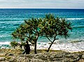
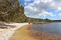
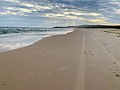
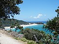
English: Stradbroke Island, also known as Minjerribah, was a large sand island that formed much of the eastern side of Moreton Bay near Brisbane, Queensland until the late 19th century. Today the island is split into two by the Jumpinpin Channel.
Subcategories
This category has the following 6 subcategories, out of 6 total.
Media in category "Stradbroke Island"
The following 25 files are in this category, out of 25 total.
-
 602 Stradbroke Island, July 1981 (52310045129).jpg 2,560 × 1,920; 3.16 MB
-
 603 Stradbroke Island, July 1981 (52310001838).jpg 2,488 × 1,852; 2.29 MB
-
 Brown Lake (North Stradbroke Island).JPG 5,184 × 3,456; 8.95 MB
-
 Cloud mirror.jpg 4,048 × 3,036; 2.97 MB
-
 Cute Kangaroo 1 (Unsplash).jpg 3,840 × 2,400; 4.42 MB
-
 Fish at Stadbroke Island.JPG 3,680 × 2,760; 1.95 MB
-
 Flinders Beach (50709012982).jpg 4,032 × 3,024; 3.66 MB
-
 Flinders Beach campsites (50709012587).jpg 6,990 × 3,928; 6.37 MB
-
 Flinders Beach Sunrise (50708927361).jpg 4,032 × 3,024; 2.28 MB
-
 Frenchman's Beach.jpg 3,648 × 2,736; 2.67 MB
-
 Grasbaum fg3.jpg 1,455 × 819; 420 KB
-

-
 Habitat (10.3897-zookeys.889.39090) Figure 31.jpg 1,447 × 2,179; 3.94 MB
-
-
 People fishing at sunset on Deadman's Beach.jpg 6,000 × 4,000; 5.71 MB
-

-

-
-
 StateLibQld 2 114856 Swan Bay, Stradbroke Island, Queensland, 1916.jpg 1,000 × 638; 130 KB
-

-
-

-
 Stradbroke Banner.jpg 5,184 × 741; 2.33 MB
-
 Stradbroke Island beach.jpg 5,608 × 3,739; 16.42 MB
-
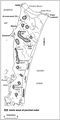 Гидрология Норт Стрекборд Исланд.PNG 249 × 499; 56 KB
.jpg)
.jpg)
.JPG)

.jpg)

.jpg)
.jpg)
.jpg)


.jpg)
_Figure_31.jpg)


