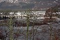
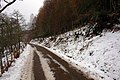
Category:Strathglass
Jump to navigation
Jump to search
Valley in the Scottish Highlands between Cannich and Beauly
Subcategories
This category has the following 4 subcategories, out of 4 total.
Media in category "Strathglass"
The following 45 files are in this category, out of 45 total.
-
 A831, Strathglass - geograph.org.uk - 36250.jpg 640 × 480; 47 KB
-
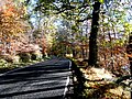 Autumn colour in Strathglass - geograph.org.uk - 2156620.jpg 640 × 480; 265 KB
-
 Autumn colour on the River Glass - geograph.org.uk - 998230.jpg 640 × 457; 227 KB
-
 Balmore Forest to Kerrow - geograph.org.uk - 1015194.jpg 640 × 480; 43 KB
-
 Balmore to Buntait - geograph.org.uk - 1015262.jpg 640 × 480; 66 KB
-
 Barn in Strath Glass - geograph.org.uk - 3494950.jpg 1,500 × 1,033; 1.55 MB
-
 Beinn a' Chairein's eastern slope - geograph.org.uk - 1013000.jpg 640 × 480; 125 KB
-
 Bracken Clad Hillside - geograph.org.uk - 1015781.jpg 640 × 480; 98 KB
-
 Cairn on Carn Gorm - geograph.org.uk - 1014626.jpg 640 × 480; 92 KB
-
 Cannich - geograph.org.uk - 1013238.jpg 640 × 480; 112 KB
-

-

-
 Carn Gorm to Kerrow, Strathglass - geograph.org.uk - 1014994.jpg 640 × 480; 71 KB
-
 Cattle at Inchully, Strathglass - geograph.org.uk - 2751403.jpg 800 × 534; 273 KB
-
 Crossing the watershed - geograph.org.uk - 1553732.jpg 640 × 480; 86 KB
-
 Fields at Runivraid - geograph.org.uk - 247768.jpg 640 × 480; 120 KB
-
 Heathery Carn Dubh-ghlaic - geograph.org.uk - 1014182.jpg 640 × 480; 68 KB
-
 Heathery hill above Glen Cannich - geograph.org.uk - 1011898.jpg 640 × 480; 77 KB
-
 Hill Moorland - geograph.org.uk - 1014296.jpg 640 × 480; 94 KB
-

-
 Strath Glass at Struy - geograph.org.uk - 57889.jpg 640 × 480; 90 KB
-
 Strathglass - geograph.org.uk - 247793.jpg 640 × 480; 118 KB
-
 The climb out of Strathglass - geograph.org.uk - 1553718.jpg 640 × 480; 75 KB
-
 The track from Strathglass - geograph.org.uk - 1049092.jpg 640 × 480; 96 KB
-
 The track from Strathglass - geograph.org.uk - 1049096.jpg 640 × 480; 48 KB
-
 The track towards Strathglass - geograph.org.uk - 1049083.jpg 640 × 480; 62 KB
-
 The track towards Strathglass - geograph.org.uk - 1049085.jpg 640 × 480; 46 KB
-

-
 Upstream River Glass - geograph.org.uk - 1553641.jpg 640 × 480; 76 KB
-
 Waterfall on Allt Coillte burn - geograph.org.uk - 1015445.jpg 640 × 480; 128 KB
-
 Waterfall on Allt Coillte burn - geograph.org.uk - 1015805.jpg 480 × 640; 135 KB
-
 West-southwest across Balmore Forest - geograph.org.uk - 1015169.jpg 640 × 480; 69 KB
-
 Across Balmore Forest (No trees) - geograph.org.uk - 1014483.jpg 640 × 480; 87 KB
-
 Birch wood in Strathglass - geograph.org.uk - 247805.jpg 640 × 480; 137 KB
-
 Cattle in Strathglass - geograph.org.uk - 247809.jpg 640 × 480; 106 KB
-
 Creag Dubh - geograph.org.uk - 247825.jpg 640 × 480; 107 KB
-
 Crops in Strathglass - geograph.org.uk - 247813.jpg 640 × 480; 119 KB
-
 Eskadale - geograph.org.uk - 446346.jpg 640 × 480; 138 KB
-
 Grazings in Strathglass - geograph.org.uk - 247786.jpg 640 × 480; 115 KB
-
 Grazings in Strathglass - geograph.org.uk - 247800.jpg 640 × 480; 105 KB
-

-
 Strathglass - geograph.org.uk - 36248.jpg 640 × 480; 115 KB
-
 Strathglass - geograph.org.uk - 659115.jpg 640 × 425; 123 KB
-
 Unclassified road in Strathglass - geograph.org.uk - 659585.jpg 640 × 425; 122 KB
-
 Unclassified road in Strathglass - geograph.org.uk - 659587.jpg 640 × 425; 107 KB


_-_geograph.org.uk_-_1014483.jpg)


