Category:Streams in the Vale of Glamorgan
Jump to navigation
Jump to search

Media in category "Streams in the Vale of Glamorgan"
The following 64 files are in this category, out of 64 total.
-
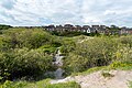
 Another view of the Hoddnant, Llanmaes. - geograph.org.uk - 914624.jpg 640 × 480; 150 KB
-
 Clatter Brook - geograph.org.uk - 507685.jpg 480 × 640; 136 KB
-
 Cosmeston Lakes Country Park, July 2023 05.jpg 5,244 × 3,496; 7.41 MB
-
 Cosmeston Medieval Village (4758).jpg 4,288 × 2,848; 6.3 MB
-
 Creek on Landimore Marsh - geograph.org.uk - 1417276.jpg 480 × 640; 121 KB
-
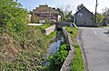
 Downstream, Nant Stepsau, Flemingston - geograph.org.uk - 858257.jpg 640 × 480; 120 KB
-
 Dyffryn Gardens cafe and River Waycock - geograph.org.uk - 3398636.jpg 2,560 × 1,920; 2.77 MB
-

-
 Footbridge over stream - Llanmaes Brook - geograph.org.uk - 1429687.jpg 640 × 425; 141 KB
-
 Former quarry at Rhoose Point (2).jpg 6,000 × 4,000; 16.31 MB
-
 Llanmaes Brook , Llantwit Major - geograph.org.uk - 1145944.jpg 640 × 480; 159 KB
-
 Llanmaes Brook - Llantwit Major - geograph.org.uk - 1573372.jpg 640 × 425; 137 KB
-

-

-
 Llanmaes Brook, Llanmaes - geograph.org.uk - 1149069.jpg 640 × 480; 177 KB
-
 Llanmaes Brook, Llanmaes - geograph.org.uk - 1149077.jpg 640 × 480; 171 KB
-
 Llanmaes Brook, Llanmaes - geograph.org.uk - 847125.jpg 640 × 480; 129 KB
-
 Man-made rill (2), Dyffryn Gardens - geograph.org.uk - 5531746.jpg 5,179 × 3,451; 5.34 MB
-
-
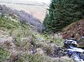
 Upstream of Nant Stepsau, Flemingston - geograph.org.uk - 858248.jpg 640 × 480; 132 KB
-
 A stream starts here - geograph.org.uk - 671702.jpg 640 × 480; 132 KB
-
 A view down the Nant Cwm-du - geograph.org.uk - 833931.jpg 640 × 480; 125 KB
-
 A view up the Nant Cwm-du - geograph.org.uk - 833934.jpg 480 × 640; 113 KB
-
 Afon Carrog - geograph.org.uk - 705587.jpg 640 × 480; 97 KB
-
 Afon Grannell, Capel-y-Groes - geograph.org.uk - 502992.jpg 428 × 640; 133 KB
-
 Afon Honddu - geograph.org.uk - 816551.jpg 640 × 427; 84 KB
-

-
 Bechan Brook at Pont y Perchyll - geograph.org.uk - 592070.jpg 640 × 480; 133 KB
-
 Birch tree by the forest edge - geograph.org.uk - 647141.jpg 640 × 480; 127 KB
-
 Branch in the River - geograph.org.uk - 1423769.jpg 480 × 640; 83 KB
-
 Brook below Belan - geograph.org.uk - 587217.jpg 640 × 480; 97 KB
-
 Brook below Garreg - geograph.org.uk - 646580.jpg 640 × 427; 123 KB
-
 Brook, Gwaithla - geograph.org.uk - 388646.jpg 640 × 480; 154 KB
-
 Camnant Brook - geograph.org.uk - 719251.jpg 640 × 427; 99 KB
-
 Cascades on the Maesnant stream - geograph.org.uk - 655530.jpg 640 × 480; 118 KB
-
 Clydach Brook - geograph.org.uk - 743913.jpg 640 × 480; 157 KB
-
 Colwyn Brook - geograph.org.uk - 610699.jpg 640 × 480; 104 KB
-
 Crossing Nant yr Helyg - geograph.org.uk - 705404.jpg 639 × 479; 182 KB
-
 Cwm Clyd - geograph.org.uk - 704439.jpg 479 × 639; 209 KB
-
 Cwm Doethie Fawr, Ceredigion - geograph.org.uk - 520164.jpg 495 × 640; 191 KB
-
 Descent beside the Gargwy Fawr - geograph.org.uk - 645353.jpg 640 × 477; 116 KB
-
 Earth wall at the Nant Lladron - geograph.org.uk - 389453.jpg 478 × 640; 82 KB
-

-

-
 Gwys Fawr - geograph.org.uk - 505753.jpg 640 × 480; 185 KB
-
 Gwys Fawr - geograph.org.uk - 505757.jpg 640 × 480; 131 KB
-
 Gwys Fawr - geograph.org.uk - 506384.jpg 640 × 480; 168 KB
-
 Head of a valley on Mynydd Mallaen - geograph.org.uk - 1421388.jpg 640 × 480; 88 KB
-
 Looking from the Bridge on the A472 - geograph.org.uk - 422120.jpg 640 × 480; 166 KB
-
 Maesnant - geograph.org.uk - 514672.jpg 479 × 640; 64 KB
-
 Melin Trebersed - geograph.org.uk - 452141.jpg 640 × 480; 95 KB
-
 Mountain stream - geograph.org.uk - 693441.jpg 640 × 480; 101 KB
-
 Nant Bowen - geograph.org.uk - 389380.jpg 640 × 479; 87 KB
-
 Nant Bowen - geograph.org.uk - 389438.jpg 640 × 479; 86 KB
-
 Nant Cleisfer headwater stream - geograph.org.uk - 448707.jpg 480 × 640; 131 KB
-
 Nant Geifr - geograph.org.uk - 393685.jpg 480 × 640; 122 KB
-
 Stream at Cwm Collo - geograph.org.uk - 705731.jpg 640 × 480; 96 KB
-
 Stream near Gilfachau farm - geograph.org.uk - 705603.jpg 479 × 640; 105 KB
-
 Stream near Waun - geograph.org.uk - 405372.jpg 640 × 480; 145 KB
-
 The Back Brook - geograph.org.uk - 388627.jpg 640 × 480; 158 KB
-
 The Mithil Brook - geograph.org.uk - 695878.jpg 640 × 480; 140 KB
-
 The start of a stream - geograph.org.uk - 682054.jpg 640 × 480; 98 KB
-
 The track diverges from Sutton Brook - geograph.org.uk - 700539.jpg 640 × 480; 49 KB
-
 Track beside Sutton Brook - geograph.org.uk - 700522.jpg 480 × 640; 96 KB


.jpg)


.jpg)


,_Dyffryn_Gardens_-_geograph.org.uk_-_5531746.jpg)


