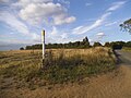
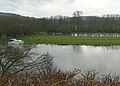
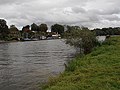
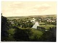
Category:Streatley, Berkshire
Jump to navigation
Jump to search
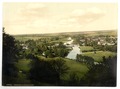
English: Streatley is a village and civil parish on the River Thames in the English county of Berkshire.
village and civil parish in West Berkshire, Berkshire, England  | |||||
| Upload media | |||||
| Instance of | |||||
|---|---|---|---|---|---|
| Part of |
| ||||
| Location | West Berkshire, Berkshire, South East England, England | ||||
| Located in or next to body of water | |||||
| Population |
| ||||
| Area |
| ||||
| official website | |||||
 | |||||
Subcategories
This category has the following 9 subcategories, out of 9 total.
G
- Goring and Streatley Bridge (27 F)
H
- Streatley House, Berkshire (6 F)
L
M
P
R
- River Thames at Streatley (22 F)
Media in category "Streatley, Berkshire"
The following 200 files are in this category, out of 544 total.
(previous page) (next page)-
 'Byways', Wantage Road - geograph.org.uk - 4276323.jpg 1,024 × 683; 165 KB
-

-
 'The Lodge' - geograph.org.uk - 4276210.jpg 1,024 × 683; 175 KB
-
 'The Old School', Streatley Hill - geograph.org.uk - 4276473.jpg 1,024 × 683; 194 KB
-
 400,000 Volts - geograph.org.uk - 1895086.jpg 2,048 × 1,536; 1.01 MB
-
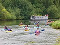
 A barge moored by the Swan Hotel - geograph.org.uk - 3026309.jpg 1,500 × 1,000; 193 KB
-
 A Bit of Yellow - geograph.org.uk - 3037648.jpg 3,648 × 2,736; 2.44 MB
-
 A clear view - geograph.org.uk - 2845084.jpg 1,024 × 683; 207 KB
-
 A field by Wantage Road - geograph.org.uk - 3034373.jpg 1,500 × 1,000; 231 KB
-
 A field on Thurle Down - geograph.org.uk - 3025378.jpg 1,500 × 1,000; 122 KB
-
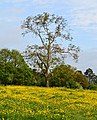
 A Gnarled Tree - geograph.org.uk - 3060922.jpg 3,648 × 2,736; 2.14 MB
-
 A grand view - geograph.org.uk - 2704932.jpg 1,024 × 683; 60 KB
-
 A narrowboat leaves Cleeve Lock - geograph.org.uk - 2490680.jpg 1,024 × 680; 187 KB
-
 A riverside scene at Goring - geograph.org.uk - 5065288.jpg 1,024 × 823; 226 KB
-
 A tranquel country lane - geograph.org.uk - 5618469.jpg 1,490 × 1,118; 540 KB
-
 A weir at Streatley - geograph.org.uk - 3026332.jpg 1,500 × 1,000; 323 KB
-
 A weir on the Thames at Streatley - geograph.org.uk - 3026336.jpg 1,500 × 1,000; 206 KB
-
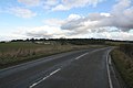
 A329 approaching Streatley - geograph.org.uk - 4195932.jpg 1,024 × 683; 235 KB
-
 A329 at Streatley - geograph.org.uk - 4276284.jpg 1,024 × 683; 192 KB
-
 A329 at Streatley village boundary - geograph.org.uk - 3129691.jpg 640 × 480; 77 KB
-
 A329 junction with A417 - geograph.org.uk - 2827202.jpg 3,571 × 2,587; 1.36 MB
-
 A329 through Streatley - geograph.org.uk - 6190887.jpg 1,024 × 684; 389 KB
-
 A329 towards Streatley - geograph.org.uk - 6190845.jpg 1,024 × 684; 403 KB
-
 A329 towards Streatley - geograph.org.uk - 6190864.jpg 1,024 × 684; 300 KB
-
 A329 towards Streatley - geograph.org.uk - 6190878.jpg 1,024 × 684; 439 KB
-
 A329 Wallingford Road - geograph.org.uk - 6190932.jpg 1,024 × 684; 334 KB
-
 A329, Reading Road at Lower Basildon - geograph.org.uk - 6641095.jpg 1,600 × 1,065; 639 KB
-
 A329, Reading Road towards Streatley - geograph.org.uk - 6641091.jpg 1,600 × 1,065; 799 KB
-
 A417 Junction, Streatley - geograph.org.uk - 1440276.jpg 640 × 444; 90 KB
-
 A417 Wantage Road - geograph.org.uk - 6578198.jpg 1,024 × 684; 328 KB
-
 Across the top - geograph.org.uk - 2706119.jpg 1,024 × 683; 236 KB
-
 Along a field Boundary - geograph.org.uk - 3021156.jpg 1,024 × 683; 133 KB
-
 Along by the Morrel Rooms - geograph.org.uk - 4828643.jpg 533 × 800; 93 KB
-
 Along Rectory Road - geograph.org.uk - 3850877.jpg 1,600 × 1,200; 529 KB
-
 Along Thurle Down - geograph.org.uk - 5328039.jpg 1,024 × 683; 160 KB
-
 Angel in the Crosses - geograph.org.uk - 4827691.jpg 1,024 × 683; 227 KB
-
 Another Path - geograph.org.uk - 5328069.jpg 1,024 × 683; 280 KB
-
 Apples in the Hedge - geograph.org.uk - 3784358.jpg 1,600 × 1,218; 703 KB
-
 At Cleeve Lock - geograph.org.uk - 5836097.jpg 4,608 × 3,456; 5.41 MB
-
 At Streatley Farm - geograph.org.uk - 6105196.jpg 1,024 × 768; 205 KB
-
 B4009 after bisecting Goring and Streatley Golf Course - geograph.org.uk - 2586228.jpg 3,393 × 2,542; 1.03 MB
-
 B4009 in Streatley - geograph.org.uk - 2538422.jpg 1,024 × 680; 166 KB
-
 Back down the Path - geograph.org.uk - 5328051.jpg 1,024 × 683; 292 KB
-
 Back to Streatley - geograph.org.uk - 1592726.jpg 640 × 480; 97 KB
-
 Bank of the Thames - geograph.org.uk - 177632.jpg 640 × 480; 55 KB
-
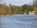
 Barge in the Flood - geograph.org.uk - 3904771.jpg 1,024 × 768; 185 KB
-
 Barn at Streatley Farm - geograph.org.uk - 2896405.jpg 1,600 × 1,200; 505 KB
-
 Barn at Streatley Farm - geograph.org.uk - 4195874.jpg 1,024 × 683; 175 KB
-
 Barn at Streatley Farm - geograph.org.uk - 4276188.jpg 1,024 × 683; 178 KB
-
 Barns at Streatley Farm - geograph.org.uk - 3021058.jpg 1,024 × 683; 161 KB
-
 Barns at Streatley Farm - geograph.org.uk - 3021152.jpg 1,024 × 683; 160 KB
-

-

-

-
 Benchmark on 'Elm Lodge' - geograph.org.uk - 4276379.jpg 683 × 1,024; 261 KB
-
 Benchmark on 'The Lodge' - geograph.org.uk - 4276197.jpg 683 × 1,024; 228 KB
-
 Benchmark on 'The Old School' - geograph.org.uk - 4276423.jpg 1,024 × 683; 291 KB
-
 Benchmark on barn at Streatley Farm - geograph.org.uk - 4276184.jpg 683 × 1,024; 266 KB
-
 Benchmark on Lough Down - geograph.org.uk - 2706120.jpg 533 × 800; 181 KB
-
 Benchmark on St Mary's Church - geograph.org.uk - 4276565.jpg 683 × 1,024; 305 KB
-
 Benchmark on Wallingford Road wall - geograph.org.uk - 4276281.jpg 683 × 1,024; 290 KB
-
 Bend on the Field Boundary - geograph.org.uk - 5335469.jpg 1,024 × 768; 206 KB
-
 Bending to Streatley - geograph.org.uk - 1736356.jpg 1,024 × 683; 96 KB
-
 Bends for the Sake Of It - geograph.org.uk - 3461094.jpg 4,020 × 2,852; 2.76 MB
-
 Bildnis des alten Müllers zu Streatley (?) (SM 16587z).png 7,424 × 8,566; 85.96 MB
-
 Bin Day in Townsend Road - geograph.org.uk - 3847532.jpg 1,024 × 810; 400 KB
-
 Blackthorn by the Field - geograph.org.uk - 3457883.jpg 4,320 × 3,240; 3.26 MB
-

-
 Blot on the Landscape - geograph.org.uk - 915181.jpg 640 × 480; 84 KB
-
 Boathouse at Cleeve - geograph.org.uk - 2490666.jpg 1,024 × 680; 238 KB
-
 Boathouses by the Thames - geograph.org.uk - 6481960.jpg 1,600 × 1,159; 476 KB
-
 Boathouses in the Floods - geograph.org.uk - 3904946.jpg 1,024 × 768; 170 KB
-
 Boundary marker - geograph.org.uk - 1628757.jpg 426 × 640; 135 KB
-
 Branches and leaves reflected in the Thames - geograph.org.uk - 2538445.jpg 1,024 × 680; 347 KB
-
 Bridge on the ditch - geograph.org.uk - 1314614.jpg 640 × 426; 86 KB
-
 Bridge over the Thames at Streatley, close view - geograph.org.uk - 4903321.jpg 2,048 × 1,536; 823 KB
-
 Buttercup meadow, Streatley, Berkshire - geograph.org.uk - 4473090.jpg 644 × 800; 219 KB
-
 By Runsford Hole - geograph.org.uk - 915046.jpg 640 × 480; 108 KB
-
 Byway near Aldworth (4) - geograph.org.uk - 3639842.jpg 640 × 423; 127 KB
-
 Calves at Streatley Warren - geograph.org.uk - 1591983.jpg 640 × 427; 189 KB
-
 Church Lane, Streatley - geograph.org.uk - 6641105.jpg 1,600 × 1,065; 642 KB
-
 Church Lane, Streatley - geograph.org.uk - 6641108.jpg 1,600 × 1,065; 655 KB
-
 Cleared of branches - geograph.org.uk - 2845075.jpg 1,024 × 683; 152 KB
-
 Closeup of Foxglove in Grimm's Ditch - geograph.org.uk - 21207.jpg 480 × 640; 188 KB
-
 Confusing Roadsign, Streatley - geograph.org.uk - 1440264.jpg 640 × 441; 76 KB
-
 Cottages near Thurle Grange Streatley - geograph.org.uk - 5618002.jpg 2,976 × 3,968; 2.48 MB
-
 Country Home, Streatley - geograph.org.uk - 1440235.jpg 640 × 437; 91 KB
-
 Cows (5926034710).jpg 1,600 × 1,067; 605 KB
-
 Cows in the shade of a tree on Lough Down - geograph.org.uk - 5836012.jpg 4,608 × 3,456; 4.83 MB
-
 Cowslips on Lardon Chase - geograph.org.uk - 3026198.jpg 1,000 × 1,500; 171 KB
-
 Cropland towards Streatley - geograph.org.uk - 1736333.jpg 1,024 × 683; 112 KB
-
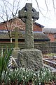 Cross among the Snowdrops - geograph.org.uk - 4828569.jpg 533 × 800; 150 KB
-
 Cross and Angel - geograph.org.uk - 4827687.jpg 533 × 800; 121 KB
-
 Crosses in the Churchyard - geograph.org.uk - 4827680.jpg 533 × 800; 130 KB
-
 Crossing the golf course at Lough Down - geograph.org.uk - 5836020.jpg 4,608 × 3,456; 4.28 MB
-
 Crossroads benchmark - geograph.org.uk - 2735620.jpg 600 × 800; 142 KB
-
 Direction Sign – Signpost - geograph.org.uk - 6505186.jpg 960 × 720; 226 KB
-
 Down to Cleeve - geograph.org.uk - 3019910.jpg 1,024 × 683; 176 KB
-
 Down to Streatley Farm - geograph.org.uk - 3021154.jpg 1,024 × 683; 152 KB
-
 Down to the Coombe - geograph.org.uk - 3903476.jpg 1,024 × 768; 103 KB
-
 Downland arable near Westridge Green - geograph.org.uk - 5222223.jpg 1,024 × 776; 143 KB
-
 Downland west of Streatley - geograph.org.uk - 1723534.jpg 640 × 480; 93 KB
-
 Downland, Aldworth, Berkshire - geograph.org.uk - 4562360.jpg 3,856 × 2,202; 4.07 MB
-
 Downland, Stichens Green, Berkshire - geograph.org.uk - 4867086.jpg 4,815 × 2,564; 5.27 MB
-
 Downland, Streatley - geograph.org.uk - 2321652.jpg 640 × 480; 132 KB
-
 Downland, Streatley - geograph.org.uk - 456810.jpg 640 × 480; 145 KB
-
 Downland, Streatley, Berkshire - geograph.org.uk - 4548519.jpg 6,016 × 4,000; 1.89 MB
-
 Downland, Streatley, Berkshire - geograph.org.uk - 4564177.jpg 5,260 × 3,424; 3 MB
-
 Downland, Streatley, Berkshire - geograph.org.uk - 4587544.jpg 4,944 × 3,071; 997 KB
-
 Downland, Streatley, Berkshire - geograph.org.uk - 4627389.jpg 5,155 × 3,736; 6.55 MB
-
 Downland, Streatley, Berkshire - geograph.org.uk - 4640633.jpg 5,706 × 3,770; 7.12 MB
-
 Dry valley, Streatley, Berkshire - geograph.org.uk - 4570253.jpg 4,325 × 2,578; 6.11 MB
-
 Egyptian Geese family - geograph.org.uk - 1036121.jpg 640 × 480; 180 KB
-

-
 Entrance to Goring ^ Streatley golf course - geograph.org.uk - 5221873.jpg 1,024 × 768; 245 KB
-
 Entrance to the yard - geograph.org.uk - 2736089.jpg 683 × 1,024; 139 KB
-
 Entrance to Thurle Grange, Streatley, Berkshire - geograph.org.uk - 4568713.jpg 2,744 × 2,647; 2.08 MB
-
 Evening light, Streatley, Berkshire - geograph.org.uk - 4680409.jpg 4,475 × 3,236; 6.27 MB
-
 Farmland above the River Thames - geograph.org.uk - 4641161.jpg 800 × 531; 157 KB
-

-

-
 Farmland on the flank of Thurle Down, in January - geograph.org.uk - 5257411.jpg 1,024 × 768; 250 KB
-
 Farmland, Streatley - geograph.org.uk - 2321462.jpg 640 × 480; 185 KB
-
 Farmland, Streatley - geograph.org.uk - 2817500.jpg 640 × 480; 171 KB
-
 Farmland, Streatley, Berkshire - geograph.org.uk - 4571822.jpg 2,786 × 2,382; 1.52 MB
-
 Farmland, Streatley, Berkshire - geograph.org.uk - 4571828.jpg 2,977 × 2,121; 1.09 MB
-
 Farmland, Streatley, Berkshire - geograph.org.uk - 4640692.jpg 3,376 × 3,376; 2.71 MB
-
 Farmland, Streatley, Berkshire - geograph.org.uk - 4651916.jpg 2,751 × 2,983; 1.97 MB
-
 Farmland, Streatley, Berkshire - geograph.org.uk - 4674465.jpg 640 × 429; 113 KB
-
 Farmland, Streatley, Berkshire - geograph.org.uk - 4847710.jpg 5,162 × 3,322; 2.12 MB
-
 Field by the B4009 west of Streatley - geograph.org.uk - 4609564.jpg 2,304 × 1,728; 819 KB
-
 Field by the B4009 west of Streatley - geograph.org.uk - 4609566.jpg 2,304 × 1,728; 814 KB
-
 Field entrance in Westridge Green - geograph.org.uk - 4611725.jpg 2,304 × 1,728; 1.3 MB
-
 Field on Thurle Down - geograph.org.uk - 3025379.jpg 1,500 × 1,000; 101 KB
-
 Field, Valley and Wood - geograph.org.uk - 3457880.jpg 4,320 × 2,802; 3.04 MB
-
 Fields near Aldworth - geograph.org.uk - 3639831.jpg 640 × 401; 130 KB
-
 Fields on the B4009 - geograph.org.uk - 4609560.jpg 2,304 × 1,728; 833 KB
-
 Fields on the hill - geograph.org.uk - 3034383.jpg 1,500 × 1,000; 158 KB
-
 Floating bar - geograph.org.uk - 3869754.jpg 1,024 × 683; 219 KB
-
 Flooded garden - geograph.org.uk - 3904938.jpg 1,024 × 768; 153 KB
-
 Flooding at Cleeve - geograph.org.uk - 3902537.jpg 1,600 × 1,200; 511 KB
-
 Flooding at Goring - geograph.org.uk - 3903471.jpg 1,024 × 768; 178 KB
-
 Flooding by the Thames - geograph.org.uk - 3451041.jpg 640 × 459; 244 KB
-
 Flooding by the Thames - geograph.org.uk - 3451044.jpg 640 × 474; 262 KB
-
 Flooding by the Thames - geograph.org.uk - 3451050.jpg 640 × 452; 181 KB
-
 Flooding in Streatley - geograph.org.uk - 3903473.jpg 1,024 × 768; 181 KB
-
 Flooding past the Grotto - geograph.org.uk - 3903475.jpg 1,024 × 768; 102 KB
-
 Flooding round Cleeve - geograph.org.uk - 3902539.jpg 1,600 × 1,200; 497 KB
-
 Floods at Cleeve - geograph.org.uk - 3902465.jpg 1,600 × 1,200; 517 KB
-
 Floods at South Stoke - geograph.org.uk - 3902538.jpg 1,600 × 1,200; 277 KB
-
 Floods at Streatley - geograph.org.uk - 3902473.jpg 1,600 × 1,200; 391 KB
-
 Floods at Streatley Church - geograph.org.uk - 3902476.jpg 1,600 × 1,200; 470 KB
-
 Foggy round the pillar - geograph.org.uk - 2706117.jpg 533 × 800; 169 KB
-
 Following the Valley - geograph.org.uk - 3784560.jpg 1,600 × 1,200; 320 KB
-
 Footpath Sign - geograph.org.uk - 5335599.jpg 533 × 800; 168 KB
-
 Footpath signpost - geograph.org.uk - 3026211.jpg 1,000 × 1,500; 154 KB
-
 Footpath through the wood - geograph.org.uk - 3025377.jpg 1,500 × 1,000; 299 KB
-
 Forever onwards - The River Thames - geograph.org.uk - 3175960.jpg 640 × 480; 106 KB
-
 Frosty course - geograph.org.uk - 1120228.jpg 640 × 426; 30 KB
-
 Frosty Morning Churchyard - geograph.org.uk - 4827257.jpg 1,024 × 683; 195 KB
-
 Frozen Mooring at Cleeve Court - geograph.org.uk - 2785186.jpg 1,024 × 693; 280 KB
-
 Gate at Keepers Cottage - geograph.org.uk - 5335478.jpg 1,024 × 683; 173 KB
-
 George Price Boyce - Dovecote at Streatley - B1979.9 - Yale Center for British Art.jpg 1,474 × 1,920; 459 KB
-
 Glass summer house by the Thames - geograph.org.uk - 6481959.jpg 1,600 × 1,200; 595 KB
-
 Goring and Streatley Golf Course - geograph.org.uk - 915195.jpg 640 × 480; 97 KB
-
 Goring and Streatley London and suburbs England.jpg 1,073 × 837; 132 KB
-
 Goring and Streatley Youth Hostel - geograph.org.uk - 3455215.jpg 2,048 × 1,536; 526 KB
-
 Goring and Streatley, Oxfordshire and West Berkshire, England-LCCN2002696967.jpg 3,691 × 2,748; 2.83 MB
-
 Goring and Streatley, Oxfordshire and West Berkshire, England-LCCN2002696967.tif 3,691 × 2,748; 29.02 MB
-
 Goring from Lough Down (138 m) - geograph.org.uk - 2257044.jpg 2,560 × 1,920; 1.23 MB
-
 Goring Lock - geograph.org.uk - 5628095.jpg 843 × 558; 196 KB
-
 Goring parish church from Streatley Youth Hostel - geograph.org.uk - 5635483.jpg 2,816 × 2,112; 2.18 MB
-
 Goring Weir - geograph.org.uk - 5617356.jpg 3,635 × 2,423; 2.37 MB
-
 Goring ^ Streatley Golf Clubhouse - geograph.org.uk - 2827243.jpg 3,648 × 2,736; 2.07 MB
-
 Goring ^ Streatley Golf Course - 14th green and 15th fairway - geograph.org.uk - 3141541.jpg 3,648 × 2,736; 1.95 MB
-
 Goring ^ Streatley Golf Course - 17th fairway and green - geograph.org.uk - 3142358.jpg 3,648 × 2,736; 1.75 MB
-
 Goring ^ Streatley Golf Course - 18th hole - geograph.org.uk - 3142371.jpg 3,648 × 2,736; 1.85 MB
-
 Goring ^ Streatley Golf Course - Green 5th Hole - geograph.org.uk - 3141230.jpg 3,556 × 2,525; 1.77 MB
-
 Goring ^ Streatley Golf Course - Green 7th Hole - geograph.org.uk - 3141250.jpg 3,648 × 2,736; 1.52 MB
-

-
 Goring ^ Streatley Golf Course Hole 1 fairway - geograph.org.uk - 3139692.jpg 3,648 × 2,736; 1.81 MB
-
 Graveyard at the back - geograph.org.uk - 1626296.jpg 640 × 427; 69 KB
-
 Growcroft Copse - geograph.org.uk - 1015812.jpg 640 × 480; 120 KB
-
 Hawsers across the steam - geograph.org.uk - 3905010.jpg 1,024 × 768; 158 KB
-
 Heading down the river - geograph.org.uk - 1449797.jpg 640 × 427; 86 KB
-
 Hiding behind the willows - geograph.org.uk - 3175889.jpg 640 × 480; 118 KB
-
 Horse chestnut leaves - geograph.org.uk - 2538452.jpg 1,024 × 680; 198 KB
-
 Horse in a field at Thurle Down - geograph.org.uk - 5836034.jpg 4,608 × 3,456; 4.77 MB
-
 House at the west end of Rectory Road - geograph.org.uk - 3710277.jpg 800 × 600; 171 KB
-
 House by the shop - geograph.org.uk - 2736095.jpg 1,024 × 683; 149 KB
-
 House in the Valley - geograph.org.uk - 3807277.jpg 1,024 × 683; 228 KB
-
 House near the church - geograph.org.uk - 1628731.jpg 640 × 427; 86 KB
-
 House overlooking the Thames - geograph.org.uk - 2538440.jpg 1,024 × 680; 215 KB
-
 House viewed from the Thames Path - geograph.org.uk - 2538453.jpg 1,024 × 680; 241 KB
-

-
 Houses on Streatley Hill - geograph.org.uk - 3020917.jpg 1,024 × 683; 207 KB
-
 Houses on The Ridgeway Streatley - geograph.org.uk - 4551443.jpg 1,280 × 720; 474 KB
-
 Ice on the Puddle - geograph.org.uk - 5335472.jpg 1,024 × 683; 212 KB
-
 Into Goring - geograph.org.uk - 2736096.jpg 1,024 × 683; 108 KB
-
 Into the yard - geograph.org.uk - 2736090.jpg 1,024 × 683; 143 KB


_-_geograph.org.uk_-_5257399.jpg)
_-_geograph.org.uk_-_5262821.jpg)
_-_geograph.org.uk_-_5262824.jpg)


_(SM_16587z).png)


_-_geograph.org.uk_-_3639842.jpg)


.jpg)


_north_of_Streatley_-_geograph.org.uk_-_5256747.jpg)


_-_geograph.org.uk_-_2257044.jpg)


