Category:Streets in Gloucester
Jump to navigation
Jump to search
English: Roads, streets, lanes, and avenues — in Gloucester, England.
Wikimedia category | |||||
| Upload media | |||||
| Instance of | |||||
|---|---|---|---|---|---|
| Category combines topics | |||||
| |||||
Subcategories
This category has the following 39 subcategories, out of 39 total.
A
- Alvin Street (1 F)
B
- Barton Street, Gloucester (10 F)
- Bearland, Gloucester (6 F)
- Brunswick Square, Gloucester (2 F)
- Bull Lane, Gloucester (2 F)
C
- Church Street, Gloucester (4 F)
- Clarence Street, Gloucester (9 F)
D
E
- Eastgate, Gloucester (3 F)
H
- Hare Lane, Gloucester (10 F)
- High Orchard Street (20 F)
K
L
- Linden Road, Gloucester (1 F)
M
N
O
- Oxford Street, Gloucester (1 F)
P
- Priory Road, Gloucester (1 F)
S
- Spa Road, Gloucester (20 F)
T
- Three Cocks Lane, Gloucester (3 F)
W
- Worcester Street, Gloucester (1 F)
Media in category "Streets in Gloucester"
The following 35 files are in this category, out of 35 total.
-
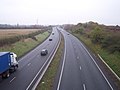 A40 (T) Gloucester By-pass - geograph.org.uk - 83362.jpg 640 × 479; 63 KB
-
 Barbican Road - geograph.org.uk - 1015278.jpg 480 × 640; 138 KB
-
 Barnet Way - geograph.org.uk - 1053084.jpg 640 × 358; 51 KB
-
 Barnwood - geograph.org.uk - 5525.jpg 640 × 480; 81 KB
-
 Berkeley Street, Gloucester - geograph.org.uk - 1015276.jpg 640 × 480; 150 KB
-
 Collingwood Crescent - geograph.org.uk - 61899.jpg 640 × 480; 197 KB
-
 Cross Keys Lane - geograph.org.uk - 1013775.jpg 480 × 640; 137 KB
-

-
 George V pillar box, Southgate Street - geograph.org.uk - 1013767.jpg 480 × 640; 109 KB
-
 Gloucester Christmas Illuminations (4211299632).jpg 2,592 × 1,728; 2.13 MB
-
 Photographing the Gloucester Christmas Illuminations (4211298420).jpg 1,833 × 1,362; 2.63 MB
-
 Gloucester, Bull Lane - geograph.org.uk - 1091382.jpg 640 × 479; 86 KB
-
 Gloucester, Hempsted Lane - geograph.org.uk - 1090396.jpg 640 × 479; 57 KB
-
 Gloucester, Llanthony Road - geograph.org.uk - 1090388.jpg 640 × 479; 49 KB
-
 Gloucester, The Quay - geograph.org.uk - 1081046.jpg 640 × 479; 55 KB
-
 Lonsdale Road, Gloucester - geograph.org.uk - 1537576.jpg 640 × 480; 232 KB
-
 Market Parade - geograph.org.uk - 1573634.jpg 640 × 480; 96 KB
-
 Marylone, off Southgate Street, Gloucester.JPG 3,000 × 4,000; 4.42 MB
-
 Mosque, Barton Road, Gloucester - geograph.org.uk - 681557.jpg 367 × 640; 63 KB
-
 Near California Crossing - geograph.org.uk - 556939.jpg 639 × 438; 48 KB
-
 New Inn Lane, Gloucester.JPG 3,000 × 4,000; 4.13 MB
-
 Nine Elms Road Elmbridge Gloucester - geograph.org.uk - 115498.jpg 640 × 480; 70 KB
-
 Old buildings in College Street - geograph.org.uk - 1432512.jpg 640 × 472; 110 KB
-
 Painswick Road Crossing - geograph.org.uk - 77884.jpg 640 × 480; 69 KB
-
 Sheep road sign, Matson, Gloucester - geograph.org.uk - 3980142.jpg 800 × 586; 103 KB
-
 St Marys St, Gloucester inc The Pelican Inn.jpg 4,000 × 2,248; 1.38 MB
-
 Swan Road, Gloucester - geograph.org.uk - 2881518.jpg 640 × 443; 64 KB
-
 Terrace South of Gloucester Cathedral - geograph.org.uk - 1704634.jpg 800 × 600; 189 KB
-
-
 View from Llanthoney Bridge - geograph.org.uk - 694158.jpg 640 × 480; 57 KB
-
 Derby Road, Gloucester - geograph.org.uk - 61896.jpg 640 × 480; 223 KB
-
 Estcourt Road, Gloucester - geograph.org.uk - 77909.jpg 640 × 480; 108 KB
-

-
 Swan Road - geograph.org.uk - 307772.jpg 640 × 480; 81 KB
-
 The Cross, Gloucester - geograph.org.uk - 61283.jpg 640 × 480; 89 KB
_Gloucester_By-pass_-_geograph.org.uk_-_83362.jpg)


.jpg)
.jpg)


