Category:Stretham
Jump to navigation
Jump to search
English: Stretham is a small village in East Cambridgeshire. It is located south of Ely along the A10. Its main attraction is Stretham Old Engine, a steam-powered pump used to drain the fens, the pump is still in use today although converted to electric power, it has open days throughout the year.
village in East Cambridgeshire, United Kingdom  | |||||
| Upload media | |||||
| Instance of | |||||
|---|---|---|---|---|---|
| Location | East Cambridgeshire, Cambridgeshire, East of England, England | ||||
| Population |
| ||||
| Area |
| ||||
| Said to be the same as | Stretham (Wikimedia duplicated page, civil parish) | ||||
 | |||||
Subcategories
This category has the following 6 subcategories, out of 6 total.
J
R
- Red Lion, Stretham (4 F)
S
- Stretham Old Engine (23 F)
- Stretham railway station (2 F)
V
- Village Cross, Stretham (5 F)
W
- Stretham Windmill (3 F)
Media in category "Stretham"
The following 200 files are in this category, out of 363 total.
(previous page) (next page)-
 A new use for an old traffic cone - geograph.org.uk - 1448260.jpg 480 × 640; 133 KB
-
 A small tree and its long shadow, off Green End - geograph.org.uk - 5815023.jpg 768 × 1,024; 269 KB
-
 A10 crossing River Great Ouse - geograph.org.uk - 3194872.jpg 1,600 × 1,200; 1.14 MB
-
 A10 crossing River Great Ouse - geograph.org.uk - 3664717.jpg 1,600 × 1,200; 748 KB
-
 A10 leaving Stretham - geograph.org.uk - 5379119.jpg 1,600 × 1,200; 226 KB
-
 A10 north of Stretham - geograph.org.uk - 2305594.jpg 1,600 × 1,200; 523 KB
-
 A10 south of Stretham - geograph.org.uk - 2854939.jpg 1,600 × 1,200; 580 KB
-
 A10, Stretham - geograph.org.uk - 5379115.jpg 1,600 × 1,211; 244 KB
-
 A1123 - geograph.org.uk - 5450092.jpg 640 × 426; 53 KB
-
 A1123 - geograph.org.uk - 5867903.jpg 1,024 × 681; 77 KB
-

-
 A1123, Gatehouse Level Crossing - geograph.org.uk - 4275926.jpg 640 × 430; 40 KB
-
 A1123, Newmarket Rd - geograph.org.uk - 4366255.jpg 640 × 596; 46 KB
-
 A1123, Newmarket Rd - geograph.org.uk - 5458019.jpg 640 × 426; 49 KB
-
 Allotment sheds, Green End, Stretham - geograph.org.uk - 5815000.jpg 1,024 × 576; 84 KB
-
 Allotment track, off Green End, Stretham - geograph.org.uk - 5815003.jpg 1,024 × 768; 159 KB
-

-

-
 Arable crops, Starlock Hay Fen Common - geograph.org.uk - 5815010.jpg 1,024 × 768; 356 KB
-
 Bank of the River Ouse, Stretham - geograph.org.uk - 1755020.jpg 800 × 600; 141 KB
-
 Baptist Chapel, Stretham - geograph.org.uk - 1763098.jpg 800 × 600; 157 KB
-
 Berry Green Farm - geograph.org.uk - 6680399.jpg 1,024 × 768; 126 KB
-
 Berry Green, Stretham - geograph.org.uk - 5820378.jpg 1,000 × 640; 122 KB
-
 Berry Timber Buildings by the A10 - geograph.org.uk - 2936615.jpg 1,600 × 1,200; 905 KB
-
 Black fenland soil - geograph.org.uk - 4370433.jpg 640 × 426; 32 KB
-
 Black fenland soil - geograph.org.uk - 4370434.jpg 640 × 426; 39 KB
-
 Boarded up chapel, Stretham - geograph.org.uk - 2304795.jpg 1,600 × 1,200; 640 KB
-
 Boating on the River Great Ouse - geograph.org.uk - 262395.jpg 480 × 640; 81 KB
-
 Boats on the River Great Ouse, Stow Bridge, Stretham - geograph.org.uk - 4226811.jpg 4,320 × 3,240; 5.42 MB
-
 Boiler Feed Pump - geograph.org.uk - 3079259.jpg 424 × 640; 257 KB
-
 Bridge over Great Ouse - geograph.org.uk - 4623143.jpg 2,560 × 1,920; 1.85 MB
-
 Broken crates in a field - geograph.org.uk - 4619414.jpg 2,560 × 1,920; 1.88 MB
-
 Cambridge Road, Elford Closes - geograph.org.uk - 5562138.jpg 2,304 × 1,728; 821 KB
-
 Cambridge Road, Stretham - geograph.org.uk - 5560747.jpg 2,304 × 1,728; 1.18 MB
-
 Caravans and a park home - geograph.org.uk - 2305628.jpg 1,600 × 1,200; 677 KB
-
 Chadwick Way, Stretham - geograph.org.uk - 6500034.jpg 1,600 × 1,200; 223 KB
-
 Chapel Street, Stretham - geograph.org.uk - 1763080.jpg 800 × 600; 126 KB
-
 Chapel Street, Stretham - geograph.org.uk - 1763081.jpg 800 × 600; 145 KB
-
 Chear Fen - geograph.org.uk - 2696573.jpg 1,600 × 1,200; 654 KB
-
 Chear Fen Farms - geograph.org.uk - 2696576.jpg 1,600 × 1,200; 709 KB
-
 Chear Lode - geograph.org.uk - 4614991.jpg 2,560 × 1,920; 2.16 MB
-
 Chittering Farm - geograph.org.uk - 4364235.jpg 640 × 297; 13 KB
-
 Chittering Solar Farm (construction) - geograph.org.uk - 4366238.jpg 640 × 426; 50 KB
-
 Chittering Solar Farm (construction) - geograph.org.uk - 4366241.jpg 640 × 426; 64 KB
-
 Chittering Solar Farm - geograph.org.uk - 4366196.jpg 640 × 426; 51 KB
-
 Chittering Solar Farm - geograph.org.uk - 4366207.jpg 640 × 426; 43 KB
-
 Chittering Solar Farm - geograph.org.uk - 4366221.jpg 640 × 426; 48 KB
-
 Chittering Solar Farm - geograph.org.uk - 4366229.jpg 640 × 426; 42 KB
-
 Chittering Solar Farm - geograph.org.uk - 4396721.jpg 640 × 430; 37 KB
-
 Chittering Solar Farm - geograph.org.uk - 5458030.jpg 640 × 426; 44 KB
-
 Chittering Solar Farm - geograph.org.uk - 5458032.jpg 640 × 253; 43 KB
-
 Chittering Solar Farm - geograph.org.uk - 5829741.jpg 1,024 × 681; 111 KB
-
 Chittering Solar Farm - geograph.org.uk - 5867909.jpg 1,024 × 681; 69 KB
-
 Chittering Solar Farm and fenland farmland - geograph.org.uk - 5830102.jpg 1,024 × 681; 109 KB
-
 Church with spire in Stretham - geograph.org.uk - 4211451.jpg 4,320 × 3,240; 5.82 MB
-
 Cottage beside the Old Engine House - geograph.org.uk - 3455485.jpg 2,477 × 1,858; 1.05 MB
-
 Covered fields - geograph.org.uk - 5450086.jpg 640 × 426; 33 KB
-
 Covered fields - geograph.org.uk - 5450087.jpg 640 × 426; 52 KB
-
 Covered in plastic - geograph.org.uk - 5452365.jpg 640 × 426; 43 KB
-
 Covered in plastic and field drain - geograph.org.uk - 5452367.jpg 640 × 426; 54 KB
-
 Cow at Wicken Washes - geograph.org.uk - 2573910.jpg 1,600 × 1,200; 823 KB
-
 Cow by the Cam - geograph.org.uk - 4629626.jpg 2,560 × 1,920; 1.7 MB
-
 Detail of Old building by the Rectory - geograph.org.uk - 1763074.jpg 800 × 600; 261 KB
-
 Ditch across Snoots Common - geograph.org.uk - 2854931.jpg 1,200 × 1,600; 699 KB
-
 Ditch on Snoots Common - geograph.org.uk - 2854900.jpg 1,600 × 1,200; 968 KB
-
 Ditch, Stretham Mere - geograph.org.uk - 4275858.jpg 640 × 430; 49 KB
-
 Drain on Starlock Hay Fen Common - geograph.org.uk - 5815004.jpg 1,024 × 768; 221 KB
-
 Drainage area for new housing, Stretham - geograph.org.uk - 6500035.jpg 1,600 × 1,200; 326 KB
-
 Drainage ditch - geograph.org.uk - 5450821.jpg 640 × 426; 43 KB
-
 Drainage dyke - geograph.org.uk - 5987345.jpg 3,264 × 2,448; 2.39 MB
-
 Drainage into the Ouse - geograph.org.uk - 3079268.jpg 640 × 424; 249 KB
-
 Ely Road passing Stretham - geograph.org.uk - 4993872.jpg 1,500 × 1,125; 135 KB
-
 Ely Road south of Stretham - geograph.org.uk - 5567325.jpg 2,220 × 1,610; 983 KB
-
 Embankment of a reservoir - geograph.org.uk - 4370435.jpg 640 × 281; 37 KB
-
 Entrance to Stretham - geograph.org.uk - 5586487.jpg 640 × 480; 38 KB
-
 Essar petrol station, Stretham - geograph.org.uk - 5379099.jpg 1,600 × 1,200; 200 KB
-
 Fareham Brewery Engine - geograph.org.uk - 3079255.jpg 530 × 800; 125 KB
-
 Farm machinery at Chear Fen Farms - geograph.org.uk - 4793588.jpg 4,320 × 3,240; 5.48 MB
-
 Farm track near Newmarket Road level crossing, Stretham - geograph.org.uk - 4226971.jpg 4,320 × 3,240; 5.21 MB
-
 Farming by solar farm - geograph.org.uk - 5829739.jpg 1,024 × 681; 108 KB
-
 Farming machinery - geograph.org.uk - 5012532.jpg 640 × 314; 39 KB
-
 Farmland near Quarterway House, Little Thetford - geograph.org.uk - 4226738.jpg 4,320 × 3,240; 5.79 MB
-
 Farmland on Middle Common, Stretham - geograph.org.uk - 4793551.jpg 4,320 × 3,240; 5.85 MB
-
 Farmland, Grunty Fen, Cambs - geograph.org.uk - 231447.jpg 640 × 480; 280 KB
-
 Farmland, Starlock Hay Fen Common - geograph.org.uk - 5815005.jpg 1,024 × 768; 221 KB
-
 Fen Rivers Way - geograph.org.uk - 4629884.jpg 2,560 × 1,920; 1.91 MB
-
 Fen Rivers Way - geograph.org.uk - 4629909.jpg 2,560 × 1,920; 1.92 MB
-
 Fenland alongside Newmarket Road, Stretham - geograph.org.uk - 4226977.jpg 4,320 × 3,240; 5.99 MB
-
 Fenland and solar farm - geograph.org.uk - 5867910.jpg 1,024 × 680; 91 KB
-
 Fenland fields - geograph.org.uk - 1755030.jpg 800 × 600; 111 KB
-
 Fens and solar farm - geograph.org.uk - 5012524.jpg 640 × 426; 36 KB
-
 Fens and solar farm - geograph.org.uk - 5012529.jpg 640 × 426; 52 KB
-
 Fidwell Fen - geograph.org.uk - 4275937.jpg 640 × 430; 46 KB
-
 Field by Wilburton Road, Stretham - geograph.org.uk - 5569073.jpg 2,238 × 1,636; 1.09 MB
-
 Field by Wilburton Road, Stretham - geograph.org.uk - 5569074.jpg 2,304 × 1,728; 816 KB
-
 Field, Tiled House Farm - geograph.org.uk - 5830103.jpg 1,024 × 681; 75 KB
-
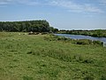
 Fields by River Great Ouse - geograph.org.uk - 3194861.jpg 1,600 × 1,200; 801 KB
-
 Flat farmland near Railway Farm - geograph.org.uk - 4706298.jpg 640 × 439; 90 KB
-
 Flat farmland, Stretham Mere - geograph.org.uk - 4709276.jpg 640 × 390; 40 KB
-
 Flat fenland farmland - geograph.org.uk - 5829744.jpg 1,024 × 681; 104 KB
-
 Flooded field by the Great Ouse - geograph.org.uk - 4578025.jpg 2,560 × 1,920; 1.53 MB
-
 Flooded field near Lazy Otter - geograph.org.uk - 4619531.jpg 2,560 × 1,920; 1.76 MB
-
 Flooded fields and anaerobic digestion plant - geograph.org.uk - 4623062.jpg 2,560 × 1,920; 1.37 MB
-
 Flooded fields south of River Great Ouse - geograph.org.uk - 2696563.jpg 1,600 × 1,200; 467 KB
-
 Flooded fields south of River Great Ouse - geograph.org.uk - 2696590.jpg 1,600 × 1,200; 557 KB
-
 Footpath along River Great Ouse - geograph.org.uk - 3194810.jpg 1,600 × 1,200; 838 KB
-
 Footpath along River Great Ouse - geograph.org.uk - 3194830.jpg 1,600 × 1,200; 970 KB
-
 Footpath along River Great Ouse - geograph.org.uk - 3194840.jpg 1,600 × 1,200; 833 KB
-
 Footpath along River Great Ouse - geograph.org.uk - 3194903.jpg 1,600 × 1,200; 956 KB
-
 Footpath along the Great Ouse - geograph.org.uk - 4578034.jpg 2,560 × 1,920; 1.57 MB
-
 Footpath away from Stretham - geograph.org.uk - 2304811.jpg 1,600 × 1,200; 722 KB
-
 Footpath beside the River Great Ouse - geograph.org.uk - 3123524.jpg 800 × 533; 282 KB
-
 Footpath from A10 - geograph.org.uk - 2854889.jpg 1,600 × 1,200; 843 KB
-
 Footpath gate on the floodbank, River Great Ouse - geograph.org.uk - 5814999.jpg 1,024 × 768; 196 KB
-
 Footpath off Mill Way - geograph.org.uk - 2305704.jpg 1,600 × 1,200; 743 KB
-
 Footpath to Little Thetford - geograph.org.uk - 2305514.jpg 1,600 × 1,200; 708 KB
-
 Footpath to Red Hill Farm - geograph.org.uk - 2854922.jpg 1,600 × 1,200; 837 KB
-
 Footpath, dike and hedgerow near Stretham, Cambs - geograph.org.uk - 4226713.jpg 4,320 × 3,240; 5.53 MB
-
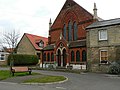
 Former Primary School, Stretham - geograph.org.uk - 1763083.jpg 800 × 600; 194 KB
-
 Former Primary School, Stretham - geograph.org.uk - 799433.jpg 640 × 480; 82 KB
-
 Garage by A10 - geograph.org.uk - 2936608.jpg 1,600 × 1,200; 564 KB
-
 Grange Farm near Stretham Ferry Bridge - geograph.org.uk - 4793562.jpg 4,320 × 3,240; 6.02 MB
-
 Gravel Farm - geograph.org.uk - 5867902.jpg 1,024 × 681; 75 KB
-
 Gravel Farm on the Old West River - geograph.org.uk - 1749408.jpg 640 × 426; 65 KB
-
 Grazing marsh by the Cam - geograph.org.uk - 4629643.jpg 2,560 × 1,920; 1.54 MB
-
 Great Ouse at Chear Fen - geograph.org.uk - 2076952.jpg 640 × 480; 86 KB
-
 Green End, Stretham - geograph.org.uk - 1755041.jpg 800 × 600; 134 KB
-
 Green space, Stretham - geograph.org.uk - 1763064.jpg 800 × 600; 220 KB
-
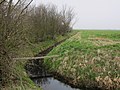
 Grunty Fen Catchwater drain - geograph.org.uk - 2305681.jpg 1,600 × 1,200; 655 KB
-
 Hannam's Wake Hub - geograph.org.uk - 4619502.jpg 2,560 × 1,920; 1.65 MB
-
 Harvesting vegetables by the Cam - geograph.org.uk - 4629632.jpg 2,560 × 1,920; 1.98 MB
-
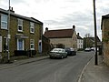
 High Street, Stretham - geograph.org.uk - 1763085.jpg 800 × 600; 205 KB
-
 High Street, Stretham - geograph.org.uk - 2305711.jpg 1,600 × 1,200; 525 KB
-
 Holt Fen - geograph.org.uk - 4629893.jpg 2,560 × 1,920; 1.77 MB
-
 Holt Fen - geograph.org.uk - 5830106.jpg 1,024 × 681; 85 KB
-
 Home Farmhouse, Stretham - geograph.org.uk - 5820414.jpg 1,000 × 833; 218 KB
-
 House for sale, Newmarket Road - geograph.org.uk - 5820545.jpg 1,024 × 768; 184 KB
-
 Housing on the edge of Stretham - geograph.org.uk - 799422.jpg 640 × 480; 71 KB
-
 Hundred Acres - geograph.org.uk - 4623162.jpg 2,560 × 1,920; 1.67 MB
-
 Innes D'Auvergne Stewart Stitt war memorial - geograph.org.uk - 5836881.jpg 2,015 × 1,334; 484 KB
-
 Irrigating a potato field - geograph.org.uk - 4623081.jpg 2,560 × 1,920; 1.75 MB
-
 Irrigating farmland on Stretham Mere - geograph.org.uk - 5816795.jpg 1,024 × 768; 266 KB
-
 Irrigation near Solar Farm - geograph.org.uk - 5829738.jpg 1,024 × 681; 108 KB
-

-
 Layby by A10 - geograph.org.uk - 2854879.jpg 1,600 × 1,200; 744 KB
-
 Line of trees - geograph.org.uk - 5450083.jpg 640 × 426; 58 KB
-
 Line of trees near Railway Farm - geograph.org.uk - 4706302.jpg 640 × 395; 55 KB
-
 Lone tree in field - geograph.org.uk - 6680395.jpg 1,024 × 768; 151 KB
-
 Lone tree on outskirts of Stretham - geograph.org.uk - 5820328.jpg 1,000 × 717; 174 KB
-
 Meadow Field, east from the public footpath - geograph.org.uk - 5816783.jpg 1,024 × 768; 266 KB
-

-
 Memorial rood screen inside St James' church, Stretham - geograph.org.uk - 5836876.jpg 2,016 × 1,512; 616 KB
-
 Mere Mill Drove, Stretham - geograph.org.uk - 1755169.jpg 800 × 600; 187 KB
-
 Middle Common Drove (1) - geograph.org.uk - 5816786.jpg 1,024 × 768; 229 KB
-
 Middle Common Drove (2) - geograph.org.uk - 5816789.jpg 1,024 × 576; 184 KB
-
 Mill Way - geograph.org.uk - 2305697.jpg 1,600 × 1,200; 753 KB
-
 Mirrlees Diesel Engine - geograph.org.uk - 3079296.jpg 424 × 640; 243 KB
-
 Mirrlees Diesel Engine - geograph.org.uk - 3079301.jpg 424 × 640; 234 KB
-
 Mirrlees Diesel Engine - geograph.org.uk - 3079303.jpg 640 × 424; 249 KB
-
 Moorings by the Lazy Otter - geograph.org.uk - 4619518.jpg 2,560 × 1,920; 1.9 MB
-
 Names of the fallen on the WW2 memorial rood screen - geograph.org.uk - 5836877.jpg 2,016 × 1,512; 578 KB
-
 Near Fidwell Farm - geograph.org.uk - 5450089.jpg 640 × 426; 54 KB
-
 New houses expanding Stretham - geograph.org.uk - 6500031.jpg 1,600 × 1,198; 257 KB
-
 New housing, Stretham - geograph.org.uk - 2573875.jpg 1,600 × 1,200; 612 KB
-
 Newmarket Road crossing River Great Ouse - geograph.org.uk - 3194825.jpg 1,600 × 1,200; 858 KB
-
 Old building by the Rectory, Stretham - geograph.org.uk - 1763070.jpg 800 × 600; 252 KB
-
 Old Engine House - geograph.org.uk - 3455470.jpg 1,600 × 1,200; 261 KB
-
 Old road by the A10 - geograph.org.uk - 2696581.jpg 1,600 × 1,200; 743 KB
-
 Old Wayside Cross - geograph.org.uk - 6493741.jpg 720 × 960; 199 KB
-

-
 Ordnance Survey Cut Mark - geograph.org.uk - 4449477.jpg 4,000 × 3,000; 4.13 MB
-
 Ordnance Survey Cut Mark - geograph.org.uk - 6022402.jpg 1,024 × 588; 195 KB
-
 Ordnance Survey Cut Mark - geograph.org.uk - 6022405.jpg 1,024 × 556; 176 KB
-
 Ordnance Survey Flush Bracket (1406) - geograph.org.uk - 6022400.jpg 767 × 1,024; 239 KB
-
 Ordnance Survey Flush Bracket (G655) - geograph.org.uk - 6022403.jpg 733 × 1,024; 234 KB
-
 Ordnance Survey Flush Bracket 1406 - geograph.org.uk - 4450423.jpg 4,000 × 3,000; 3.43 MB
-
 Ordnance Survey Flush Bracket G655 - geograph.org.uk - 4450437.jpg 4,000 × 3,000; 3.98 MB
-
 Ouse Valley Way - geograph.org.uk - 4619525.jpg 2,560 × 1,920; 2.04 MB
-
 Ouse Valley Way - geograph.org.uk - 4619541.jpg 2,560 × 1,920; 1.94 MB
-
 Ouse Valley Way - geograph.org.uk - 4623083.jpg 2,560 × 1,920; 2.17 MB
-
 Ouse Valley Way - geograph.org.uk - 4623152.jpg 2,560 × 1,920; 1.96 MB
-
 Pantiles and solar panels - geograph.org.uk - 5820568.jpg 1,000 × 753; 170 KB
-
 Parson's Drove - geograph.org.uk - 2305686.jpg 1,600 × 1,200; 788 KB
-
 Parson's Drove - geograph.org.uk - 2305691.jpg 1,600 × 1,200; 881 KB
-
 Parson's Drove near Stretham, Cambridgeshire - geograph.org.uk - 4226695.jpg 4,320 × 3,240; 5.37 MB
-
 Passing place, Green End, Stretham - geograph.org.uk - 5815009.jpg 1,024 × 768; 147 KB
-
 Path along Grunty Fen Catchwater drain - geograph.org.uk - 2305641.jpg 1,600 × 1,200; 810 KB
-
 Path along Grunty Fen Catchwater drain - geograph.org.uk - 2305676.jpg 1,600 × 1,200; 1.09 MB
-
 Path along Grunty Fen Catchwater drain - geograph.org.uk - 2305679.jpg 1,600 × 1,200; 804 KB
-
 Pavement along A10 - geograph.org.uk - 3194879.jpg 1,600 × 1,200; 1,002 KB
-
 Peter Junior Patent Safety Oil Engine - geograph.org.uk - 3079299.jpg 424 × 640; 216 KB
-
 Petrol station on Cambridge Road, Stretham - geograph.org.uk - 5560746.jpg 2,304 × 1,728; 817 KB
-
 Pillbox off Newmarket Road - geograph.org.uk - 4232968.jpg 4,320 × 3,240; 6.06 MB
-
 Plantation Farm - geograph.org.uk - 6680403.jpg 1,024 × 768; 110 KB
-
 Pond connected to the River Cam - geograph.org.uk - 4305360.jpg 640 × 430; 81 KB
-

-
 Public footpath to Middle Common Drove - geograph.org.uk - 5816778.jpg 1,024 × 768; 408 KB
-
 Public footpath to Stretham - geograph.org.uk - 5816784.jpg 1,024 × 768; 304 KB
-
 Pump Lane, Stretham - geograph.org.uk - 1763077.jpg 450 × 600; 74 KB
-
 Railway near Stretham - geograph.org.uk - 4785295.jpg 1,280 × 960; 195 KB


_-_geograph.org.uk_-_4366238.jpg)
_-_geograph.org.uk_-_4366241.jpg)


_-_geograph.org.uk_-_5816786.jpg)
_-_geograph.org.uk_-_5816789.jpg)


_-_geograph.org.uk_-_6022400.jpg)
_-_geograph.org.uk_-_6022403.jpg)


