Category:Strijperstraat 44, Leende
Jump to navigation
Jump to search
| Object location | | View all coordinates using: OpenStreetMap |
|---|
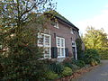
farmhouse in Heeze-Leende, Netherlands  | |||||
| Upload media | |||||
| Instance of | |||||
|---|---|---|---|---|---|
| Location | Leende, North Brabant, Netherlands | ||||
| Street address |
| ||||
| Heritage designation |
| ||||
 | |||||
|
This is a category about rijksmonument number 23992
|
| Address |
|
Media in category "Strijperstraat 44, Leende"
The following 2 files are in this category, out of 2 total.
-
 44 - Leenderstrijp - 20129704 - RCE.jpg 1,200 × 804; 219 KB
-
 Strijperstraat 44 Leenderstrijp Monument 23992.jpg 4,320 × 3,240; 5.91 MB
