Category:Stromeferry
Jump to navigation
Jump to search
human settlement in Highland, Scotland, UK  | |||||
| Upload media | |||||
| Instance of | |||||
|---|---|---|---|---|---|
| Location |
| ||||
 | |||||
English: Stromeferry is a village on the west coast of Scotland.
Nederlands: Stromeferry ( Schots-Gaelisch: Port an t-Sròim) is een dorp aan de westkust van de Schotse Lieutenancy Ross and Cromarty in de council Highland op de zuidelijke oever van Loch Carron.
Subcategories
This category has only the following subcategory.
S
- Stromeferry railway station (14 F)
Media in category "Stromeferry"
The following 75 files are in this category, out of 75 total.
-
 Admiralty Chart No 3564 Loch Kishorn and the approaches to Loch Carron, Published 1906.jpg 10,507 × 15,982; 71.22 MB
-
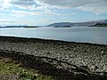
 Beached boat on Castle Bay - geograph.org.uk - 2460966.jpg 640 × 480; 121 KB
-
 Bridge - geograph.org.uk - 171015.jpg 640 × 480; 119 KB
-
 Castle Bay and Loch Carron - geograph.org.uk - 2571421.jpg 3,661 × 2,690; 2.49 MB
-
 Castle Bay as seen from Strome Castle - geograph.org.uk - 2732801.jpg 1,024 × 768; 125 KB
-
 Colours - panoramio (25).jpg 4,000 × 3,000; 4.78 MB
-
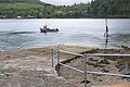
 Ferry, Strome Ferry - geograph.org.uk - 2812316.jpg 640 × 360; 214 KB
-
 Fishing gear at Strome Ferry slipway - geograph.org.uk - 2571445.jpg 3,930 × 2,942; 1.86 MB
-
 I Like It - panoramio (4).jpg 4,000 × 3,000; 4.46 MB
-
 Jetty at Strome Ferry - geograph.org.uk - 922600.jpg 640 × 480; 67 KB
-
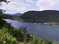
 Loch Carron - geograph.org.uk - 1873715.jpg 640 × 480; 116 KB
-
 Loch Carron - geograph.org.uk - 4507237.jpg 4,608 × 3,456; 5.04 MB
-
 Loch Carron - geograph.org.uk - 4614964.jpg 640 × 480; 63 KB
-
 Loch Carron - geograph.org.uk - 6337920.jpg 3,520 × 2,303; 1.44 MB
-
 Loch Carron from near Stromeferry - geograph.org.uk - 6046623.jpg 1,600 × 1,063; 271 KB
-
 Loch Carron from Strome Ferry - geograph.org.uk - 1973728.jpg 1,024 × 768; 353 KB
-
 Loch Carron from the Inverness-bound train - geograph.org.uk - 5583352.jpg 1,600 × 900; 266 KB
-
 Loch Carron View - geograph.org.uk - 2323154.jpg 3,456 × 2,304; 1.09 MB
-
 Loch Carron view above Strome Ferry - geograph.org.uk - 3523905.jpg 750 × 563; 86 KB
-
 Loch Carron, viewpoint view - geograph.org.uk - 2436983.jpg 1,575 × 1,171; 2.08 MB
-
 Low Tide - panoramio (5).jpg 4,000 × 3,000; 2.53 MB
-
 Milepost, Mid Strome - geograph.org.uk - 1349467.jpg 640 × 427; 92 KB
-
 MV 'Glenachulish' at Stromeferry.jpg 480 × 320; 112 KB
-
 MV Glenachulish ferry at Strome Narrows (6866211776).jpg 1,280 × 960; 922 KB
-
 MV Glenachullish at South Strome (6866210916).jpg 1,280 × 960; 878 KB
-
 Nice Weather - panoramio (3).jpg 4,000 × 3,000; 4.89 MB
-
 No Wind - panoramio.jpg 4,000 × 3,000; 2.4 MB
-
 North Strome slipway - geograph.org.uk - 2571315.jpg 4,000 × 3,000; 2.26 MB
-
 North Strome slipway - geograph.org.uk - 5078645.jpg 1,600 × 873; 501 KB
-
 Pier and Sea Wall at Stromeferry - geograph.org.uk - 1595986.jpg 640 × 441; 83 KB
-
 Pier, North Strome - geograph.org.uk - 2948069.jpg 640 × 360; 233 KB
-
 Salmon - panoramio (2).jpg 4,000 × 3,000; 2.95 MB
-
 Scotland 1994 (49565678537).jpg 12,671 × 8,224; 6.99 MB
-
 Scotland190609 67C (6817651063).jpg 1,432 × 768; 651 KB
-
 Strome Castle - geograph.org.uk - 5640767.jpg 1,106 × 1,600; 404 KB
-
 Strome Castle, Loch Carron - geograph.org.uk - 5239968.jpg 7,790 × 4,717; 5.35 MB
-
 Strome Ferry - with a ferry - geograph.org.uk - 2943787.jpg 640 × 360; 180 KB
-
 Strome Ferry 1963 - geograph.org.uk - 2341143.jpg 2,592 × 1,680; 203 KB
-
 Strome Ferry from the ferry - geograph.org.uk - 2811500.jpg 640 × 360; 201 KB
-
 Strome Ferry Hotel - geograph.org.uk - 957284.jpg 640 × 480; 92 KB
-
 Strome Ferry in operation, February 2012 - geograph.org.uk - 3050273.jpg 3,888 × 2,185; 1.35 MB
-
 Strome Ferry ticket office (7012325249).jpg 1,280 × 960; 948 KB
-
 Strome Ferry timetable (6866213284).jpg 1,280 × 960; 734 KB
-
 Strome House - geograph.org.uk - 2098549.jpg 3,504 × 2,336; 336 KB
-
 Stromeferry (with ferry).jpg 480 × 318; 136 KB
-
 Stromeferry ferry 2012 - geograph.org.uk - 2808301.jpg 640 × 423; 67 KB
-
 Stromeferry in 1967 - geograph.org.uk - 1840347.jpg 800 × 530; 86 KB
-
 Stromeferry-no ferry.jpg 480 × 360; 70 KB
-
 Stromeferry1.JPG 3,264 × 2,448; 2.77 MB
-
 Stromemore from Strome Ferry - geograph.org.uk - 4644602.jpg 2,300 × 1,540; 499 KB
-
 The narrows at Strome - geograph.org.uk - 2404916.jpg 1,000 × 669; 168 KB
-
 The old slipway, North Strome - geograph.org.uk - 5398369.jpg 1,600 × 1,066; 578 KB
-
 View from the ruins of Strome Castle - geograph.org.uk - 4510203.jpg 800 × 532; 99 KB
-
 View over Loch Carron to Stromemore - geograph.org.uk - 2358511.jpg 640 × 480; 45 KB
-
 Am Meallan - geograph.org.uk - 1154118.jpg 640 × 480; 83 KB
-
 Am Meallan - geograph.org.uk - 1155774.jpg 640 × 480; 120 KB
-
 Bridge at Fernaig Shore - geograph.org.uk - 374697.jpg 640 × 482; 145 KB
-
 Creag Mhoal, Nr. Stromeferry - geograph.org.uk - 88193.jpg 640 × 480; 77 KB
-
 Fernaig Shore - geograph.org.uk - 374705.jpg 640 × 482; 106 KB
-
 Fishing boat off Stromeferry - geograph.org.uk - 332734.jpg 640 × 425; 273 KB
-
 Gleann Udalain - geograph.org.uk - 291924.jpg 640 × 480; 345 KB
-
 Loch Carron and Lochcarron - geograph.org.uk - 394815.jpg 640 × 427; 75 KB
-
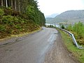
 Road - geograph.org.uk - 171006.jpg 640 × 480; 82 KB
-
 Road - geograph.org.uk - 171028.jpg 640 × 480; 79 KB
-
 Sinuous Estuary - geograph.org.uk - 359331.jpg 640 × 480; 123 KB
-
 Slipway at Strome Ferry - geograph.org.uk - 393330.jpg 640 × 480; 64 KB
-
 Strome Ferry Hotel - geograph.org.uk - 216766.jpg 480 × 640; 88 KB
-
 Strome Ferry telephone box and slipway - geograph.org.uk - 526442.jpg 640 × 482; 101 KB
-
 Stromeferry - geograph.org.uk - 350794.jpg 480 × 640; 161 KB
-
 Stromeferry looking up the hill - geograph.org.uk - 526469.jpg 640 × 482; 85 KB
-
 Stromeferry slipway - geograph.org.uk - 526464.jpg 640 × 482; 65 KB
-
 The slipway at Stromeferry - geograph.org.uk - 216764.jpg 640 × 480; 62 KB
-
 Track to Achmore - geograph.org.uk - 291927.jpg 640 × 480; 349 KB
-
 Track to Tigh Bruadair - geograph.org.uk - 268167.jpg 640 × 480; 78 KB
-
 Trees by the Fernaig Road - geograph.org.uk - 348332.jpg 640 × 482; 99 KB


.jpg)


.jpg)


.jpg)


.jpg)
.jpg)
.jpg)


.jpg)
.jpg)
.jpg)


.jpg)
.jpg)

.jpg)


