Category:Stromness
Jump to navigation
Jump to search
second largest town in Orkney, Scotland  | |||||
| Upload media | |||||
| Instance of |
| ||||
|---|---|---|---|---|---|
| Location |
| ||||
| Population |
| ||||
 | |||||
 | |||||


English: Stromness is a town in Orkney, Scotland.
Subcategories
This category has the following 6 subcategories, out of 6 total.
Media in category "Stromness"
The following 200 files are in this category, out of 411 total.
(previous page) (next page)-
 2 - panoramio (6).jpg 3,240 × 4,320; 5.04 MB
-
 2018 07 12 Schottland (77).jpg 4,000 × 3,000; 4.53 MB
-
 2018 07 12 Schottland (80).jpg 4,000 × 3,000; 4.92 MB
-

-
 A Little Paint And It's New - panoramio.jpg 4,320 × 3,240; 4.42 MB
-

-
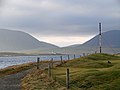 A view from Point of Ness - geograph.org.uk - 2703492.jpg 640 × 480; 139 KB
-
 A965 Stromness to Kirkwall road - geograph.org.uk - 377682.jpg 640 × 480; 103 KB
-
 A967 approaching Redlandhill - geograph.org.uk - 1111445.jpg 640 × 403; 36 KB
-
 A967 Junction - geograph.org.uk - 1092074.jpg 640 × 425; 81 KB
-
 A967 junction - geograph.org.uk - 1110268.jpg 640 × 367; 42 KB
-
 ABDAG007790 - William Daniell - Stromness, Orkney.jpeg 800 × 555; 57 KB
-
 Admiralty Chart No 2180b Southern portion of the Orkney Islands, Scotland, Published 1886.jpg 11,787 × 8,260; 11.67 MB
-

-

-
 Alleyway to the sea, Stromness - geograph.org.uk - 1972485.jpg 544 × 800; 93 KB
-
 An ebbing tide by Ness Point - geograph.org.uk - 3099412.jpg 534 × 800; 234 KB
-
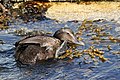 An eider and an itchy lug - geograph.org.uk - 3099389.jpg 800 × 533; 351 KB
-
 Approaching Stromness ferry terminal - geograph.org.uk - 1342028.jpg 640 × 427; 77 KB
-
 Approaching Stromness Harbour - geograph.org.uk - 1342018.jpg 640 × 282; 47 KB
-
 Arrival at Stromness on MV Hamnavoe - geograph.org.uk - 3094009.jpg 1,024 × 768; 253 KB
-
 Arriving at Stromness - geograph.org.uk - 950584.jpg 640 × 480; 53 KB
-
 Back Again - panoramio.jpg 3,240 × 4,320; 7.68 MB
-
 Bank of Scotland in Stromness in summer 2012.JPG 4,752 × 3,168; 4.65 MB
-
 Beacon at Skerry of Ness - geograph.org.uk - 1361992.jpg 640 × 423; 50 KB
-
 Beacon on the Skerry of Ness, Stromness harbour - geograph.org.uk - 4128535.jpg 1,024 × 681; 110 KB
-
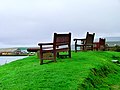 Benches With Gun - panoramio.jpg 4,320 × 3,240; 5.04 MB
-
 Billia Croo from Black Craig - geograph.org.uk - 491265.jpg 640 × 480; 108 KB
-
 Black Craig Observation Point - geograph.org.uk - 260060.jpg 640 × 480; 63 KB
-
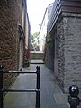 Boy's Lane, Stromness - geograph.org.uk - 950699.jpg 480 × 640; 78 KB
-
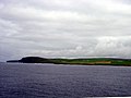 Breck Ness from the Hamnavoe - geograph.org.uk - 54197.jpg 640 × 480; 53 KB
-
 Breckness WWII Coast Defence radar station - geograph.org.uk - 14731.jpg 640 × 444; 102 KB
-
 Buildings off Ferry Road, Stromness - geograph.org.uk - 5889930.jpg 1,600 × 1,065; 423 KB
-
 Buildings on Inner Holm - geograph.org.uk - 2641538.jpg 2,592 × 1,944; 2.28 MB
-
 Cairn on Lounders Fea - geograph.org.uk - 1032207.jpg 640 × 360; 55 KB
-
 Caution Wet Floor - panoramio.jpg 3,240 × 4,320; 6.42 MB
-
 Centurion - panoramio.jpg 3,240 × 4,320; 6.29 MB
-
 Chimneys - Stromness, Orkney, Scotland - June 1, 1989.jpg 1,907 × 2,700; 2.27 MB
-
 Church in Stromness in summer 2012 (1).JPG 3,168 × 4,752; 4.64 MB
-
 Church in Stromness in summer 2012 (2).JPG 3,168 × 4,752; 4.59 MB
-
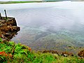 Clear Water - panoramio.jpg 4,320 × 3,240; 5.46 MB
-
 Clouds over Stromness, Orkney 2017-05-23.jpg 7,360 × 4,912; 7.55 MB
-
 Coastline west of the Point of Ness, Stromness - geograph.org.uk - 4128690.jpg 1,024 × 681; 134 KB
-
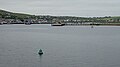 Copland's Dock and Starboard Hand Buoy - geograph.org.uk - 5811606.jpg 640 × 358; 178 KB
-
 Copland's Dock and Stromness Ferry Terminal - geograph.org.uk - 2842540.jpg 4,174 × 3,032; 4.34 MB
-
 Crossing of Dundas Street and Leslie's Close, Stromness .jpg 5,184 × 3,456; 9.64 MB
-
 Don't Get Wet - panoramio.jpg 2,018 × 1,267; 1.23 MB
-
 Don't Move - panoramio (2).jpg 3,240 × 4,320; 4.99 MB
-
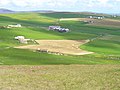 Don, by Outertown, Stromness - geograph.org.uk - 490313.jpg 640 × 480; 102 KB
-
 Dry Plumage - panoramio.jpg 4,320 × 3,240; 3.72 MB
-
 Drystone dyke at Noust of Nethertown - geograph.org.uk - 819644.jpg 640 × 480; 85 KB
-
 Dykes at Garthna Geo, Yesnaby - geograph.org.uk - 490020.jpg 480 × 640; 136 KB
-

-
 Expired - panoramio.jpg 4,320 × 3,240; 4.39 MB
-
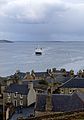 Ferry - Stromness, Orkney, Scotland, UK - June 1, 1989.jpg 1,889 × 2,700; 1.95 MB
-
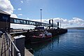 Ferry Terminal, Stromness - geograph.org.uk - 5905071.jpg 1,600 × 1,065; 434 KB
-
 Fire Access - panoramio.jpg 4,320 × 3,240; 4.45 MB
-
 Fish n chips (cropped).jpg 560 × 306; 44 KB
-
 Fish n chips.jpg 604 × 453; 68 KB
-
 Fisherman's Friend - panoramio.jpg 4,320 × 3,240; 4.72 MB
-
 Fitzroy fisheries barometer No 98, Stromness, Orkney.jpg 3,360 × 5,040; 14.06 MB
-
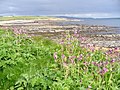 Foreshore at Noust of Nethertown - geograph.org.uk - 487739.jpg 640 × 480; 154 KB
-
 Foreshore near Warebeth - geograph.org.uk - 487769.jpg 640 × 480; 164 KB
-
 Foreshore Slabs by Noust of Nethertown - geograph.org.uk - 487754.jpg 640 × 480; 104 KB
-
 Fähre nach Hoy.jpg 640 × 480; 29 KB
-
 George VI Postbox on Ferry Road, Stromness - geograph.org.uk - 5905099.jpg 1,065 × 1,600; 548 KB
-
 Geschützstand Stromness.jpg 618 × 450; 59 KB
-
 Golfplatz Stromness.jpg 640 × 480; 49 KB
-
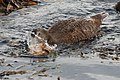 Gottcha^^^ Death in the Bladderwrack - geograph.org.uk - 3099397.jpg 800 × 534; 302 KB
-
 Graveyard by the sea - geograph.org.uk - 819649.jpg 640 × 480; 81 KB
-
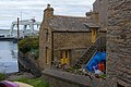 Gray's Noust, Stromness.jpg 5,089 × 3,393; 9.96 MB
-
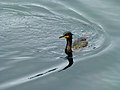 Green Eyes - panoramio.jpg 4,320 × 3,240; 4.18 MB
-
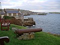 Guarding Stromness Harbour - geograph.org.uk - 2703481.jpg 640 × 480; 192 KB
-
 Haggis from a take-away restaurant in Stromness, 11.08.2015.jpg 5,184 × 3,456; 7.23 MB
-
 Hamnavoe - geograph.org.uk - 3642951.jpg 3,872 × 2,592; 1.27 MB
-
 Hamnavoe at night - geograph.org.uk - 819661.jpg 640 × 480; 54 KB
-
 Hamnavoe Licensed Restaurant sign - geograph.org.uk - 950767.jpg 640 × 480; 69 KB
-
 Hamnavoe, Stromness (1994) - geograph.org.uk - 2957498.jpg 1,168 × 784; 777 KB
-
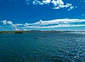 Harbour at Stromness - geograph.org.uk - 3488876.jpg 640 × 472; 92 KB
-
 Harbour by Dundas Street - geograph.org.uk - 3488890.jpg 640 × 480; 135 KB
-
 Harp In The Window - panoramio.jpg 3,240 × 4,320; 3.54 MB
-
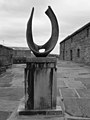 Hepworth at the Pier - geograph.org.uk - 858062.jpg 480 × 640; 59 KB
-
 Hill of Lynedardy, Orkney - geograph.org.uk - 1424750.jpg 640 × 425; 63 KB
-
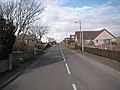 Hillside Road - geograph.org.uk - 355376.jpg 640 × 480; 126 KB
-
 Hillside Road - geograph.org.uk - 355380.jpg 640 × 480; 110 KB
-

-
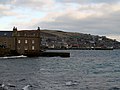
-
 House by the Stromness Museum - geograph.org.uk - 583126.jpg 640 × 425; 141 KB
-
 House on Inner Holm, Stromness harbour - geograph.org.uk - 4128518.jpg 1,024 × 680; 90 KB
-
 House ruin - geograph.org.uk - 1423630.jpg 640 × 480; 102 KB
-
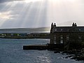 Houses beside Stromness Harbour - geograph.org.uk - 2703437.jpg 640 × 480; 95 KB
-
 Houses on Graemsay - geograph.org.uk - 4128677.jpg 1,024 × 681; 134 KB
-
 Hoy High lighthouse, Graemsay - geograph.org.uk - 4128510.jpg 1,024 × 684; 60 KB
-
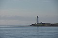 Hoy High lighthouse, Graemsay - geograph.org.uk - 4128660.jpg 1,024 × 681; 71 KB
-
 Hoy Low lighthouse, Graemsay - geograph.org.uk - 4128671.jpg 1,024 × 681; 94 KB
-
 Hoy Low lighthouse, Graemsay - geograph.org.uk - 4128681.jpg 1,024 × 681; 107 KB
-
 Hoy Low lighthouse, Graemsay - geograph.org.uk - 4128685.jpg 1,024 × 681; 115 KB
-
 Hoy Low lighthouse, Graemsay - geograph.org.uk - 4128689.jpg 1,024 × 681; 123 KB
-
 Hoy Sound - geograph.org.uk - 3643659.jpg 3,872 × 2,592; 1.58 MB
-
 Hoy Sound, and the beacon on the Skerry of Ness - geograph.org.uk - 2960351.jpg 2,345 × 1,568; 2.8 MB
-
 Hut In The Rut - panoramio.jpg 4,320 × 3,240; 4.52 MB
-
 I'm sure he'll see me... - geograph.org.uk - 3099423.jpg 800 × 533; 244 KB
-
 Inner Holm - geograph.org.uk - 2641650.jpg 2,592 × 1,944; 1.98 MB
-
 Inner Holm off Stromness - geograph.org.uk - 3094041.jpg 1,024 × 768; 167 KB
-
 Inner Holm, Stromness harbour - geograph.org.uk - 4128502.jpg 1,024 × 682; 69 KB
-
 Inner Holm.jpg 4,000 × 3,000; 1.38 MB
-
 Inner Holmes from the Hamnavoe - geograph.org.uk - 359456.jpg 640 × 480; 92 KB
-

-
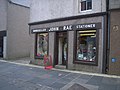 John Rae Bookseller and Stationer - geograph.org.uk - 950762.jpg 640 × 480; 80 KB
-
 Just some of Stromness slipways - panoramio.jpg 4,000 × 3,000; 4.53 MB
-
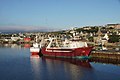 K58 Viking Monarch, Stromness Harbour - geograph.org.uk - 4128393.jpg 1,024 × 681; 170 KB
-
 Khyber Pass, Stromness - geograph.org.uk - 14733.jpg 480 × 640; 81 KB
-
 Large house built in 1802 - geograph.org.uk - 950820.jpg 640 × 480; 79 KB
-

-
 Leaving Stromness - geograph.org.uk - 5990834.jpg 1,024 × 769; 181 KB
-
 LH-0920-107.jpg 5,184 × 3,456; 11.49 MB
-
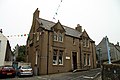 Library in Stromness in summer 2012.JPG 4,752 × 3,168; 4.2 MB
-
 Loch Of Harray (11393145).jpeg 900 × 377; 20 KB
-
 Login's well in Stromness in summer 2012.JPG 4,510 × 3,110; 9.03 MB
-
 Login's Well Stromness 2017.jpg 3,040 × 2,280; 3.7 MB
-
 Login's well, Stromness. - geograph.org.uk - 79444.jpg 640 × 480; 161 KB
-
 Logins Well at South End, Stromness.jpg 5,184 × 3,456; 12.27 MB
-
 Looking across the bay at Stromness - geograph.org.uk - 950789.jpg 640 × 480; 80 KB
-
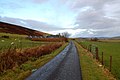 Looking at Queer - geograph.org.uk - 1081852.jpg 640 × 426; 63 KB
-

-
 Looking towards Hoy from Warebeth - geograph.org.uk - 2704268.jpg 640 × 480; 118 KB
-
 Looking towards the golf club - geograph.org.uk - 950818.jpg 640 × 480; 48 KB
-
 Lovely old winch Stromness - panoramio.jpg 4,000 × 3,000; 4.03 MB
-
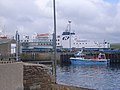 M.V. Hamnavoe at Stromness Pier - geograph.org.uk - 950718.jpg 640 × 480; 68 KB
-
 Main Means Of Transportation On Orkney - panoramio.jpg 3,240 × 4,320; 7.15 MB
-
 Mind Your Step - panoramio (1).jpg 3,240 × 4,320; 7.08 MB
-
 MV Hamnavoe entering Stromness Harbour - geograph.org.uk - 2701452.jpg 640 × 480; 149 KB
-
 MV Hamnavoe in Stromness harbour at night - geograph.org.uk - 4128377.jpg 1,024 × 681; 150 KB
-
 MV Hamnavoe, Stromness - geograph.org.uk - 2462080.jpg 1,024 × 681; 204 KB
-

-
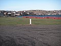 Ness Campsite - geograph.org.uk - 339771.jpg 640 × 480; 145 KB
-
 Nethertown Rd, Stromness KW16 3JR, UK - panoramio.jpg 2,592 × 1,936; 2.47 MB
-
 Nethertown shore - geograph.org.uk - 349784.jpg 640 × 480; 139 KB
-
 New Pier, Stromness - geograph.org.uk - 5637491.jpg 640 × 479; 80 KB
-
 No Parking - panoramio (1).jpg 4,320 × 3,240; 5.24 MB
-
 North End of Stromness - geograph.org.uk - 339793.jpg 640 × 480; 122 KB
-
 North End Road, Stromness - geograph.org.uk - 1445770.jpg 640 × 428; 68 KB
-
 Not To Be Confused - panoramio.jpg 3,240 × 4,320; 5.06 MB
-
 Now for the good bit^ - geograph.org.uk - 3099399.jpg 800 × 533; 198 KB
-
 Old anker Stromness - panoramio.jpg 1,683 × 1,016; 510 KB
-
 Old Lifeboat Station - geograph.org.uk - 5811611.jpg 640 × 418; 346 KB
-
 Old Stromness - geograph.org.uk - 487808.jpg 640 × 480; 116 KB
-
-
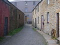
 Ordnance Survey One-Inch Sheet 6 Orkney (Kirkwall), Published 1959.jpg 8,275 × 9,882; 8.34 MB
-
 Orkney - Stromness (3721759822).jpg 1,085 × 1,600; 334 KB
-
 Orkney - Stromness - Browns Hostel (3720946353).jpg 1,600 × 1,082; 433 KB
-
 Orkney - View of Stromness (3721763584).jpg 1,600 × 1,084; 431 KB
-
 Orkney Village From Ferry.jpg 1,600 × 977; 762 KB
-
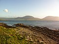 Orkney, UK - panoramio (11).jpg 2,592 × 1,936; 1.98 MB
-
 Orkney, UK - panoramio (8).jpg 2,592 × 1,936; 817 KB
-
 Orkney-Stromness 12-von Faehre-2009-gje.jpg 3,066 × 1,663; 1.5 MB
-
 Orkney-Stromness 14-von Faehre-2009-gje.jpg 3,072 × 1,728; 1.78 MB
-
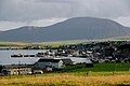 Orkney-Stromness-02-2009-gje.jpg 3,072 × 2,048; 2.11 MB
-
 Orkney-Stromness-04-2009-gje.jpg 3,072 × 2,048; 2.13 MB
-
 Orkney-Stromness-06-Zimmer-2009-gje.jpg 3,072 × 2,048; 2.53 MB
-
 Orkney-Stromness-08-Zimmer-2009-gje.jpg 3,072 × 2,048; 2.4 MB
-
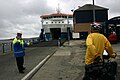 Orkney-Stromness-10-Faehre-2009-gje.jpg 3,072 × 2,048; 1.99 MB
-
 Orkney-Stromness-16-Landzunge-Oelplattform-2009-gje.jpg 3,072 × 2,048; 1.94 MB
-
 Outer Holm and Starboard Hand Buoy - geograph.org.uk - 5811608.jpg 640 × 317; 144 KB
-
 Outer Holm, Stromness harbour - geograph.org.uk - 4128500.jpg 1,024 × 681; 63 KB
-
 Overlooking Hoy Sound - geograph.org.uk - 487724.jpg 640 × 480; 78 KB
-
 PandO Ferry coming into Stromness - geograph.org.uk - 1147246.jpg 640 × 422; 39 KB
-
 Parish Church in Stromness in summer 2012.JPG 4,752 × 3,168; 4.28 MB
-
 Pier arts center.jpg 800 × 600; 219 KB
-
 Pier Arts Centre, Stromness - geograph.org.uk - 1448602.jpg 428 × 640; 74 KB
-
 Plaque for John Rae, Raes Close, Stromness.jpg 5,184 × 3,456; 12.64 MB
-
 Point and Skerry of Ness - geograph.org.uk - 2960346.jpg 2,345 × 1,568; 2.45 MB
-
 Point Ness Campsite.jpg 640 × 480; 27 KB
-
 Point of Ness - geograph.org.uk - 5811598.jpg 640 × 460; 327 KB
-
 Point of Ness and Port Hand Buoy - geograph.org.uk - 5811602.jpg 640 × 430; 201 KB
-
 Point of Ness campsite, Stromness - geograph.org.uk - 2989118.jpg 640 × 480; 159 KB
-
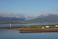 Point of Ness, at the mouth of Stromness harbour - geograph.org.uk - 4128527.jpg 1,024 × 681; 107 KB
-
 Point of Ness, Stromness harbour - geograph.org.uk - 4128532.jpg 1,024 × 681; 100 KB
-
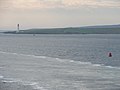 Port lateral buoy in Stromness Harbour - geograph.org.uk - 2634505.jpg 2,592 × 1,944; 1.97 MB
-
 Raes Close, Stromness.jpg 3,456 × 5,184; 10.36 MB
-
 Red Duster on the MV Hamnavoe - geograph.org.uk - 5990833.jpg 1,024 × 769; 143 KB
-
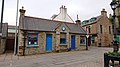 Registrar's Office, Stromness 01.jpg 5,504 × 3,096; 8.33 MB
-
 Registrar's Office, Stromness 02.jpg 3,096 × 5,504; 5.67 MB
-
 RNLI lifeboat in Stromness Harbour - geograph.org.uk - 1342115.jpg 640 × 427; 87 KB
-
 RNLI, Stromness - geograph.org.uk - 1727192.jpg 640 × 428; 69 KB
-
 Road round the Point of Ness - geograph.org.uk - 3643693.jpg 3,872 × 2,592; 1.59 MB
-
 Road Sign - panoramio.jpg 4,320 × 3,240; 5 MB
-
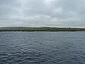 Rocky coastline - geograph.org.uk - 5403380.jpg 2,560 × 1,920; 2.75 MB
-
 Sandside, Graemsay. - geograph.org.uk - 1422270.jpg 640 × 425; 71 KB
-
 Scapa Flow, Winter morning - geograph.org.uk - 5384.jpg 640 × 401; 91 KB
-
 Seaman's Delight - panoramio.jpg 3,099 × 4,217; 4.79 MB
-
 Shore at Noust of Nethertown - geograph.org.uk - 2704246.jpg 640 × 480; 203 KB
-
 Signpost near museum - geograph.org.uk - 950799.jpg 480 × 640; 77 KB
-
 Skerry of Ness - geograph.org.uk - 1361985.jpg 640 × 427; 62 KB
-
 Skerry of Ness - geograph.org.uk - 5811596.jpg 640 × 448; 315 KB
-
 Skerry of Ness beacon - geograph.org.uk - 2637062.jpg 1,944 × 2,592; 1.77 MB
-
 Slabstone at Warebeth - geograph.org.uk - 54181.jpg 640 × 480; 108 KB
-
 Slipway at Stromness boat club - geograph.org.uk - 3488000.jpg 1,440 × 964; 241 KB
-
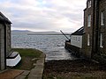 Slipway in Stromness Harbour - geograph.org.uk - 2703476.jpg 640 × 480; 130 KB
-
 Small boatbuilding yard at Ness, Stromness - geograph.org.uk - 4128525.jpg 1,024 × 681; 177 KB
.jpg)
.jpg)
.jpg)


.JPG)
.JPG)


.jpg)


.jpg)


_-_geograph.org.uk_-_2957498.jpg)


.jpeg)


.jpg)


.jpg)


,_Published_1959.jpg)
.jpg)
.jpg)
.jpg)

.jpg)
.jpg)


