Category:Stroud, Hampshire
Jump to navigation
Jump to search
village and civil parish in Hampshire, UK  | |||||
| Upload media | |||||
| Instance of | |||||
|---|---|---|---|---|---|
| Location | East Hampshire, Hampshire, South East England, England | ||||
 | |||||
English: Stroud is a village and civil parish in the East Hampshire district of Hampshire, England. It is west of Petersfield, on the A272 road.
Subcategories
This category has the following 2 subcategories, out of 2 total.
S
- Stroud Mission Church (18 F)
Media in category "Stroud, Hampshire"
The following 40 files are in this category, out of 40 total.
-
 A272 passing the Seven Stars - geograph.org.uk - 5219067.jpg 640 × 426; 41 KB
-
 Broad field boundary - geograph.org.uk - 6433340.jpg 6,016 × 4,000; 6.48 MB
-
 Bus shelter for eastbound buses, A272 in Stroud - geograph.org.uk - 6220575.jpg 1,600 × 1,151; 624 KB
-
 Bushcraft shelter in Furzefield Copse - geograph.org.uk - 6447276.jpg 4,288 × 3,216; 4.61 MB
-
 Dead Tree - geograph.org.uk - 6433337.jpg 4,000 × 6,016; 5.74 MB
-
 East Hampshire , Winchester Road A272 - geograph.org.uk - 5739198.jpg 6,000 × 4,000; 6.85 MB
-

-
 Flowers by Winchester Road, Stroud - geograph.org.uk - 5881517.jpg 1,920 × 1,280; 2.13 MB
-
 Footbridge, Stroudbridge Farm - geograph.org.uk - 3763765.jpg 640 × 480; 157 KB
-

-
 Footpath crosses North Stroud Lane - geograph.org.uk - 4193301.jpg 800 × 600; 200 KB
-
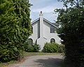 Former Primitive Methodist Chapel, Ridge Common Lane, Stroud, Hampshire (July 2019) (1).JPG 2,000 × 1,600; 1.43 MB
-

-

-
 Langrish Primary School - closed for the duration - geograph.org.uk - 6438206.jpg 4,032 × 3,024; 5.4 MB
-
 Lichen covered tree on Ramsdean Road - geograph.org.uk - 6447279.jpg 3,216 × 4,288; 4.6 MB
-
 Life goes on during the lockdown - geograph.org.uk - 6438191.jpg 3,020 × 1,903; 2.85 MB
-
 Long dead and fallen tree trunk - geograph.org.uk - 6433336.jpg 6,016 × 4,000; 6.21 MB
-

-
 Looking South across fields towards Butser Hill - geograph.org.uk - 6433328.jpg 6,016 × 4,000; 6.14 MB
-
 New housing development in Stroud - geograph.org.uk - 6438483.jpg 4,288 × 3,216; 4.33 MB
-

-
 Petersfield Means Business (170) - geograph.org.uk - 6313506.jpg 640 × 480; 60 KB
-
 Petersfield Means Business (171) - geograph.org.uk - 6313509.jpg 640 × 480; 71 KB
-
 Power lines across farm fields - geograph.org.uk - 6433334.jpg 6,016 × 4,000; 6.39 MB
-
 Pregnant ewes near Stroud Common - geograph.org.uk - 6438479.jpg 4,288 × 3,216; 4.23 MB
-
 Redundant phonebox on Ramsdean Road - geograph.org.uk - 6447283.jpg 3,216 × 4,288; 4.49 MB
-
 Sheep grazing - geograph.org.uk - 6433320.jpg 6,016 × 4,000; 6.38 MB
-
 Southward View along Ramsdean Road, Stroud, Hampshire (July 2019).JPG 3,000 × 1,800; 2.19 MB
-
 Stroud , North Stroud Lane - geograph.org.uk - 5739203.jpg 6,000 × 4,000; 6.19 MB
-
 Stroud , Ramsdean Road - geograph.org.uk - 5739202.jpg 6,000 × 4,000; 7.14 MB
-
 Stroud , The Seven Stars - geograph.org.uk - 5739199.jpg 6,000 × 4,000; 6.07 MB
-
 The outskirts of Stroud - geograph.org.uk - 3749966.jpg 640 × 428; 87 KB
-
 The school at Stroud - geograph.org.uk - 2215352.jpg 800 × 600; 131 KB
-
 The Seven Stars - closed for the duration - geograph.org.uk - 6438481.jpg 4,288 × 3,216; 4.26 MB
-
 The Seven Stars - geograph.org.uk - 3807836.jpg 3,088 × 1,640; 871 KB
-
 Trees in varying stages of the lifecycle - geograph.org.uk - 6433326.jpg 6,016 × 4,000; 6.14 MB
-
 Winchester Rd, A272 - geograph.org.uk - 5219066.jpg 640 × 395; 61 KB
-
 Winchester Road - geograph.org.uk - 3120599.jpg 3,872 × 2,592; 4.58 MB
-
 Winchester Road, Stroud - geograph.org.uk - 5881515.jpg 1,920 × 1,280; 1.85 MB


_(1).JPG)
_(2).JPG)


_-_geograph.org.uk_-_6313506.jpg)
_-_geograph.org.uk_-_6313509.jpg)


.JPG)


