Category:Struve Geodetic Arc
Jump to navigation
Jump to search
|
This place is a UNESCO World Heritage Site, listed as
Struve Geodetic Arc.
|
Deutsch: Der skandinavisch-russische Meridianbogen oder kurz Struve-Bogen, benannt nach dem baltendeutschen Astronomen Wilhelm von Struve (1793–1864), ist ein langgestrecktes Netz geodätischer Vermessungspunkte. Er hat etwa den Verlauf eines Meridianbogens und ist fast 3.000 km lang.
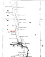
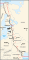
English: The Struve Geodetic Arc is a chain of survey triangulations stretching from Hammerfest in Norway to the Black Sea, through ten countries and over 2,820 km. The chain was established and used by the German-born Russian scientist Friedrich Georg Wilhelm von Struve in the years 1816 to 1855 to establish the exact size and shape of the earth.
Español: El Arco geodésico de Struve es un conjunto monumental declarado Patrimonio de la Humanidad por la Unesco en 2005, conformado por una serie de 34 hitos o vértices para mediciones geodésicas repartidos por diez países de Europa del Norte y Oriental.
Français : L’arc géodésique de Struve est une chaîne de repères géodésiques de triangulation, qui traverse l'Europe de Hammerfest en Norvège jusqu'à la mer Noire, sur plus de 2 800 km. La chaîne est réalisée par le scientifique russe germanophone Friedrich Georg Wilhelm von Struve entre 1816 et 1855 pour mesurer la taille et la forme exacte de la Terre.
日本語: シュトルーヴェの測地弧(シュトルーヴェのそくちこ)は、ドイツ出身のロシアの天文学者、フリードリヒ・フォン・シュトルーヴェが中心となって、1816年から1855年に掛けて子午線弧長の三角測量のために設置された三角点群。
meridian arc from Hammerfest in Norway to the Black Sea  | |||||
| Upload media | |||||
| Instance of |
| ||||
|---|---|---|---|---|---|
| Part of | |||||
| Named after | |||||
| Location | |||||
| Has part(s) |
| ||||
| Heritage designation |
| ||||
 | |||||
Subcategories
This category has the following 11 subcategories, out of 11 total.
Pages in category "Struve Geodetic Arc"
This category contains only the following page.
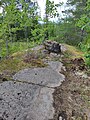
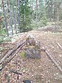
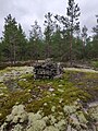
Media in category "Struve Geodetic Arc"
The following 37 files are in this category, out of 37 total.
-
 Struve Arc Aavasaksa.png 1,936 × 2,484; 567 KB
-
 Struve Arc Huhtmar.jpeg 3,024 × 4,032; 9.66 MB
-
 Struve Arc Kilpimäki.jpeg 3,024 × 4,032; 10.18 MB
-
 Struve Arc Kokkovuori.jpeg 3,024 × 4,032; 11.5 MB
-
 Struve Arc Korsmalm.jpeg 3,024 × 4,032; 9.19 MB
-
 Struve Arc Kukkukivi.jpeg 3,024 × 4,032; 7.93 MB
-
 Struve Arc Kulvenmäki.jpeg 3,024 × 4,032; 9.56 MB
-
 Struve Arc Ohimäki.jpeg 3,024 × 4,032; 8.28 MB
-
 Struve Arc Perheniemi.jpeg 3,024 × 4,032; 8.56 MB
-
 Struve Arc PorlomI.jpeg 3,024 × 4,032; 11.12 MB
-
 Struve Arc Puolakka.jpeg 3,024 × 4,032; 6.5 MB
-
 Struve Arc Saukkovaara.jpeg 3,024 × 4,032; 10.6 MB
-
 Struve Arc Silmutmäki.jpeg 3,024 × 4,032; 10.48 MB
-
 Struve Arc Soitinkallio.jpeg 3,024 × 4,032; 10.32 MB
-
 Struve Arc Strömfors.jpeg 3,024 × 4,032; 10.33 MB
-
 Struve Arc Tornio.png 1,936 × 2,484; 577 KB
-
 Struve Arc Tuskas.jpeg 3,024 × 4,032; 7.34 MB
-
 Struve Arc Vesamäki.jpeg 3,024 × 4,032; 11.57 MB
-
 Struve Arc Viljaminvuori.jpeg 3,024 × 4,032; 11.74 MB
-
 Struve Arc Virmala.jpeg 3,024 × 4,032; 10.85 MB
-
 Struve Geodetic Arc-fr.svg 975 × 1,076; 657 KB
-
 Struve Geodetic Arc-he.svg 975 × 1,076; 357 KB
-
 Struve Geodetic Arc-zoom-af.svg 775 × 1,558; 325 KB
-
 Struve Geodetic Arc-zoom-cs.svg 775 × 1,558; 253 KB
-
 Struve Geodetic Arc-zoom-de.svg 775 × 1,558; 244 KB
-
 Struve Geodetic Arc-zoom-en.svg 775 × 1,558; 408 KB
-
 Struve Geodetic Arc-zoom-fr.svg 775 × 1,558; 440 KB
-
 Struve Geodetic Arc-zoom-hu.svg 775 × 1,558; 179 KB
-
 Struve Geodetic Arc-zoom-ka.svg 775 × 1,558; 263 KB
-
 Struve Geodetic Arc-zoom-lt.svg 775 × 1,558; 244 KB
-
 Struve Geodetic Arc-zoom-lv.svg 775 × 1,558; 244 KB
-
 Struve Geodetic Arc-zoom-pl.svg 775 × 1,558; 284 KB
-
 Struve Geodetic Arc-zoom-ru.svg 775 × 1,558; 174 KB
-
 Struve Geodetic Arc-zoom-sv.svg 775 × 1,558; 246 KB
-
 Struve Geodetic Arc-zoom-vi.svg 775 × 1,558; 406 KB
-
 Struve meridiaan.svg 775 × 1,558; 286 KB
-
 Дуга Струве, Базалія.jpg 1,920 × 2,560; 1.37 MB


