Category:Sugar Loaf, Monmouthshire
Jump to navigation
Jump to search

hill situated 2 miles north-west of Abergavenny, Monmouthshire, Wales  | |||||
| Upload media | |||||
| Instance of | |||||
|---|---|---|---|---|---|
| Location | Monmouthshire, Wales | ||||
| Mountain range | |||||
| Topographic prominence |
| ||||
| Elevation above sea level |
| ||||
| Parent peak | |||||
 | |||||
Sugar Loaf, Monmouthshire
Subcategories
This category has only the following subcategory.
S
Media in category "Sugar Loaf, Monmouthshire"
The following 55 files are in this category, out of 55 total.
-
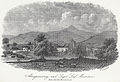 Abergavenny, and Suger Loaf mountain from the Monmouth road.jpeg 700 × 478; 172 KB
-

-
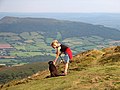
 Bridleway to Sugarloaf (Y Fal) 2 - geograph.org.uk - 1298396.jpg 640 × 480; 154 KB
-
 Bridleway to Sugarloaf (Y Fal) 3 - geograph.org.uk - 1298406.jpg 640 × 480; 296 KB
-
 Bridleway to Sugarloaf (Y Fal) 4 - geograph.org.uk - 1298442.jpg 640 × 480; 107 KB
-
 Bridleway to Sugarloaf (Y Fal) 5 - geograph.org.uk - 1298481.jpg 640 × 480; 98 KB
-
 Bridleway to Sugarloaf (Y Fal) 6 - geograph.org.uk - 1298499.jpg 640 × 480; 102 KB
-
 Bridleway to Sugarloaf (Y Fal) 7 - geograph.org.uk - 1298519.jpg 640 × 480; 118 KB
-
 Bridleway to Sugarloaf (Y Fal)1 - geograph.org.uk - 1298384.jpg 640 × 480; 141 KB
-
 Cattle grid entrance to Court Farm - geograph.org.uk - 217096.jpg 640 × 480; 125 KB
-
 Clydach looking towards Sugar Loaf - geograph.org.uk - 769041.jpg 640 × 480; 70 KB
-

-
 East View of Panty Goettre, with the Sugar Loaf.jpeg 750 × 646; 202 KB
-
 Llanbedr below Sugar Loaf - geograph.org.uk - 333839.jpg 640 × 480; 76 KB
-

-
 Meadows and the Sugar Loaf.jpg 2,666 × 4,000; 8.02 MB
-

-
 North-west end of Sugarloaf - geograph.org.uk - 1299308.jpg 640 × 426; 214 KB
-
 Panorama - View from the Sugarloaf in the snow - panoramio.jpg 13,695 × 2,771; 9.37 MB
-
 Path to the Sugar Loaf in winter - geograph.org.uk - 472720.jpg 640 × 420; 44 KB
-
 Pen y Fâl - geograph.org.uk - 91938.jpg 640 × 365; 33 KB
-
 Skirrid and Sugarloaf - geograph.org.uk - 350175.jpg 640 × 480; 49 KB
-
 Snowcap on the Sugarloaf - Crisp and Clear - panoramio.jpg 2,736 × 3,648; 3.64 MB
-
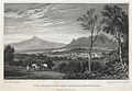
 South west view of Abergavenny Castle.jpeg 750 × 620; 208 KB
-
 Sugar Loaf - geograph.org.uk - 447466.jpg 640 × 480; 121 KB
-
 Sugar Loaf - panoramio (1).jpg 2,048 × 1,536; 634 KB
-
 Sugar Loaf - panoramio (2).jpg 2,048 × 1,536; 647 KB
-
 Sugar Loaf - panoramio (3).jpg 2,048 × 1,536; 611 KB
-
 Sugar Loaf - panoramio (4).jpg 2,048 × 1,536; 664 KB
-
 Sugar Loaf - panoramio.jpg 2,048 × 1,536; 605 KB
-
 Sugar Loaf Cloud Day.jpg 5,472 × 3,648; 10.3 MB
-
 Sugar Loaf Paths.jpg 5,472 × 3,648; 10.62 MB
-
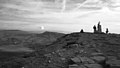
 Sugar Loaf summit rocks - geograph.org.uk - 1287602.jpg 426 × 640; 219 KB
-
-
 Sugar Loaf, Abergavenny, July 2020.jpg 4,032 × 3,024; 2.43 MB
-
 Sugar Loaf, Little & Great Skirrid & Blorenge Mountains.jpeg 750 × 547; 170 KB
-
 Sugarloaf Mountain above Abergavenny (30251942556).jpg 2,592 × 1,936; 1.49 MB
-
 Sugarloaf top rocks - geograph.org.uk - 1300368.jpg 640 × 480; 123 KB
-
 Sugarloaf, Abergavenny - geograph.org.uk - 1239791.jpg 640 × 480; 57 KB
-
-
 The Skirrid - geograph.org.uk - 555208.jpg 640 × 480; 112 KB
-
 The Sugar Loaf and Skyrrid mountains, Monmouthshire (3375060).jpg 700 × 484; 154 KB
-
 The Sugar Loaf from the east - geograph.org.uk - 472714.jpg 640 × 421; 49 KB
-
 The Sugar Loaf, near Abergavenny - geograph.org.uk - 129254.jpg 640 × 480; 64 KB
-
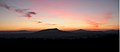
 The Sugarloaf and The Skirrid at Sunset.jpg 1,024 × 672; 122 KB
-

-
 View from the sugar loaf.jpg 4,032 × 3,024; 3.65 MB
-
 View South from the top of the Sugarloaf with Snow - Phenomenal Winter Day - panoramio.jpg 3,264 × 4,928; 6.67 MB
-
 View to Sugar Loaf - geograph.org.uk - 2235291.jpg 1,024 × 682; 123 KB
-
 Walk up to the sugar loaf.jpg 4,032 × 3,024; 6.3 MB
-
 Looking NNE from the Sugar Loaf - geograph.org.uk - 355915.jpg 640 × 480; 70 KB
-

-
 Skirrid skyline - geograph.org.uk - 345057.jpg 640 × 480; 45 KB
-
 Sugarloaf viewed from Deri - geograph.org.uk - 347430.jpg 640 × 426; 132 KB
-
 Ysgyryd Fawr and Sugar Loaf - geograph.org.uk - 211465.jpg 640 × 480; 116 KB


_2_-_geograph.org.uk_-_1298396.jpg)
_3_-_geograph.org.uk_-_1298406.jpg)
_4_-_geograph.org.uk_-_1298442.jpg)
_5_-_geograph.org.uk_-_1298481.jpg)
_6_-_geograph.org.uk_-_1298499.jpg)
_7_-_geograph.org.uk_-_1298519.jpg)
1_-_geograph.org.uk_-_1298384.jpg)


.jpg)
.jpg)
.jpg)
.jpg)


.jpg)


.jpg)


