Category:Sugarloaf (Christchurch)
Jump to navigation
Jump to search
mountain in New Zealand  | |||||
| Upload media | |||||
| Instance of | |||||
|---|---|---|---|---|---|
| Location |
| ||||
| Elevation above sea level |
| ||||
 | |||||
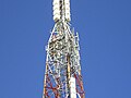
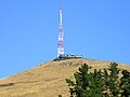
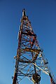
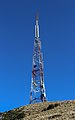
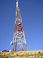
The Sugarloaf in Christchurch's Port Hills is a landmark to the south of the city. The Sugarloaf communications tower is an iconic transmission mast located on top of the hill.
Media in category "Sugarloaf (Christchurch)"
The following 46 files are in this category, out of 46 total.
-

-

-
 Christchurch from Sugarloaf.jpg 1,024 × 768; 321 KB
-
 Christchurch With Hazy Sky.jpg 2,592 × 1,944; 2.3 MB
-
 Flying Nun 039.jpg 3,648 × 5,472; 6.64 MB
-
 Mt Sugarloaf, Port Hills, Canterbury, New Zealand 17.jpg 5,472 × 3,648; 14.94 MB
-
 Port Hills 228.JPG 5,472 × 3,648; 1.21 MB
-
 Quail Island 069.jpg 5,472 × 3,648; 2.66 MB
-
 Sugarloaf (Christchurch), New Zealand 09.jpg 5,472 × 3,648; 13.09 MB
-
 Sugarloaf (Christchurch), New Zealand 11.jpg 5,330 × 3,601; 9.24 MB
-
 Sugarloaf 2023-01-15 1.jpg 3,456 × 5,184; 5.65 MB
-
 Sugarloaf 2023-01-15 10.jpg 5,184 × 3,456; 7.75 MB
-
 Sugarloaf 2023-01-15 11.jpg 3,456 × 5,184; 5.63 MB
-
 Sugarloaf 2023-01-15 2.jpg 3,456 × 5,184; 5.38 MB
-
 Sugarloaf 2023-01-15 3.jpg 3,456 × 5,184; 5.28 MB
-
 Sugarloaf 2023-01-15 4.jpg 3,456 × 5,184; 5.09 MB
-
 Sugarloaf 2023-01-15 5.jpg 5,184 × 3,456; 7.83 MB
-
 Sugarloaf 2023-01-15 6.jpg 5,184 × 3,456; 5.38 MB
-
 Sugarloaf 2023-01-15 7.jpg 5,184 × 3,456; 4.87 MB
-
 Sugarloaf 2023-01-15 8 Crop.jpg 2,198 × 3,372; 1.97 MB
-
 Sugarloaf 2023-01-15 8.jpg 3,456 × 5,184; 6.17 MB
-
 Sugarloaf 2023-01-15 9.jpg 3,456 × 5,184; 5.12 MB
-
 Sugarloaf Antenna.jpg 512 × 384; 81 KB
-
 Sugarloaf CableRun.jpg 512 × 384; 107 KB
-
 Sugarloaf Christchurch.jpg 512 × 384; 51 KB
-
 Sugarloaf Communications Tower Base.jpg 3,456 × 5,184; 11.06 MB
-
 Sugarloaf Communications Tower from Bowenvale Reserve, Christchurch, New Zealand.jpg 5,180 × 2,914; 5.68 MB
-
 Sugarloaf Communications Tower Rear.jpg 3,456 × 5,184; 13.42 MB
-
 Sugarloaf Communications Tower Side.jpg 3,456 × 5,184; 10.39 MB
-
 Sugarloaf Communications Tower.jpg 3,456 × 5,184; 10.48 MB
-
 Sugarloaf in Christchurch, New Zealand 001.jpg 4,718 × 2,835; 6.51 MB
-
 Sugarloaf in Christchurch, New Zealand 02.jpg 3,326 × 4,950; 8 MB
-
 Sugarloaf in Christchurch, New Zealand 03.jpg 4,581 × 3,169; 6.31 MB
-
 Sugarloaf in Christchurch, New Zealand 04.jpg 3,173 × 4,683; 7.26 MB
-
 Sugarloaf in Christchurch, New Zealand 06.jpg 3,456 × 5,184; 10.24 MB
-
 Sugarloaf in Christchurch, New Zealand.jpg 2,701 × 4,324; 5.7 MB
-
 Sugarloaf Lattice.jpg 512 × 384; 48 KB
-
 Sugarloaf LatticeStructure.jpg 384 × 512; 61 KB
-
 Sugarloaf MainPhoto.jpg 384 × 512; 40 KB
-
 Sugarloaf RestrictedAccess.jpg 512 × 384; 69 KB
-
 Sugarloaf transmission tower, January 1990.jpg 795 × 1,200; 158 KB
-
 Sugarloaf TransmissionHouse.jpg 512 × 384; 40 KB
-
 Sugarloaf, Christchurch, New Zealand 07.jpg 5,472 × 3,648; 12.2 MB
-
 Tower on Sugarloaf Mountain.jpg 768 × 1,024; 227 KB
-
 Vic Park fire damage 029.jpg 5,472 × 3,648; 6.36 MB
-
 Vic Park fire damage 034.jpg 5,472 × 3,648; 8.86 MB


,_New_Zealand_09.jpg)
,_New_Zealand_11.jpg)


.jpg)
.jpg)