Category:Canterbury Region
Jump to navigation
Jump to search
Regions of New Zealand: Auckland · Bay of Plenty · Canterbury · Gisborne · Hawke's Bay · Manawatu-Whanganui · Marlborough · Nelson · Otago · Northland · Southland · Taranaki · Tasman · Waikato · Wellington · West Coast
Outlying islands, territories and dependencies: Antipodes Islands · Auckland Islands · Bounty Islands · Chatham Islands · Kermadec Islands · Snares Islands · Three Kings Islands · Tokelau – Territory with specific status: Ross Dependency
Associated countries: Cook Islands · Niue
Outlying islands, territories and dependencies: Antipodes Islands · Auckland Islands · Bounty Islands · Chatham Islands · Kermadec Islands · Snares Islands · Three Kings Islands · Tokelau – Territory with specific status: Ross Dependency
Associated countries: Cook Islands · Niue
region of New Zealand's South Island   | |||||
| Upload media | |||||
| Instance of | |||||
|---|---|---|---|---|---|
| Location | New Zealand | ||||
| Capital | |||||
| Head of government | |||||
| Significant event |
| ||||
| Population |
| ||||
| Area |
| ||||
 | |||||

Subcategories
This category has the following 57 subcategories, out of 57 total.
!
- Quality images of Canterbury Region (265 F)
*
+
1
- 1901 Cheviot earthquake (3 F)
2
- 2016 Christchurch earthquake (12 F)
A
- Annavale Circuit (11 F)
- Aviemore Dam (3 F)
B
C
D
E
- Eyreton Branch (1 F)
- Eyrewell Forest (7 F)
G
H
- Helicopter Hill Track (18 F)
K
M
N
O
- Opuha Dam (5 F)
P
- Postcards of Canterbury Region (14 F)
S
T
V
W
- Waitaki Dam (15 F)
Media in category "Canterbury Region"
The following 200 files are in this category, out of 342 total.
(previous page) (next page)-
 Position of Canterbury Region.png 405 × 590; 7 KB
-
 105mm L5 pack howitzer (32215329642).jpg 3,434 × 1,899; 3.71 MB
-
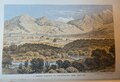
 HURSTHOUSE(1857) p280 PORT LYTTLETON, CANTERBURRY.jpg 1,901 × 1,104; 1.35 MB
-
 A house by Lake Ida, Canterbury, New Zealand 25.jpg 3,024 × 4,032; 3.05 MB
-
 A moan a day keeps the doctor away. - panoramio.jpg 3,264 × 2,448; 2.64 MB
-
 A Sheep Station in Canterbury, New Zealand. C. F. Kell, Litho 7 Cooks Court, WC.tif 2,760 × 1,890; 14.93 MB
-
 Above The Treeline Southern Alps I.jpg 1,600 × 1,200; 340 KB
-
 Above The Treeline Southern Alps II.jpg 1,600 × 1,200; 434 KB
-
 Aerial view of the Ashburton River, North Branch.tif 4,032 × 3,024; 34.89 MB
-
 After the trains have gone - panoramio.jpg 2,816 × 1,880; 2.28 MB
-
 Albury District from The Brothers.jpg 806 × 537; 46 KB
-
 Albury Park, South Canterbury, ca 1925 (3229323175).jpg 6,259 × 1,351; 2.79 MB
-
 Aleocharinae sp. NZ1.jpg 673 × 1,016; 71 KB
-
 Another gate standing up to the passage of time - panoramio.jpg 2,816 × 1,880; 1.35 MB
-
 Approaching Lake Pukaki (31385862255).jpg 4,174 × 2,900; 5.48 MB
-
 Arthurs Pass NP.svg 442 × 600; 140 KB
-
-
 Avalance creek - panoramio.jpg 1,880 × 2,816; 1.73 MB
-
 Avoca River with Mt Fitzwilliam on the right, Canterbury, New Zealand 16.jpg 4,032 × 3,024; 2.43 MB
-

-
 Back view to The Anglican Church of the Holy Innocents, Mount Peel Forest, Canterbury.jpg 4,032 × 3,024; 4.89 MB
-
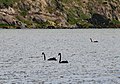 Black Swans (31368914055).jpg 2,724 × 1,906; 3.87 MB
-
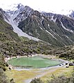 Blue Lake (30598942423).jpg 3,456 × 3,858; 11.36 MB
-
 Bluff farm, Windwhistle, 1925 (3230174748).jpg 6,561 × 1,512; 3.33 MB
-
 Bra Collection! (6580999931).jpg 1,280 × 960; 284 KB
-
 Bridge On The Road To The Hermitage.jpg 1,600 × 1,200; 1.21 MB
-
 Broken River valley - panoramio.jpg 2,816 × 1,880; 3.05 MB
-
 Cabbage tree by the side of Double Hill Run Road, Canterbury, New Zealand.jpg 3,648 × 5,142; 13.86 MB
-
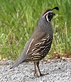 Californian Quail (31254665731).jpg 866 × 1,006; 938 KB
-
 Canal from Lake Pukaki (31369822066).jpg 4,722 × 3,113; 8.11 MB
-
 Canterbury Acclimatisation Society minute book 1864 (26352472916).jpg 3,134 × 2,464; 1.61 MB
-
 Canterbury Aviation Co. (c.1917) (40229646961).jpg 2,663 × 1,456; 2.07 MB
-

-
 Canterbury Folk Festival.jpg 2,048 × 673; 214 KB
-
 Canterbury from Tranzalpine.jpg 640 × 480; 117 KB
-
 Canterbury houses near Cathedral.jpg 1,632 × 1,232; 631 KB
-
 Canterbury Northwester.jpg 3,264 × 2,176; 5.37 MB
-
 Canterbury NZ (8711178835).jpg 2,400 × 1,413; 2.92 MB
-
 Canterbury Papers 0011.jpg 3,402 × 1,629; 652 KB
-
 Canterbury Papers 0012.jpg 1,690 × 2,436; 223 KB
-
 Canterbury Papers.djvu 1,923 × 3,132, 70 pages; 2.33 MB
-
 Canterbury purchase.jpg 445 × 600; 22 KB
-

-
 CanterburyRegionPopulationDensity.png 2,236 × 2,176; 255 KB
-
 Carex secta or pūkio, a wetland plant.jpg 2,816 × 2,112; 2.81 MB
-
 Castle Hill Canterbury NZ.jpg 5,472 × 3,080; 9.48 MB
-
 Centre pivot irrigator in Canterbury, New Zealand.jpg 2,591 × 1,272; 320 KB
-
 Chaetosomodes halli Broun.jpg 880 × 1,387; 176 KB
-
 Chapel on a Hill (6568608975).jpg 1,280 × 960; 139 KB
-
 CHC on arrival (20941379433).jpg 3,456 × 4,608; 3.31 MB
-
 Christchurch Rebuild. Strange's Building. (12809860643).jpg 2,400 × 1,682; 2.51 MB
-
 Chroicocephalus scopulinus.jpg 2,592 × 1,944; 761 KB
-
 Clarence River mouth.jpg 2,864 × 1,924; 5.24 MB
-
 Clarence River New Zealand 2.jpg 2,048 × 1,024; 1.65 MB
-
 Clearing trees after snow dump - panoramio.jpg 2,816 × 1,880; 2.53 MB
-
 Conway River Bridge, Canterbury, New Zealand.jpg 3,872 × 2,592; 6.3 MB
-
 Coopers Creek, New Zealand sign.jpg 1,936 × 1,936; 3.16 MB
-
 Cormorants (31254176401).jpg 2,164 × 2,261; 2.67 MB
-
 Corona? (29198622374).jpg 3,072 × 2,304; 1.67 MB
-
 Cows on Blackford Rd, Canterbury, New Zealand.jpg 5,142 × 3,431; 11.16 MB
-
 Cray boat waiting for the next tide - panoramio.jpg 2,816 × 1,880; 1.86 MB
-
 Day trip to Kaikoura (27010670983).jpg 4,896 × 3,264; 6.68 MB
-
 Day trip to Kaikoura (27342488210).jpg 4,896 × 3,264; 6.74 MB
-
 Day trip to Kaikoura (27342488430).jpg 4,896 × 3,264; 4.06 MB
-
 Day trip to Kaikoura (27546831731).jpg 4,896 × 3,264; 7.04 MB
-
 Day trip to Kaikoura (27619912945).jpg 4,896 × 3,264; 6.88 MB
-
 Didymo sign on gate.JPG 2,816 × 2,112; 2.65 MB
-
 Double Hill Run Road, Canterbury, New Zealand 12.jpg 3,648 × 5,472; 14.66 MB
-
 Double Hill Run Road, Canterbury, New Zealand.jpg 5,388 × 3,592; 15.05 MB
-
 Duck pond near Hakataramea Valley Rd - panoramio.jpg 4,896 × 2,752; 4.68 MB
-
 Elizabeth by Lake Tekapo (6568609437).jpg 1,262 × 748; 147 KB
-
 Elizabeth on the Rocks (6568608645).jpg 1,279 × 802; 199 KB
-

-
 Evening Lake Pukaki (31370000166).jpg 5,184 × 3,456; 9.25 MB
-
 Evening light. (8533610702).jpg 2,500 × 1,398; 3.91 MB
-
 Evening on the Road (31261999972).jpg 5,040 × 3,328; 10.35 MB
-
 Exhausted From The Heat (Unsplash).jpg 5,680 × 3,834; 12.44 MB
-
 Exposed Rock (31291340341).jpg 5,184 × 3,456; 10.1 MB
-
 Exposed Rock 2 (31037085960).jpg 4,753 × 3,341; 13.58 MB
-
 Fault line trees(1).jpg 660 × 495; 96 KB
-
 Fence on Mt Ida, Canterbury, New Zealand 19.jpg 4,032 × 3,024; 3.09 MB
-
 Fig 2 Canterbury Coast.jpg 1,163 × 1,421; 148 KB
-
 Flight from Rotorua to Queenstown - panoramio (1).jpg 2,048 × 1,150; 568 KB
-
 Flight from Rotorua to Queenstown - panoramio (11).jpg 2,048 × 1,152; 438 KB
-
 Flight from Rotorua to Queenstown - panoramio (8).jpg 2,048 × 1,151; 595 KB
-
 Flight from Rotorua to Queenstown. Lake Pukaki - panoramio.jpg 2,048 × 1,151; 402 KB
-
 Flight from Rotorua to Queenstown. South Island - panoramio (1).jpg 2,048 × 1,151; 686 KB
-
 Flight from Rotorua to Queenstown. Woodend Beach, South Island - panoramio.jpg 2,048 × 1,152; 586 KB
-
 Flying over a river near Christchurch (31310741505).jpg 5,184 × 3,456; 12.63 MB
-
 FMIB 34968 Catch of Trout, Canterbury District.jpeg 636 × 931; 163 KB
-
 FMIB 34969 Catch of Trout, Canterbury District.jpeg 879 × 535; 113 KB
-
 Fog clearing, South Canterbury, New Zealand, 5 August 2005.jpg 3,188 × 1,680; 3.47 MB
-
 Friendly little buggers - panoramio.jpg 2,816 × 1,880; 2.17 MB
-
 Gate No. 2 on the Weka Pass Railway.jpg 4,608 × 3,456; 5.1 MB
-
 Gate No.1 "Matches" Hut.jpg 3,937 × 2,758; 3.24 MB
-
 Gateway to The Anglican Church of the Holy Innocents, Mount Peel Forest, Canterbury.jpg 3,024 × 4,032; 6.68 MB
-
 Glentunnel Aerial 1, 1943.jpg 5,744 × 4,261; 4.68 MB
-
 Glentunnel Aerial 1, 1956.jpg 4,326 × 5,845; 5.14 MB
-
 Glentunnel Aerial 1, 1965.jpg 6,873 × 7,237; 11.88 MB
-
 Glentunnel Aerial 1, 1974.jpg 6,898 × 7,264; 11.79 MB
-
 Glentunnel Aerial 2,1943.jpg 5,759 × 4,279; 4.64 MB
-
 Glentunnel Domain.jpg 1,280 × 960; 305 KB
-
 Glentunnel Library and Post Office.jpg 528 × 960; 76 KB
-
 Glentunnel Railway Station.jpg 3,831 × 2,203; 928 KB
-
 Glentunnel Swimming Hole (1).jpg 1,280 × 720; 298 KB
-
 Goods lift with the first snow of 2011 - panoramio.jpg 2,816 × 1,880; 2.57 MB
-

-
 Ground View (6568608811).jpg 1,280 × 960; 148 KB
-
 Guv Bay 27.jpg 4,080 × 3,060; 3.59 MB
-
 Hatfield ford rail bridge.JPG 427 × 640; 127 KB
-
 Haumuri Bluffs rail bridge - panoramio.jpg 1,024 × 768; 330 KB
-
 Hay Bales in North Canterbury.jpg 4,271 × 1,485; 3.53 MB
-
 Helicopter (31037094370).jpg 2,599 × 2,512; 4.73 MB
-
 Helicopter 2 (30584895014).jpg 3,753 × 2,446; 6.1 MB
-
 Helicopters (31037091680).jpg 3,436 × 1,855; 4.46 MB
-
 High and dry Jetboat art - panoramio.jpg 3,264 × 2,448; 1.68 MB
-
 Hire Car Rav4 (31037063270).jpg 3,582 × 2,792; 4.56 MB
-
 Homebush Aerial 1, 1943.jpg 5,753 × 4,270; 3.91 MB
-
 Humidicutis rosella (Speg.) Singer 99863 crop.jpg 2,470 × 1,677; 1.6 MB
-
 Hunting party, probably Christchurch district, (ca 1915) (4835444063).jpg 5,019 × 3,838; 5.27 MB
-
 Hurunui River at sunset - panoramio.jpg 1,024 × 768; 380 KB
-
 Icebergs (31291424251).jpg 4,524 × 2,297; 8.39 MB
-
 Ilam Fields University of Canterbury New Zealand 2007.jpg 2,048 × 1,536; 330 KB
-
 Inland Road, Waiau.jpg 4,032 × 3,024; 1.96 MB
-
 Into the storm. Aproaching the Southern Alps - panoramio.jpg 2,816 × 1,880; 1.77 MB
-
 Kaikoura banner 1.jpg 2,100 × 300; 885 KB
-
 Kaikoura City.jpg 2,048 × 1,536; 749 KB
-
 Kaikoura Panorama.jpg 8,700 × 2,300; 2.6 MB
-
 Kaikoura seagulls. - panoramio.jpg 3,264 × 2,448; 3.04 MB
-
 Kaikoura seal colony.JPG 1,280 × 960; 269 KB
-
 Kairaki.jpg 800 × 533; 391 KB
-
 Kemps-Deed-Plan-1848-ccc-600x716.jpg 600 × 716; 51 KB
-
 Kiwiaesthetus.jpg 514 × 1,037; 69 KB
-
 Ladbrooks Railway Station.png 3,507 × 2,480; 576 KB
-
 Lake Catherine, Canterbury, New Zealand 14.jpg 3,542 × 2,464; 2.68 MB
-
 Lake Coleridge 27.jpg 4,080 × 3,060; 1.63 MB
-
 Lake Coleridge Village - panoramio.jpg 2,816 × 1,880; 2.83 MB
-
 Lake Evelyn on the right, Lake Coleridge in the back, Canterbury, New Zealand 08.jpg 3,024 × 4,032; 4.09 MB
-
 Lake Guyon, New Zealand.jpg 2,815 × 1,544; 583 KB
-
 Lake Ida with Little Mt Ida, Canterbury, New Zealand 05.jpg 4,032 × 3,024; 4.83 MB
-
 Lake Lyndon in Canterbury, New Zealand.jpg 5,625 × 3,750; 4.46 MB
-
 Lake Ohau - panoramio.jpg 7,884 × 2,148; 4.22 MB
-
 Lake Pukaki - 2013.04 - panoramio.jpg 4,608 × 3,456; 2.52 MB
-
 Lake Pukaki - panoramio (3).jpg 4,928 × 3,264; 9.04 MB
-
 Lake Pukaki - panoramio (4).jpg 10,000 × 4,490; 7.55 MB
-
 Lake Pukaki - panoramio (5).jpg 10,000 × 5,000; 9.22 MB
-
 Lake Pukaki 1 (31016885910).jpg 5,010 × 3,225; 6.54 MB
-
 Lake Pukaki 2 (30564396954).jpg 5,184 × 3,456; 7.93 MB
-
 Lake Pukaki 3 (31349799566).jpg 5,134 × 2,494; 6.77 MB
-
 Lake Pukaki 3a (31291303811).jpg 5,060 × 3,054; 9.64 MB
-
 Lake Pukaki 4 (30564401304).jpg 5,088 × 3,294; 9.83 MB
-
 Lake Pukaki 5 (30584856594).jpg 5,049 × 3,057; 8.27 MB
-
 Lake Pukaki 6 (31385949385).jpg 5,184 × 3,456; 7.27 MB
-
 Lake Pukaki 7 (31261995242).jpg 5,085 × 3,128; 6.09 MB
-
 Lake Pukaki 8 (31291332411).jpg 5,184 × 3,456; 8.29 MB
-
 Lake Pukaki and Mount Cook 1 (31291330091).jpg 5,184 × 3,456; 9.02 MB
-
 Lake Reflections (6568626723).jpg 1,280 × 960; 122 KB
-
 Lake Selfe fly fishing.jpg 1,440 × 999; 850 KB
-
 Lake Tasman (31369925016).jpg 5,184 × 3,456; 9.59 MB
-
 Lake Tasman 2 (31369922216).jpg 5,184 × 3,167; 10.48 MB
-
 Lake Tasman 3 (31037176320).jpg 5,184 × 3,299; 13.31 MB
-
 Lake Tekapo (6568609297).jpg 1,206 × 745; 166 KB
-
 Lake tekapo - panoramio.jpg 2,496 × 1,664; 140 KB
-
 Lake Tekapo Lake Overlook - 2013.04 - panoramio.jpg 4,524 × 3,393; 5.29 MB
-
 Lake Tekapo New Zealand (108117661).jpeg 2,048 × 1,365; 353 KB
-
 Lake Tekapo Overlook - 2013.04 - panoramio.jpg 4,608 × 3,456; 3.34 MB
-
 Lakes380 team sampling Irishman Stream Tarn in Canterbury.jpg 4,032 × 3,024; 3.8 MB
-
 Lakeside Flowers (32365486365).jpg 4,613 × 2,064; 5.24 MB
-
 Landscape in Canterbury Region 01.jpg 3,754 × 2,248; 5.97 MB
-
 Landscape of Canterbury 01.jpg 3,606 × 1,527; 2.49 MB
-
 Landscape of Canterbury 02.jpg 4,066 × 1,267; 3.57 MB
-
 Landscape of Canterbury 03.jpg 3,236 × 1,712; 3.96 MB
-
 Larch planted on a scree slope.JPG 2,816 × 2,112; 2.65 MB
-
 Levels Valley, South Canterbury 1986.jpg 2,848 × 1,896; 868 KB
-
 Levels Valley, South Canterbury, New Zealand. 1992.jpg 3,488 × 2,351; 1.26 MB
-
 Lewis Pass Road - panoramio.jpg 1,966 × 1,493; 2.52 MB
-
 Linda Tasman Glacier (30598988733).jpg 4,175 × 3,456; 11.44 MB
-
 Little river railtrail near kaituna lagoon.jpg 1,600 × 1,200; 668 KB
-
 Little River St Andrews Anglican Church 27.jpg 2,508 × 1,672; 533 KB
-
 Little River St John Catholic Church 27.jpg 5,472 × 3,648; 7.37 MB
-
 Looking up the Waimakariri river from Mt White bridge - panoramio.jpg 3,888 × 2,592; 3.7 MB
-
 Lords Bush forest.jpg 4,912 × 7,360; 14.92 MB
-
 Lupins 1 (31396166476).jpg 5,184 × 3,456; 14.01 MB
-
 Lupins 2 (31062874600).jpg 5,173 × 2,600; 12.02 MB
-
 Lupins 3 (31317471901).jpg 5,184 × 3,456; 14.54 MB
-
 Lupins 4 (31287687212).jpg 5,184 × 2,436; 9.31 MB
-
 Lush Details (129491171).jpeg 2,048 × 1,365; 624 KB
-
 Mackenzie Country, Canterbury, New Zealand, 22 July 2005.jpg 3,264 × 2,176; 3.4 MB
-
 Mackenzie Country.jpg 800 × 600; 121 KB
-
 Mackenzie District, Canterbury, New Zealand - panoramio.jpg 6,904 × 2,127; 5.68 MB
-
 Makikihi, Canterbury, South Island.jpg 2,701 × 2,967; 1.93 MB
-
 Map of Canterbury by Thomas, 1849.JPG 3,444 × 2,515; 759 KB
-
 Marko Choices Choices Yes Or Yes Switch.jpg 1,800 × 1,200; 1.17 MB
-
 Marko Gravel Road In The McKenzie Basin.jpg 1,800 × 1,200; 1.07 MB
-
 Marko Hydro Channel From Lake Pukaki.jpg 2,400 × 1,600; 2.15 MB
-
 McLaren Traction Engine No. 1718 of 1925.jpg 3,040 × 2,540; 773 KB
-
 Michaelodonnellportrait.jpg 2,448 × 3,264; 1.11 MB
-
 Midland Line from Kirwee and Rolleston.jpg 1,014 × 1,280; 169 KB
-
 Motukarara, Canterbury, New Zealand.jpg 3,872 × 2,592; 5.49 MB
-
 Mount Grey 27.jpg 4,080 × 3,060; 2.2 MB

.jpg)
_p280_PORT_LYTTLETON,_CANTERBURRY.jpg)


.jpg)

.jpg)


.jpg)
.jpg)
.jpg)


.jpg)
.jpg)
.jpg)
_(40229646961).jpg)
.jpg)


.jpg)


.jpg)
.jpg)
.jpg)


.jpg)
.jpg)


.jpg)
.jpg)
.jpg)
.jpg)
.jpg)


.jpg)
.jpg)

.jpg)
.jpg)
.jpg)
.jpg)
.jpg)
.jpg)
.jpg)


.jpg)
.jpg)
.jpg)

.jpg)

.jpg)


.jpg)


.jpg)


.jpg)
.jpg)
.jpg)

.jpg)

_Singer_99863_crop.jpg)
_(4835444063).jpg)

.jpg)


.jpg)
.jpg)
.jpg)
.jpg)
.jpg)
.jpg)
.jpg)
.jpg)
.jpg)
.jpg)
.jpg)
.jpg)
.jpg)
.jpg)

.jpg)
.jpg)
.jpg)
.jpg)


.jpeg)


.jpg)


.jpg)


.jpg)
.jpg)
.jpg)
.jpg)
.jpeg)


.jpg)
.jpg)