Category:Sukumari, South 24 Parganas
Jump to navigation
Jump to search
village in India | |||||
| Upload media | |||||
| Instance of | |||||
|---|---|---|---|---|---|
| Location | Gosaba community development block, Canning subdivision, South 24 Parganas district, Presidency division, West Bengal, India | ||||
 | |||||
Subcategories
This category has only the following subcategory.
E
- Eco Village Hostel, Sukumari (63 F)
Media in category "Sukumari, South 24 Parganas"
The following 38 files are in this category, out of 38 total.
-

-
 Breakfast (23011552604).jpg 3,216 × 4,288; 4.47 MB
-
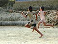 Competition (23531165862).jpg 2,273 × 1,705; 1.88 MB
-

-

-
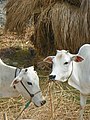
 Farm building (23011500824).jpg 2,773 × 3,697; 3.08 MB
-
 Ferry (23639769125).jpg 4,288 × 3,216; 4.38 MB
-
 Field work (23613626326).jpg 4,288 × 3,216; 7.44 MB
-
 Fishing (23844227749).jpg 898 × 1,199; 419 KB
-
 Good morning! (23012610523).jpg 4,288 × 3,216; 4.15 MB
-
 Ma Manasa mandir (23639686605).jpg 2,736 × 3,420; 3.74 MB
-
 Palm wine experience (23076090703).jpg 1,200 × 900; 168 KB
-

-

-
 Physical training class (1) (23012662213).jpg 3,430 × 2,573; 3.26 MB
-
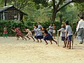 Physical training class (2) (23012665583).jpg 3,430 × 2,573; 3.47 MB
-
 Physical training class (3) (23639755575).jpg 3,430 × 2,573; 3.02 MB
-

-
 Rice (23012654523).jpg 4,288 × 3,216; 9.3 MB
-
 Rice (23344022170).jpg 4,288 × 3,216; 9.68 MB
-
 Rice (23531134232).jpg 3,216 × 4,288; 7.14 MB
-
 Rice field (23639738115).jpg 4,288 × 3,216; 8.61 MB
-
 Rice field panorama (23557288911).jpg 5,165 × 1,368; 4.1 MB
-
 Rice fields (23271745379).jpg 4,288 × 3,216; 4.39 MB
-

-
 Satjelia Eco Village (Sunderbans) (38271306166).jpg 3,888 × 2,592; 5.86 MB
-

-

-
 Sundarbans69 2015-11-27 07-01 (23271720019).jpg 4,288 × 3,216; 4.44 MB
-
 Sundarbans72 2015-11-27 07-27 (23531112842).jpg 3,216 × 4,288; 10.68 MB
-
 Sundarbans73 2015-11-27 07-37 (23531116562).jpg 3,216 × 4,288; 4.14 MB
-
 Sundarbans88 2015-11-27 07-45 (23344055470).jpg 3,216 × 4,288; 7.16 MB
-
 Sundarbans89 2015-11-27 08-40 (23557333711).jpg 1,944 × 2,592; 1.53 MB
-
 View of Sukumari Village - Sundarban District - South of Kolkata - India (12346506395).jpg 3,639 × 2,694; 4.28 MB
-

-

-

-

.jpg)
.jpg)
.jpg)
_Drying_-_Sukumari_Village_-_Sundarban_District_-_South_of_Kolkata_-_India_-_01_(12347271773).jpg)
_Drying_-_Sukumari_Village_-_Sundarban_District_-_South_of_Kolkata_-_India_-_02_(12347219033).jpg)
.jpg)
.jpg)
.jpg)
.jpg)
.jpg)
.jpg)
.jpg)
_(23012662213).jpg)
_(23012665583).jpg)
_(23639755575).jpg)
.jpg)
.jpg)
.jpg)
.jpg)
.jpg)
.jpg)
.jpg)
_(38271306166).jpg)
.jpg)
.jpg)
.jpg)
.jpg)
.jpg)
.jpg)
.jpg)
.jpg)
.jpg)
.jpg)
.jpg)
.jpg)
.jpg)
.jpg)
.jpg)