Category:Sunderland, Massachusetts
Jump to navigation
Jump to search
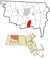
town in Franklin County, Massachusetts, United States   | |||||
| Upload media | |||||
| Instance of | |||||
|---|---|---|---|---|---|
| Part of |
| ||||
| Location | Franklin County, Massachusetts | ||||
| Inception |
| ||||
| Population |
| ||||
| Area |
| ||||
| Elevation above sea level |
| ||||
| official website | |||||
 | |||||
Subcategories
This category has the following 8 subcategories, out of 8 total.
Media in category "Sunderland, Massachusetts"
The following 21 files are in this category, out of 21 total.
-
 American Elm at Sunderland Library, Sunderland, MA - June 2022.jpg 4,032 × 3,024; 9.23 MB
-
 Amherst and Sunderland Street Railway.svg 859 × 268; 1.54 MB
-
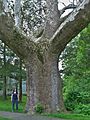 Buttonball Sycamore - sycamore tree in Sunderland, Massachusetts, May 2012.jpg 1,712 × 2,288; 3.08 MB
-
 Buttonball Sycamore in Sunderland, MA (March 2019).jpg 1,704 × 2,272; 2.87 MB
-
 Connecticut River, Sunderland, MA (4751531667).jpg 902 × 697; 81 KB
-
 Falls Road Waterfall, Sunderland MA.jpg 4,032 × 3,024; 8.41 MB
-
 Falls Road, Sunderland MA.jpg 4,032 × 3,024; 7.37 MB
-
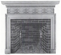 Fireboard ca1825 NorthSunderlandMassachusetts SPNEA.png 405 × 367; 159 KB
-
-
 Gunn Brook Falls.jpg 5,184 × 3,456; 11.92 MB
-

-
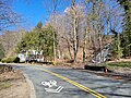
 Intersection in Sunderland MA.JPG 3,648 × 2,736; 2.54 MB
-
 MA-Route-116-Traffic-Over-Sunderland-Bridge-Into-Sunderland-Massachusetts-IMG 5510.jpg 4,032 × 2,359; 8.63 MB
-
 Pioneer Valley South From Mt. Sugarloaf.jpg 2,272 × 1,704; 808 KB
-
 Seal of Sunderland, Massachusetts.png 316 × 315; 130 KB
-
 Southbound MA Route 47, Sunderland MA.jpg 3,248 × 2,164; 1.4 MB
-
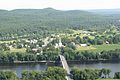
 Sunderland MA from Sugarloaf.jpg 5,472 × 3,648; 9.61 MB
-
 Sunderland Massachusetts.JPG 3,648 × 2,048; 2.8 MB
-
 Sunderland View.jpg 600 × 450; 110 KB
-
 UMass Clouds.jpg 4,272 × 2,848; 6.77 MB
-
 View of Sunderland from Mt Sugarloaf, Deerfield MA.jpg 2,492 × 1,664; 878 KB


.jpg)
.jpg)


