Category:Sundials in Nottinghamshire
Jump to navigation
Jump to search
Ceremonial counties of England: Bedfordshire · Berkshire · Buckinghamshire · Cambridgeshire · Cheshire · Cornwall · Cumbria · Derbyshire · Devon · Dorset · Durham · East Riding of Yorkshire · East Sussex · Essex · Gloucestershire · Greater London · Greater Manchester · Hampshire · Herefordshire · Hertfordshire · Kent · Lancashire · Leicestershire · Lincolnshire · Merseyside · Norfolk · North Yorkshire · Northamptonshire · Northumberland · Nottinghamshire · Oxfordshire · Shropshire · Somerset · South Yorkshire · Staffordshire · Suffolk · Surrey · Tyne and Wear · Warwickshire · West Sussex · West Yorkshire · Wiltshire · Worcestershire
City-counties: Bristol ·
Former historic counties:
Other former counties:
City-counties: Bristol ·
Former historic counties:
Other former counties:
Subcategories
This category has the following 3 subcategories, out of 3 total.
L
- Langold War Memorial (1 F)
Media in category "Sundials in Nottinghamshire"
The following 36 files are in this category, out of 36 total.
-
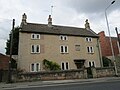 82 and 84 Station Street, Mansfield Woodhouse.jpg 1,024 × 768; 152 KB
-
 Not in working order - geograph.org.uk - 622435.jpg 469 × 631; 103 KB
-
 The Millennium Sundial - geograph.org.uk - 1096961.jpg 640 × 480; 102 KB
-
 The Sundial detail 1 - geograph.org.uk - 1096964.jpg 640 × 416; 79 KB
-
 The Sundial detail 2 - geograph.org.uk - 1096966.jpg 640 × 422; 86 KB
-
 Church of All Saints, Sutton-on-Trent - geograph.org.uk - 4098843.jpg 960 × 1,280; 517 KB
-
 Church of All Saints, Weston - geograph.org.uk - 4104567.jpg 960 × 1,280; 556 KB
-
 Church of Our Lady of Egmanton, Egmanton - geograph.org.uk - 4105749.jpg 951 × 1,280; 408 KB
-
 Church of St Helen, Stapleford - geograph.org.uk - 5808760.jpg 960 × 1,280; 494 KB
-
 Sundial at Clumber - geograph.org.uk - 415701.jpg 427 × 640; 66 KB
-
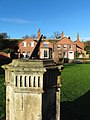
 Clumber Park - geograph.org.uk - 415707.jpg 427 × 640; 86 KB
-
 Dial House - geograph.org.uk - 3063626.jpg 640 × 427; 96 KB
-
 Eight Ladies Homes at Sherwood Rise in Nottingham.JPG 2,848 × 4,272; 6.38 MB
-
 French Garden, Newstead Abbey.jpg 1,280 × 960; 440 KB
-
 Green's Windmill sundial 1261.JPG 3,264 × 2,448; 3.84 MB
-
 Green's Windmill sundial 1262.JPG 3,264 × 2,448; 4.17 MB
-
 Green's Windmill sundial 1263.JPG 3,264 × 2,448; 4.2 MB
-
 Green's Windmill sundial 1265.JPG 3,264 × 2,448; 2.83 MB
-
 Green's Windmill sundial 1267.JPG 3,264 × 2,448; 2.93 MB
-
 Green's Windmill sundial 1268.JPG 3,264 × 2,448; 2.72 MB
-
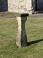
 Medieval cross base - geograph.org.uk - 588920.jpg 427 × 640; 106 KB
-
 University Park MMB 47 Millennium Garden.jpg 2,304 × 1,728; 1.62 MB
-
 Old Market Cross, Mansfield – sundial - geograph.org.uk - 6256183.jpg 960 × 1,280; 500 KB
-
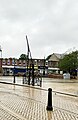
 Rufford Abbey – heliochronometer - geograph.org.uk - 6336432.jpg 1,280 × 1,280; 487 KB
-
 Sundial and The Old Parsonage - Clumber Estate - geograph.org.uk - 4276557.jpg 3,696 × 4,928; 4.64 MB
-
 Sundial in Cloister Garth, Newstead Abbey.jpg 960 × 1,280; 243 KB
-
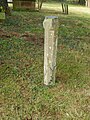
 Sundial, Farnsfield churchyard - geograph.org.uk - 4015761.jpg 960 × 1,280; 474 KB
-
 Sundial, Holy Trinity Church, Rolleston.jpg 960 × 1,280; 644 KB
-
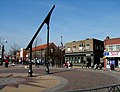
 Sundial,'Thirteen', Bridge Street, Mansfield - geograph.org.uk - 6249498.jpg 1,280 × 960; 497 KB
-
 Sundials, St Helena's Church - geograph.org.uk - 3987433.jpg 960 × 1,280; 514 KB
-
 Sutton sundial 4.JPG 1,188 × 908; 147 KB
-
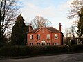 The Dial House, Winthorpe (geograph 6747075).jpg 1,024 × 768; 206 KB
-
 The Sundial Portland Square. .jpg 1,572 × 2,636; 713 KB
-
 The Sundial, Sutton in Ashfield.jpg 757 × 1,025; 211 KB
-
 The Sundial.jpg 2,246 × 3,462; 1.69 MB
-
 University Park MMB 90 Lenton Hurst.jpg 2,304 × 1,728; 1.55 MB


.jpg)


