Category:Supervisorial maps of counties of California
Jump to navigation
Jump to search
States of the United States: California
Media in category "Supervisorial maps of counties of California"
The following 37 files are in this category, out of 37 total.
-
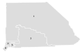
 2010 Alpine County Supervisorial district map.svg 512 × 768; 15 KB
-
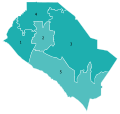
 2010 Sierra County Supervisorial Map.svg 512 × 396; 308 KB
-
 2011 San Bernardino County Supervisorial district map.svg 512 × 331; 102 KB
-
 2016 San Mateo County Supervisorial map.svg 512 × 663; 233 KB
-
 2018 Orange County, CA DA runoff.svg 408 × 386; 103 KB
-
 2022 Orange County Assessor.svg 397 × 376; 25 KB
-
 2022 Orange County DA.svg 412 × 393; 22 KB
-
 2022 Orange County, CA Board of Supervisors election.svg 412 × 393; 22 KB
-
 Imperial County Supervisorial district map.svg 512 × 362; 58 KB
-
 Los Angeles County Supervisorial districts.svg 1,056 × 1,056; 80 KB
-
 Orange County Board of Supervisors districts.svg 700 × 560; 22 KB
-
 Orange County, California Board of Supervisors districts.svg 418 × 404; 24 KB
-
 Orange County, California Presidential Election Results 2020.svg 468 × 446; 108 KB
-
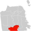
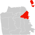
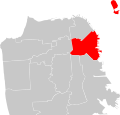
 San Francisco Board of Supervisors District 1 (2022).svg 512 × 512; 101 KB
-
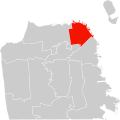
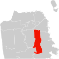
 San Francisco Board of Supervisors District 10 (2022).svg 512 × 512; 101 KB
-
 San Francisco Board of Supervisors District 11 (2022).svg 512 × 512; 101 KB
-
 San Francisco Board of Supervisors District 2 (2022).svg 512 × 512; 101 KB
-
 San Francisco Board of Supervisors District 3 (2022).svg 512 × 512; 101 KB
-
 San Francisco Board of Supervisors District 4 (2022).svg 512 × 512; 101 KB
-
 San Francisco Board of Supervisors District 5 (2022).svg 512 × 512; 101 KB
-
 San Francisco Board of Supervisors District 6 (2022).svg 512 × 512; 101 KB
-
 San Francisco Board of Supervisors District 7 (2022).svg 512 × 512; 101 KB
-
 San Francisco Board of Supervisors District 8 (2022).svg 512 × 512; 101 KB
-
 San Francisco Board of Supervisors District 9 (2022).svg 512 × 512; 101 KB
-
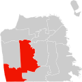
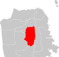
 San Francisco District 1 (2012).svg 2,268 × 2,168; 33 KB
-
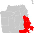 San Francisco District 10 (2012).svg 2,268 × 2,168; 33 KB
-
 San Francisco District 11 (2012).svg 2,268 × 2,168; 33 KB
-
 San Francisco District 2 (2012).svg 2,268 × 2,168; 33 KB
-
 San Francisco District 3 (2012).svg 2,268 × 2,168; 33 KB
-
 San Francisco District 4 (2012).svg 2,268 × 2,168; 33 KB
-
 San Francisco District 5 (2012).svg 2,268 × 2,168; 33 KB
-
 San Francisco District 6 (2012).svg 2,268 × 2,168; 33 KB
-
 San Francisco District 7 (2012).svg 2,268 × 2,168; 33 KB
-
 San Francisco District 8 (2012).svg 2,268 × 2,168; 33 KB
-
 San Francisco District 9 (2012).svg 2,268 × 2,168; 33 KB
-
 San Mateo County, California Presidential Election Results.svg 512 × 663; 233 KB
-
 Sierra County, California Presidential Election Results 2020.svg 512 × 396; 252 KB


.svg)
.svg)
.svg)
.svg)
.svg)
.svg)
.svg)
.svg)
.svg)
.svg)
.svg)
.svg)
.svg)
.svg)
.svg)
.svg)
.svg)
.svg)
.svg)
.svg)
.svg)
.svg)

