Category:Sutton Veny
Jump to navigation
Jump to search
village and civil parish in Wiltshire, United Kingdom  | |||||
| Upload media | |||||
| Instance of | |||||
|---|---|---|---|---|---|
| Location | Wiltshire, South West England, England | ||||
| Population |
| ||||
| official website | |||||
 | |||||
English: Sutton Veny is a small village situated in the Wylye Valley, about 2 miles south east of the town of Warminster in Wiltshire, England. 'Sutton' means south farmstead in relation to Norton Bavant, one mile to the north. 'Veny' may be a French family name or else may describe the village's fenny situation.
Nederlands: Sutton Veny is een dorp (village) en civil parish in de unitary authority Wiltshire, in het Engelse graafschap Wiltshire. De civil parish telt
Subcategories
This category has the following 4 subcategories, out of 4 total.
S
- Sutton Veny War Memorial (1 F)
T
Media in category "Sutton Veny"
The following 173 files are in this category, out of 173 total.
-
 'Pink Cottage', Sutton Veny - geograph.org.uk - 903596.jpg 640 × 480; 108 KB
-

-

-

-
 2010 , Barn on Whiten Hill - geograph.org.uk - 1993483.jpg 800 × 442; 133 KB
-
 2010 , Bishopstrow Road heading south - geograph.org.uk - 1973829.jpg 800 × 590; 195 KB
-
 2010 , Bishopstrow Road looking north - geograph.org.uk - 1969177.jpg 800 × 670; 219 KB
-
 2010 , Bishopstrow Road looking north - geograph.org.uk - 1973830.jpg 800 × 666; 224 KB
-

-
 2010 , Copper maple, Sutton Veny - geograph.org.uk - 1875030.jpg 800 × 631; 261 KB
-

-

-

-
 2010 , Five Ash Lane near Raxters Farm - geograph.org.uk - 1973855.jpg 800 × 579; 245 KB
-

-
 2010 , Horse trough near Henfords Marsh - geograph.org.uk - 1970946.jpg 800 × 541; 234 KB
-
 2010 , Lane on Whiten Hill - geograph.org.uk - 1993451.jpg 800 × 562; 126 KB
-
 2010 , Long Ivor Farm in may - geograph.org.uk - 1875171.jpg 800 × 380; 141 KB
-

-

-
 2010 , South from Deverill Road - geograph.org.uk - 1975613.jpg 800 × 407; 100 KB
-
 2010 , Sutton Veny House - geograph.org.uk - 1971079.jpg 800 × 553; 190 KB
-
 2010 , Track through Southleigh Wood - geograph.org.uk - 1875103.jpg 800 × 633; 208 KB
-
 2010 , Wheat on Whiten Hill - geograph.org.uk - 1993466.jpg 800 × 464; 127 KB
-
-
 2011 , Best's Lane, Sutton Veny - geograph.org.uk - 2305429.jpg 4,069 × 2,692; 7.82 MB
-
 2011 , Can't see the wood for the trees - geograph.org.uk - 2306670.jpg 3,460 × 2,567; 7.63 MB
-
 2011 , Entering Tytherington - geograph.org.uk - 2306639.jpg 4,046 × 2,763; 5.76 MB
-
 2011 , Field above Littlecombe Bottom - geograph.org.uk - 2311954.jpg 4,752 × 3,168; 6.49 MB
-
 2011 , Field above Littlecombe Bottom 2 - geograph.org.uk - 2311982.jpg 4,752 × 3,168; 5.3 MB
-
 2011 , High Street, Sutton Veny looking north west - geograph.org.uk - 2305406.jpg 3,983 × 2,653; 6.83 MB
-
 2011 , High Street, Sutton Veny looking south east - geograph.org.uk - 2299249.jpg 2,986 × 2,269; 4.27 MB
-
 2011 , Hill Road, Sutton Veny - geograph.org.uk - 2306631.jpg 3,735 × 2,698; 6.24 MB
-
 2011 , Leaving Tytherington, soon at Sutton Veny - geograph.org.uk - 2306646.jpg 3,135 × 2,664; 6.71 MB
-
 2011 , North east above Littlecombe Bottom - geograph.org.uk - 2311928.jpg 4,185 × 2,249; 6.11 MB
-
 2011 , On the hill above Littlecombe Bottom - geograph.org.uk - 2312257.jpg 4,752 × 3,168; 6.76 MB
-
 2011 , Sheep on Littlecombe Hill - geograph.org.uk - 2312235.jpg 4,752 × 3,168; 6.83 MB
-
 2011 , Track above Littlecombe Bottom - geograph.org.uk - 2299151.jpg 3,292 × 2,549; 5.69 MB
-
 2011 , Track on Tytherington Hill - geograph.org.uk - 2311913.jpg 3,579 × 2,744; 7.59 MB
-
 2011 , Trotting the trail to Tytherington - geograph.org.uk - 2306678.jpg 2,490 × 2,093; 4.23 MB
-
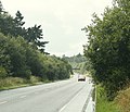
 A36 - geograph.org.uk - 5179816.jpg 640 × 320; 39 KB
-
 A36 - geograph.org.uk - 5179828.jpg 640 × 368; 37 KB
-
 A36 - geograph.org.uk - 5179837.jpg 640 × 426; 39 KB
-
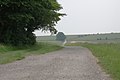
 Arable field - geograph.org.uk - 811090.jpg 640 × 480; 78 KB
-
 At Sutton Veny.jpg 1,073 × 696; 323 KB
-
 Bench Mark, Sutton Veny - geograph.org.uk - 2463818.jpg 480 × 640; 92 KB
-
 Best's Lane, Sutton Veny - geograph.org.uk - 5926467.jpg 1,024 × 683; 287 KB
-
 Bridleway near Norton Bavant - geograph.org.uk - 2316909.jpg 640 × 480; 69 KB
-

-
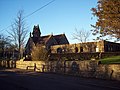
 Church of St John The Evangelist, Sutton Veny - geograph.org.uk - 5926453.jpg 683 × 1,024; 171 KB
-
 Cottages in High Street, Sutton Veny - geograph.org.uk - 5926461.jpg 1,024 × 683; 154 KB
-
 Crossroads at Sutton Veny - geograph.org.uk - 5926475.jpg 1,024 × 683; 292 KB
-
 Fenced paddock at Tytherington - geograph.org.uk - 5926689.jpg 1,024 × 683; 246 KB
-
 Field beside Best's Lane, Sutton Veny - geograph.org.uk - 5926457.jpg 1,024 × 683; 235 KB
-
 Five Ash Lane - geograph.org.uk - 5300224.jpg 640 × 480; 161 KB
-
 Flush Bracket G3786, Sutton Veny - geograph.org.uk - 2281804.jpg 480 × 640; 89 KB
-
 Footbridge, A36 - geograph.org.uk - 5179831.jpg 640 × 377; 46 KB
-

-
 Forestry operations at Eastleigh Wood - geograph.org.uk - 348156.jpg 640 × 480; 58 KB
-

-
 Grass growing at edge of crop - geograph.org.uk - 461195.jpg 640 × 427; 93 KB
-
 Greenhill Gardens, Sutton Veny - geograph.org.uk - 1180194.jpg 640 × 480; 77 KB
-
 Haycombe Hill - geograph.org.uk - 811087.jpg 640 × 480; 103 KB
-
 House in Sutton Veny - geograph.org.uk - 2463813.jpg 640 × 481; 79 KB
-
-
 House with clipped bushes - geograph.org.uk - 2911865.jpg 640 × 480; 123 KB
-
 Housing, Sutton Veny - geograph.org.uk - 2281807.jpg 640 × 482; 78 KB
-

-
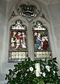
 Inside St James, Tytherington (II) - geograph.org.uk - 3677655.jpg 640 × 480; 75 KB
-
 Inside St James, Tytherington (VI) - geograph.org.uk - 3677672.jpg 640 × 462; 42 KB
-

-

-

-

-

-
 Milepost near Bishopstrow - geograph.org.uk - 2281814.jpg 480 × 640; 108 KB
-
 Milepost, Sutton Veny - geograph.org.uk - 2281794.jpg 640 × 480; 100 KB
-
 Mind the step^ - geograph.org.uk - 5926677.jpg 683 × 1,024; 256 KB
-
 Minor road near Bishopstrow - geograph.org.uk - 2281815.jpg 640 × 480; 88 KB
-
 My 95,000th image - geograph.org.uk - 3686503.jpg 640 × 480; 47 KB
-
 Norton Bavant, lay-by - geograph.org.uk - 5710597.jpg 1,024 × 768; 186 KB
-

-

-
 Ordnance Survey Flush Bracket G3786 - geograph.org.uk - 5340185.jpg 4,000 × 3,000; 3.67 MB
-
 Ornate gatehouse at Sutton Veny - geograph.org.uk - 5926481.jpg 1,024 × 683; 189 KB
-
 Parsonage Down - geograph.org.uk - 811103.jpg 640 × 480; 93 KB
-

-

-
 Rape and mature trees - geograph.org.uk - 811120.jpg 640 × 480; 87 KB
-
 Rape field in chalk downland - geograph.org.uk - 811115.jpg 640 × 480; 92 KB
-

-
 Robin Hood's Bower, Southleigh Wood (geograph 7091054).jpg 3,776 × 2,520; 2.72 MB
-
 Rush hour in Sutton Veny - geograph.org.uk - 3659174.jpg 640 × 480; 55 KB
-
 Rush hour in Tytherington - geograph.org.uk - 3658161.jpg 640 × 480; 60 KB
-
 St James, Tytherington, lectern - geograph.org.uk - 3677675.jpg 480 × 640; 48 KB
-

-

-

-

-

-

-

-

-
-

-

-

-
-

-
-

-

-

-
-

-

-

-

-

-

-

-

-

-
-

-

-

-

-
 St. James Court, Tytherington - geograph.org.uk - 5301574.jpg 640 × 428; 116 KB
-
 Start of footpath up over Parsonage Down - geograph.org.uk - 3561070.jpg 3,648 × 2,736; 3.34 MB
-

-
 Sutton Veny - London Country RF308 (NLE527).jpg 1,024 × 683; 383 KB
-
 Sutton Veny - Ulsterbus 2440 (WOI2440).jpg 1,024 × 768; 400 KB
-
 Sutton Veny church - geograph.org.uk - 5300204.jpg 640 × 480; 147 KB
-
 Sutton Veny elm 3.6.jpg 3,072 × 2,304; 2.36 MB
-
 Sutton Veny elm 4.2.jpg 2,304 × 3,072; 4.37 MB
-
 Sutton Veny Primary School - geograph.org.uk - 3659170.jpg 640 × 480; 75 KB
-
 The Church of St John the Evangelist at Sutton Veny - geograph.org.uk - 5340190.jpg 2,999 × 3,999; 1.74 MB
-
 The end of Eastleigh Wood Lane - geograph.org.uk - 5300219.jpg 640 × 480; 197 KB
-
 The Richest in Cream, Sutton Veny - geograph.org.uk - 2281798.jpg 640 × 480; 89 KB
-
 The River Wylye - geograph.org.uk - 1238278.jpg 640 × 480; 109 KB
-
 The River Wylye - geograph.org.uk - 1238286.jpg 480 × 640; 98 KB
-
 The Village, Sutton Veny.jpg 1,116 × 732; 421 KB
-
 The Woolpack - geograph.org.uk - 1180170.jpg 640 × 480; 83 KB
-
 Ulmus laevis bole, Sutton Veny, UK.jpg 2,752 × 2,064; 1.94 MB
-

-
 View from the A36 - geograph.org.uk - 1416595.jpg 640 × 476; 131 KB
-
 View towards Church Farm, Tytherington - geograph.org.uk - 5926693.jpg 1,024 × 683; 274 KB
-
 War graves, Sutton Veny - geograph.org.uk - 2057620.jpg 640 × 480; 85 KB
-
 Wessex Downland - geograph.org.uk - 811098.jpg 640 × 480; 79 KB
-
 Wild Mignonette, Reseda lutea - geograph.org.uk - 813097.jpg 640 × 480; 156 KB
-

-
 Wiltshire Downs - geograph.org.uk - 811108.jpg 640 × 310; 51 KB
-
 Woodlands for sale - geograph.org.uk - 5300226.jpg 640 × 428; 182 KB
-
 Yellow, white and green - geograph.org.uk - 811112.jpg 640 × 480; 110 KB
-

-
 A36 Warminster bypass eastbound - geograph.org.uk - 1422916.jpg 640 × 516; 130 KB
-
 A36 Warminster bypass going west - geograph.org.uk - 1422900.jpg 640 × 474; 112 KB
-
 A36 Warminster bypass heading east - geograph.org.uk - 1422904.jpg 640 × 466; 120 KB
-
 A36 Warminster bypass heading west - geograph.org.uk - 1422913.jpg 640 × 506; 144 KB
-
 A36 Warminster bypass looking west - geograph.org.uk - 1416843.jpg 640 × 552; 161 KB
-
 Barn at Haycombe Hill Farm - geograph.org.uk - 348224.jpg 640 × 480; 34 KB
-
 Downland, Sutton Veny - geograph.org.uk - 539183.jpg 640 × 480; 130 KB
-
 Haycombe Bottom - geograph.org.uk - 535748.jpg 640 × 480; 88 KB
-
 Haycombe Bottom - geograph.org.uk - 539096.jpg 640 × 480; 95 KB
-
 Hidden pond - geograph.org.uk - 330630.jpg 640 × 480; 66 KB
-
 Lane to Whiten Hill - geograph.org.uk - 348215.jpg 640 × 480; 33 KB
-
 Pound Barton Trading Estate, Sutton Veny - geograph.org.uk - 111529.jpg 640 × 480; 125 KB
-
 RUPP from Haycombe Hill Farm - geograph.org.uk - 460937.jpg 640 × 427; 85 KB
-
 Sutton Veny - geograph.org.uk - 109669.jpg 640 × 480; 102 KB
-
 Sutton Veny from Whiten Hill - geograph.org.uk - 348211.jpg 640 × 480; 29 KB
-
 Sutton Veny School - geograph.org.uk - 332589.jpg 640 × 480; 112 KB
-
 Whiten Hill - geograph.org.uk - 348231.jpg 640 × 480; 29 KB


_-_geograph.org.uk_-_3677655.jpg)
_-_geograph.org.uk_-_3677672.jpg)
_-_geograph.org.uk_-_3672730.jpg)
_-_geograph.org.uk_-_3672732.jpg)
_-_geograph.org.uk_-_3672733.jpg)
_-_geograph.org.uk_-_3672736.jpg)
_-_geograph.org.uk_-_3672737.jpg)


.jpg)


_-_geograph.org.uk_-_3677668.jpg)
_-_geograph.org.uk_-_3672755.jpg)

_-_geograph.org.uk_-_3672759.jpg)
_-_geograph.org.uk_-_3672760.jpg)
_-_geograph.org.uk_-_3672764.jpg)
_-_geograph.org.uk_-_3672765.jpg)
_-_geograph.org.uk_-_3672767.jpg)
_-_geograph.org.uk_-_3672769.jpg)
_-_geograph.org.uk_-_3672770.jpg)
_-_geograph.org.uk_-_3672772.jpg)
_-_geograph.org.uk_-_3672773.jpg)


_-_geograph.org.uk_-_3672683.jpg)
_-_geograph.org.uk_-_3672720.jpg)
_-_geograph.org.uk_-_3672724.jpg)
_-_geograph.org.uk_-_3672774.jpg)
_-_geograph.org.uk_-_3672757.jpg)
_-_geograph.org.uk_-_3672698.jpg)
_-_geograph.org.uk_-_3672705.jpg)
_-_geograph.org.uk_-_3672713.jpg)
_-_geograph.org.uk_-_3672716.jpg)


_-_geograph.org.uk_-_3672739.jpg)
_-_geograph.org.uk_-_3672741.jpg)
_-_geograph.org.uk_-_3672743.jpg)
_-_geograph.org.uk_-_3672745.jpg)
_-_geograph.org.uk_-_3672747.jpg)
_-_geograph.org.uk_-_3672750.jpg)


.jpg)
.jpg)


