Category:Swanwick, Hampshire
Jump to navigation
Jump to search
village in Hampshire, United Kingdom | |||||
| Upload media | |||||
| Instance of | |||||
|---|---|---|---|---|---|
| Location | Fareham, Hampshire, South East England, England | ||||
 | |||||
English: Swanwick is a village in Hampshire, England, west of the River Hamble and just north of the M27 motorway.
Subcategories
This category has the following 4 subcategories, out of 4 total.
Media in category "Swanwick, Hampshire"
The following 92 files are in this category, out of 92 total.
-
 Alleyway by Park Gate Police Station - geograph.org.uk - 609549.jpg 640 × 480; 91 KB
-
 Beacon Bottom, looking east. - geograph.org.uk - 609472.jpg 640 × 480; 77 KB
-
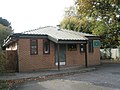
 Brook Lane Surgery - geograph.org.uk - 610076.jpg 640 × 480; 99 KB
-
 Car park near village centre - geograph.org.uk - 608680.jpg 640 × 480; 83 KB
-
 Clock on industrial unit - geograph.org.uk - 608596.jpg 640 × 480; 68 KB
-
 Detached house in Stalybridge Close - geograph.org.uk - 609514.jpg 640 × 480; 96 KB
-
 Dove Gardens, Park Gate - geograph.org.uk - 610655.jpg 640 × 480; 105 KB
-
 Footpath through Swanwick Wood - geograph.org.uk - 464674.jpg 427 × 640; 259 KB
-

-
 Hampshire, UK - panoramio.jpg 1,600 × 1,200; 189 KB
-
 Hoe Moor Creek - geograph.org.uk - 1375225.jpg 640 × 427; 170 KB
-
 Hoe Moor Creek - geograph.org.uk - 1375926.jpg 640 × 427; 196 KB
-
 Houses in Swanwick Wood - geograph.org.uk - 464666.jpg 640 × 427; 205 KB
-
 Interesting tree on Bridge Road - geograph.org.uk - 610674.jpg 640 × 480; 107 KB
-
 Junction of Beacon Way and Beacon Bottom - geograph.org.uk - 609469.jpg 640 × 480; 107 KB
-

-
 Looking towards Beacon Bottom - geograph.org.uk - 609394.jpg 640 × 480; 64 KB
-
-

-

-
 Lower Duncan Road - geograph.org.uk - 608643.jpg 640 × 480; 69 KB
-

-
 NATS London Area Control Centre, Swanwick - geograph.org.uk - 464744.jpg 640 × 414; 156 KB
-
 New Office space on the Botley Road - geograph.org.uk - 609421.jpg 640 × 480; 49 KB
-
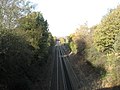 On railway bridge looking north-west - geograph.org.uk - 609356.jpg 640 × 480; 92 KB
-
-
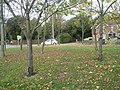
 Park Gate Primary School Playing Field - geograph.org.uk - 610553.jpg 640 × 480; 127 KB
-

-
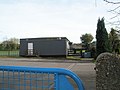
 Rookery Farm Landfill Site - geograph.org.uk - 609368.jpg 640 × 480; 78 KB
-
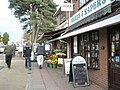 Small shops in Middle Street - geograph.org.uk - 608745.jpg 640 × 480; 102 KB
-
 Station Garage - geograph.org.uk - 609361.jpg 640 × 480; 70 KB
-
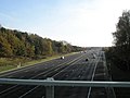
 Steps down to Motorway - geograph.org.uk - 609378.jpg 640 × 480; 140 KB
-
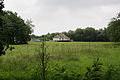
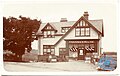 Swanwick House.jpg 2,048 × 1,298; 262 KB
-
 Terrace of houses in Botley Road - geograph.org.uk - 610647.jpg 640 × 480; 71 KB
-

-
 Traditional Cottages - geograph.org.uk - 227405.jpg 640 × 480; 55 KB
-

-

-
 Army Cadet HQ at Park Gate - geograph.org.uk - 610565.jpg 640 × 480; 91 KB
-
 Bridge Road-Park Gate - geograph.org.uk - 739120.jpg 640 × 476; 82 KB
-

-
 Businesses in the centre of Park Gate - geograph.org.uk - 608702.jpg 640 × 480; 60 KB
-

-
 Caspian Close - geograph.org.uk - 609371.jpg 640 × 480; 128 KB
-
 Chinese restaurant - geograph.org.uk - 608756.jpg 640 × 480; 97 KB
-
 Close in Northmore Road - geograph.org.uk - 610683.jpg 640 × 480; 119 KB
-
 Couple shopping at Park Gate - geograph.org.uk - 608711.jpg 640 × 480; 75 KB
-
 Detached house in Station Road - geograph.org.uk - 608803.jpg 640 × 480; 98 KB
-

-

-
 Duncan Road - geograph.org.uk - 608661.jpg 640 × 480; 64 KB
-
 Factory in Botley Road - geograph.org.uk - 610663.jpg 640 × 480; 79 KB
-
 Footpath in grounds of Coldeast Hospital - geograph.org.uk - 610107.jpg 640 × 480; 100 KB
-
 Footpath leading to Hollybrook Gardens - geograph.org.uk - 610072.jpg 640 × 480; 123 KB
-
 Footpath to housing at Badger's Copse - geograph.org.uk - 610645.jpg 640 × 480; 103 KB
-

-

-
 Honeysuckle Close - geograph.org.uk - 610124.jpg 640 × 480; 61 KB
-

-

-

-
-

-
 Kam's Palace Bed and Breakfast - geograph.org.uk - 610601.jpg 640 × 480; 57 KB
-
 Kam's Palace Chinese Restaurant - geograph.org.uk - 610595.jpg 640 × 480; 124 KB
-
 Lloyds TSB at Park Gate - geograph.org.uk - 610562.jpg 640 × 480; 67 KB
-
 Locks Heath W.M. Social Club - geograph.org.uk - 608646.jpg 640 × 480; 65 KB
-

-
 Looking down beacon Mount towards CVM - geograph.org.uk - 609450.jpg 640 × 480; 60 KB
-
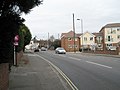 Looking down the Botley Road - geograph.org.uk - 608826.jpg 640 × 480; 61 KB
-
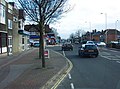
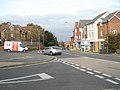
 Looking south-west down Station Road - geograph.org.uk - 608823.jpg 640 × 480; 64 KB
-

-

-

-
 New road near Swanwick Station - geograph.org.uk - 608639.jpg 640 × 480; 84 KB
-
 Northmore Road, Park Gate - geograph.org.uk - 610164.jpg 640 × 480; 51 KB
-
 Park Gate Royal British Legion Club - geograph.org.uk - 610067.jpg 640 × 480; 82 KB
-
 Pretty cottage in Duncan Road - geograph.org.uk - 608634.jpg 640 × 480; 104 KB
-

-

-
 Route bends at Duncan Road - geograph.org.uk - 608629.jpg 640 × 480; 51 KB
-

-
 Semi-detached homes on Duncan Road - geograph.org.uk - 608671.jpg 640 × 480; 56 KB
-

-
 Shop in village centre - geograph.org.uk - 608651.jpg 640 × 480; 76 KB
-
 Signposts looking towards Segensworth - geograph.org.uk - 610635.jpg 640 × 480; 93 KB
-

-
-
 The Green, Park Gate - geograph.org.uk - 608784.jpg 640 × 480; 146 KB
-
 The Meadows Outpatients Clinic - geograph.org.uk - 610093.jpg 640 × 480; 84 KB
-
 Tropical tree in Station Road - geograph.org.uk - 608810.jpg 640 × 480; 102 KB
-


