Category:Swefling
Jump to navigation
Jump to search
English: Swefling is a civil parish in the Suffolk Coastal district, in the county of Suffolk, England.
civil parish in Suffolk, England | |||||
| Upload media | |||||
| Instance of | |||||
|---|---|---|---|---|---|
| Location |
| ||||
| Population |
| ||||
 | |||||
Subcategories
This category has the following 4 subcategories, out of 4 total.
Media in category "Swefling"
The following 125 files are in this category, out of 125 total.
-
 A farmer at work south-east of Sweffling - geograph.org.uk - 2451376.jpg 640 × 480; 226 KB
-
 B1119 Low Rd and Suffolk Kinsman Victorian Postbox - geograph.org.uk - 1429280.jpg 3,072 × 2,304; 1.45 MB
-
 B1119 Low Road, Sweffling - geograph.org.uk - 2387137.jpg 3,072 × 2,304; 1.36 MB
-
 B1119 north of Hall Farm - geograph.org.uk - 3593120.jpg 3,648 × 2,736; 1.47 MB
-
 B1119 Saxmundham Road - geograph.org.uk - 2362180.jpg 3,072 × 2,304; 1.39 MB
-
 B1119 Saxmundham Road - geograph.org.uk - 2385874.jpg 3,072 × 2,304; 1.6 MB
-
 B1119 Saxmundham Road south of Sweffling Hall - geograph.org.uk - 3593112.jpg 3,648 × 2,736; 1.62 MB
-
 B1119 Saxmundham Road ^ the footpath to Bruisyard Road - geograph.org.uk - 2362236.jpg 3,072 × 2,304; 1.23 MB
-
 B1119 ^ Footpath to Glemham Road - geograph.org.uk - 2387132.jpg 3,072 × 2,304; 1.32 MB
-
 Base Of An Old Windmill - geograph.org.uk - 4177412.jpg 1,024 × 768; 322 KB
-
 Benhall Low Street Sign - geograph.org.uk - 1988179.jpg 3,072 × 2,304; 1.67 MB
-
 Bird Scarer - geograph.org.uk - 4178478.jpg 1,024 × 768; 256 KB
-
 Bridge on Benhall Low Street - geograph.org.uk - 1988176.jpg 3,072 × 2,304; 1.35 MB
-
 Bridge over the River Alde, Sweffling - geograph.org.uk - 2451334.jpg 640 × 480; 199 KB
-
 Bungalows - geograph.org.uk - 4177389.jpg 1,024 × 768; 207 KB
-
 Bungalows off Glemham Road - geograph.org.uk - 2778320.jpg 3,072 × 2,304; 1.51 MB
-

-

-

-

-

-
 Chapel Lane - geograph.org.uk - 2385836.jpg 3,072 × 2,304; 1.38 MB
-
 Chapel Lane - geograph.org.uk - 2385852.jpg 3,072 × 2,304; 1.49 MB
-
 Chapel Lane - geograph.org.uk - 2385855.jpg 3,072 × 2,304; 1.27 MB
-
 Chapel Lane - geograph.org.uk - 2385857.jpg 3,072 × 2,304; 1.26 MB
-
 Chapel Lane ^ Footpath to Glemham Road - geograph.org.uk - 2385718.jpg 3,072 × 2,304; 1.65 MB
-
 Chapel Lane, Sweffling - geograph.org.uk - 2385781.jpg 3,072 × 2,304; 1.65 MB
-
 Chapel Lane, Sweffling - geograph.org.uk - 2385784.jpg 3,072 × 2,304; 1.68 MB
-
 Cottage in Sweffling - geograph.org.uk - 2450637.jpg 640 × 480; 196 KB
-
 Cottages by the lane, south of Sweffling - geograph.org.uk - 6272541.jpg 1,600 × 1,064; 482 KB
-
 Cottages in Sweffling - geograph.org.uk - 2450635.jpg 640 × 480; 203 KB
-
 Cottages in Sweffling - geograph.org.uk - 2450638.jpg 640 × 480; 189 KB
-
 Country Field - geograph.org.uk - 4178468.jpg 1,024 × 768; 223 KB
-

-
 Cransford, B1119 junction - geograph.org.uk - 6562053.jpg 7,172 × 4,782; 7.49 MB
-
 Cransford, Harvested field - geograph.org.uk - 6562048.jpg 6,079 × 4,053; 5.95 MB
-
 Cransford, Road signpost - geograph.org.uk - 6562051.jpg 5,894 × 3,930; 4.38 MB
-
 Cransford, Sweffling boundary sign - geograph.org.uk - 6562046.jpg 5,626 × 3,750; 6.33 MB
-
 Eggs For Sale - geograph.org.uk - 4177383.jpg 1,024 × 768; 291 KB
-
 Entering Rendham - geograph.org.uk - 4178172.jpg 1,024 × 768; 255 KB
-
 Entering Sweffling on Glemham Road - geograph.org.uk - 1988233.jpg 3,072 × 2,304; 1.63 MB
-

-

-
 Fields next to the footpath to Glemham Road - geograph.org.uk - 2385730.jpg 3,072 × 2,304; 1.34 MB
-
 Finger post at Sweffling - geograph.org.uk - 2286907.jpg 760 × 570; 154 KB
-
 Footpath - geograph.org.uk - 4177413.jpg 1,024 × 768; 327 KB
-
 Footpath to Bridge Farm ^ B1119 - geograph.org.uk - 2778307.jpg 2,304 × 3,072; 1.31 MB
-
 Footpath to Bridge Farm ^ B1119 - geograph.org.uk - 2778311.jpg 3,072 × 2,304; 1.37 MB
-
 Footpath to Bruisyard Road - geograph.org.uk - 2362241.jpg 2,304 × 3,072; 1.46 MB
-
 Footpath to Bruisyard Road - geograph.org.uk - 2362268.jpg 3,072 × 2,304; 1.37 MB
-
 Footpath to Bruisyard Road - geograph.org.uk - 2387025.jpg 3,072 × 2,304; 1.37 MB
-
 Footpath to Bruisyard Road - geograph.org.uk - 2387027.jpg 3,072 × 2,304; 1.64 MB
-
 Footpath to Bruisyard Road - geograph.org.uk - 2387028.jpg 2,304 × 3,072; 1.65 MB
-
 Footpath to Bruisyard Road - geograph.org.uk - 2387033.jpg 3,072 × 2,304; 1.5 MB
-
 Footpath to Bruisyard Road - geograph.org.uk - 2387106.jpg 3,072 × 2,304; 1.66 MB
-
 Footpath to Bruisyard Road - geograph.org.uk - 2387112.jpg 2,304 × 3,072; 1.44 MB
-
 Footpath to Chapel Lane - geograph.org.uk - 2778299.jpg 3,072 × 2,304; 1.41 MB
-
 Footpath to Chapel Lane ^ Entrance - geograph.org.uk - 1988205.jpg 3,072 × 2,304; 1.56 MB
-
 Footpath to Deadman's Lane - geograph.org.uk - 2322274.jpg 3,072 × 2,304; 1.2 MB
-
 Footpath to Deadman's Lane - geograph.org.uk - 2362440.jpg 3,072 × 2,304; 1.4 MB
-
 Footpath to Glemham Road - geograph.org.uk - 2362438.jpg 3,072 × 2,304; 1.68 MB
-
 Footpath to Glemham Road - geograph.org.uk - 2362524.jpg 3,072 × 2,304; 1.51 MB
-
 Footpath to Glemham Road - geograph.org.uk - 2385709.jpg 3,072 × 2,304; 1.65 MB
-
 Footpath to Glemham Road - geograph.org.uk - 2385716.jpg 3,072 × 2,304; 1.42 MB
-
 Footpath to Glemham Road - geograph.org.uk - 2385725.jpg 3,072 × 2,304; 1.41 MB
-
 Footpath to Glemham Road - geograph.org.uk - 2387129.jpg 3,072 × 2,304; 1.44 MB
-
 Footpath to Glemham Road ^ Chapel Lane - geograph.org.uk - 2385818.jpg 3,072 × 2,304; 1.32 MB
-
 Footpath to Glemham Road ^ Holdans Lane - geograph.org.uk - 2362172.jpg 3,072 × 2,304; 1.66 MB
-
 Footpath to Glemham Road ^ Holdans Lane - geograph.org.uk - 2362175.jpg 3,072 × 2,304; 1.68 MB
-
 Footpath to Glemham Road ^ Holdans Lane - geograph.org.uk - 2362207.jpg 3,072 × 2,304; 1.45 MB
-
 Footpath to Glemham Road ^ Holdans Lane - geograph.org.uk - 2362210.jpg 3,072 × 2,304; 1.33 MB
-
 Footpath to Glemham Road ^ Holdans Lane - geograph.org.uk - 2362212.jpg 2,304 × 3,072; 1.38 MB
-
 Footpath to Glemham Road ^ Holdans Lane - geograph.org.uk - 2362233.jpg 3,072 × 2,304; 1.39 MB
-
 Footpath to Grove Farm, B1119 ^ Deadman's Lane - geograph.org.uk - 2362442.jpg 3,072 × 2,304; 1.48 MB
-
 Footpath to Grove Road - geograph.org.uk - 2385876.jpg 3,072 × 2,304; 1.66 MB
-
 Footpath to Grove Road - geograph.org.uk - 2385877.jpg 3,072 × 2,304; 1.67 MB
-
 Footpath to Holdans ^ Chapel Lanes - geograph.org.uk - 2322269.jpg 3,072 × 2,304; 1.26 MB
-
 Footpath to Mill Road - geograph.org.uk - 2362382.jpg 3,072 × 2,304; 1.4 MB
-
 Footpath to St.Mary the Virgin Church ^ Glemham Road - geograph.org.uk - 2322265.jpg 3,072 × 2,304; 1.37 MB
-
 Footpath to Sweffling Grange - geograph.org.uk - 2362379.jpg 2,304 × 3,072; 1.49 MB
-
 Footpath to the B1119 Low Road - geograph.org.uk - 4524160.jpg 3,072 × 2,304; 1.85 MB
-
 Footpath to the B1119 Low Road - geograph.org.uk - 4524161.jpg 2,265 × 3,011; 2.51 MB
-
 Footpath to the B1119 Saxmundham Road - geograph.org.uk - 2362285.jpg 3,072 × 2,304; 1.39 MB
-
 Footpath to the B1119 Saxmundham Road - geograph.org.uk - 2362288.jpg 3,072 × 2,304; 1.21 MB
-
 Footpath to The Gull, B1119 Saxmundham Road ^ Grove Road - geograph.org.uk - 2385789.jpg 3,072 × 2,304; 1.61 MB
-
 Footpath to The Gull, B1119 Saxmundham Road ^ Grove Road - geograph.org.uk - 2385808.jpg 3,072 × 2,304; 1.59 MB
-
 Footprints - geograph.org.uk - 4178509.jpg 768 × 1,024; 321 KB
-
 Glemham Road - geograph.org.uk - 2778314.jpg 2,304 × 3,072; 1.42 MB
-
 Glemham Road - geograph.org.uk - 2778315.jpg 3,072 × 2,304; 1.51 MB
-
 Glemham Road ^ footpath - geograph.org.uk - 4524158.jpg 3,072 × 2,304; 1.82 MB
-
 Glemham Road ^ the Footpath to Bridge Farm - geograph.org.uk - 2778305.jpg 3,072 × 2,304; 1.45 MB
-
 Grass verge on B1119 at Rendham, Suffolk - geograph.org.uk - 2902146.jpg 1,600 × 1,158; 464 KB
-
 Holdans Lane - geograph.org.uk - 2385840.jpg 3,072 × 2,304; 1.38 MB
-
 Holdans Lane, Sweffling - geograph.org.uk - 2385806.jpg 3,072 × 2,304; 1.61 MB
-
 Holdans Lane, Sweffling - geograph.org.uk - 2385812.jpg 3,072 × 2,304; 1.32 MB
-
 Holdens Meadow Sign - geograph.org.uk - 2385850.jpg 3,072 × 2,304; 1.5 MB
-

-
 Kissing Gate of the footpath to Bruisyard Road - geograph.org.uk - 2387034.jpg 2,304 × 3,072; 1.65 MB
-
 Looking North - geograph.org.uk - 4177368.jpg 768 × 1,024; 337 KB
-

-

-
 Road to Bruisyard - geograph.org.uk - 2387094.jpg 3,072 × 2,304; 1.67 MB
-
 Road to Bruisyard - geograph.org.uk - 2387102.jpg 3,072 × 2,304; 1.43 MB
-
 Road to Bruisyard ^ Footpath to Bruisyard Road - geograph.org.uk - 2387101.jpg 3,072 × 2,304; 1.47 MB
-
 Road to Sweffling - geograph.org.uk - 1429299.jpg 3,072 × 2,304; 1.68 MB
-
 Road to the B1119 Low Road - geograph.org.uk - 2322272.jpg 2,304 × 3,072; 1.36 MB
-

-
 Speed Restriction Signs - geograph.org.uk - 4177374.jpg 1,024 × 768; 266 KB
-
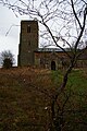 St Mary the Virgin, Sweffling - geograph.org.uk - 6396398.jpg 1,064 × 1,600; 479 KB
-
 Sweffling - geograph.org.uk - 4860917.jpg 4,320 × 3,240; 2.99 MB
-
 Sweffling Hall Farm - geograph.org.uk - 6562030.jpg 5,495 × 3,664; 7.3 MB
-
 Sweffling Hall Farm - geograph.org.uk - 6564456.jpg 5,963 × 3,976; 6.95 MB
-
 Sweffling, Cereal crop - geograph.org.uk - 6564475.jpg 7,238 × 4,825; 5.93 MB
-
 Sweffling, Chapel Lane - geograph.org.uk - 6564445.jpg 6,353 × 4,235; 6.87 MB
-
 Sweffling, Harvested cereal crop - geograph.org.uk - 6562035.jpg 6,848 × 4,565; 6.28 MB
-
 Sweffling, Harvesting in progress - geograph.org.uk - 6562044.jpg 5,714 × 3,809; 4.93 MB
-
 Sweffling, Looking towards Hall Farm in Chapel Lane - geograph.org.uk - 6564438.jpg 6,926 × 4,618; 5.95 MB
-
 Sweffling, Woolnough Lane - geograph.org.uk - 6562038.jpg 6,902 × 4,600; 7.78 MB
-
 Sweffling, Woolnough Lane, Looking towards Gull Covert - geograph.org.uk - 6562042.jpg 6,496 × 4,330; 6.83 MB
-
 The B1119 Saxmundham Road - geograph.org.uk - 2362184.jpg 3,072 × 2,304; 1.43 MB
-
 The Grove - geograph.org.uk - 2778302.jpg 2,304 × 3,072; 1.32 MB
-
 The Grove and the footpath to Chapel Lane - geograph.org.uk - 2778296.jpg 3,072 × 2,304; 1.35 MB
-
 The River Alde - geograph.org.uk - 2286917.jpg 760 × 570; 167 KB
-
 The River Alde - geograph.org.uk - 2286923.jpg 760 × 570; 176 KB
-
 Village Name Sign - geograph.org.uk - 4177379.jpg 1,024 × 768; 301 KB


