Category:Synagogue (Veenhuizen, Noordenveld)
Jump to navigation
Jump to search
| Object location | | View all coordinates using: OpenStreetMap |
|---|
.jpg) | |||||
| Upload media | |||||
| Instance of | |||||
|---|---|---|---|---|---|
| Location | Veenhuizen, Noordenveld, Drenthe, Netherlands | ||||
| Street address |
| ||||
| Located on street |
| ||||
| Architect | |||||
| Heritage designation |
| ||||
| Date of official opening |
| ||||
| Date of official closure |
| ||||
 | |||||
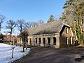
Nederlands: Vm. synagoge, Hoofdweg 120, Veenhuizen (gem. Noordenveld, Drenthe), rm 469406
|
This is a category about rijksmonument number 469406
|
| Address |
|
Media in category "Synagogue (Veenhuizen, Noordenveld)"
The following 6 files are in this category, out of 6 total.
-
 Exterieur OVERZICHT - Veenhuizen - 20276520 - RCE.jpg 1,200 × 1,197; 488 KB
-
 Exterieur VOORGEVEL - Veenhuizen - 20276521 - RCE.jpg 1,193 × 1,200; 450 KB
-
 Exterieur VOORGEVEL, ZIJGEVEL - Veenhuizen - 20276522 - RCE.jpg 1,188 × 1,200; 376 KB
-
 Synagoge (Veenhuizen, Noordenveld).jpg 2,592 × 1,944; 2.88 MB
-
 Synagoge, Veenhuizen.JPG 4,608 × 3,456; 3.23 MB
-
 Voormalig synagoge Veenhuizen.jpg 2,449 × 1,633; 1.9 MB


