Category:TIFF versions of Bromley maps of Manhattan published in 1916
Jump to navigation
Jump to search
Maps from: Bromley, George W. and Walter S. Atlas of the Borough of Manhattan City of New York. Desk and library edition. (New York: G. W. Bromley and Co., 1916). Comprising title page, four-page street index, five outline and index maps, and block index, plus 191 section maps (plates). All are double pages. (Missing from this category are 74 section maps.)
Online at The New York Public Library Digital Collection website, Atlas of the borough of Manhattan….
Media in category "TIFF versions of Bromley maps of Manhattan published in 1916"
The following 128 files are in this category, out of 128 total.
-

-
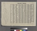 BLOCK INDEX. (With the Manhattan map on the left.) NYPL1511717.tiff 6,299 × 5,248; 94.6 MB
-
 STREET INDEX. Abington Square - Harry Howard Square. NYPL1511718.tiff 6,299 × 5,248; 94.6 MB
-
 Street Index. Haven Ave. - Water St. NYPL1511719.tiff 6,299 × 5,248; 94.6 MB
-
 Street Index. Water St. - 79th Street, East. NYPL1511713.tiff 6,299 × 5,248; 94.6 MB
-
 Street Index. 80th St. - 228th St. NYPL1511714.tiff 6,299 × 5,248; 94.6 MB
-
 Index- Borough of Manhattan, Battery to 14th St. NYPL1511715.tiff 6,299 × 5,248; 94.6 MB
-
 Index- Borough of Manhattan, 14th St. to 59th St. NYPL1511716.tiff 6,299 × 5,248; 94.6 MB
-
 Index- Borough of Manhattan, 59th St.to 110th St. NYPL1511731.tiff 6,299 × 5,248; 94.6 MB
-
 Index- Borough of Manhattan, 110th St. to 145th St. NYPL1511721.tiff 6,299 × 5,248; 94.6 MB
-
 Index- Borough of Manhattan, 145th Street to Spuyten Duyvil. NYPL1511723.tiff 6,299 × 5,248; 94.6 MB
-

-

-

-

-

-

-

-

-

-

-

-

-

-

-

-

-

-

-

-

-

-

-

-

-

-

-

-

-

-

-

-

-

-

-

-

-

-

-

-

-

-

-

-

-

-

-

-

-

-

-

-

-

-

-

-

-

-

-

-

-

-

-

-

-

-

-

-

-

-

-

-

-

-

-

-

-

-

-

-

-

-

-

-

-

-

-

-

-

-

-

-

-

-

-

-

-

-

-

-

-

-

-

-

-

-

-

-

-

-

-

-

-

-

-

-
-
