Category:Tacitusbrug
Jump to navigation
Jump to search
| Object location | | View all coordinates using: OpenStreetMap |
|---|
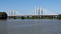
bridge over the Waal, Ewijk, the Netherlands  | |||||
| Upload media | |||||
| Instance of | |||||
|---|---|---|---|---|---|
| Location |
| ||||
| Crosses | |||||
| Carries | |||||
| Inception |
| ||||
| Length |
| ||||
 | |||||
Media in category "Tacitusbrug"
The following 31 files are in this category, out of 31 total.
-

-

-

-

-
 Ewijk Herman de Man Brug 002.JPG 600 × 450; 46 KB
-
 Ewijk Herman de Man Brug 001.JPG 1,200 × 297; 259 KB
-
 Pyloon Herman de Manbrug.jpg 3,178 × 4,138; 1.93 MB
-
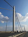
 Tacitusbrug-1.jpg 3,744 × 2,479; 1.52 MB
-
 Tacitusbrug-1edit.jpg 2,217 × 2,096; 1.17 MB
-
 Tacitusbrug-2.jpg 3,976 × 3,004; 1.89 MB
-
 Tacitusbrug-3.jpg 4,173 × 3,030; 1.98 MB
-
 Tacitusbrug.jpg 3,370 × 2,280; 1.29 MB
-

-

-
-

-

-

-

-
-
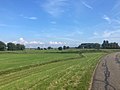
 Over-Betuws landschapsbeeld met de Tacitusbrug.jpg 4,348 × 3,042; 5.22 MB
-
 Slijk-Ewijk, de Waal vanaf de Waaldijk tijdens hoog water IMG 9755 2021-07-18 11.02.jpg 4,836 × 2,648; 8.36 MB
-
 Tacitusbrug (bridge over the Waal river).jpg 3,571 × 2,257; 964 KB
-

-

-

-
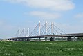
 Tussen Herveld en Ewijk, de Tacitusbrug IMG 4384 2020-04-11 09.28.jpg 5,412 × 3,608; 11.2 MB
-
-

-

-
 Vanaf tussen Slijk-Ewijk en Andelst, de Tacitusbrug IMG 9714 2021-07-18 10.10.jpg 5,472 × 3,072; 10.64 MB


_-_Afferdensche_en_Deestsche_Waarden_00_26_42_569000.jpeg)
_-_Afferdensche_en_Deestsche_Waarden_00_27_03_967000.jpeg)
_-_Afferdensche_en_Deestsche_Waarden_00_27_12_078000.jpeg)
_-_Afferdensche_en_Deestsche_Waarden_00_27_21_101000.jpeg)
_-_Afferdensche_en_Deestsche_Waarden.jpeg)
_-_Afferdensche_en_Deestsche_Waarden_09_43_59_567000.jpeg)


.jpg)
_opened_Tacitus_bridge_with_270_m_spanwidth_over_the_Waalriver_near_Ewijk_-_panoramio.jpg)


