Category:Tahoe National Forest
Jump to navigation
Jump to search
U.S. National Forest in California  | |||||
| Upload media | |||||
| Instance of | |||||
|---|---|---|---|---|---|
| Location | California, Pacific States Region | ||||
| IUCN protected areas category | |||||
| Area |
| ||||
| official website | |||||
 | |||||
Subcategories
This category has the following 8 subcategories, out of 8 total.
Media in category "Tahoe National Forest"
The following 125 files are in this category, out of 125 total.
-
 14 - FallenLeafLake 1925. 25x30.jpg 1,000 × 838; 216 KB
-
 160000-FS-Tahoe-KB-003 (32665649481).jpg 5,652 × 3,902; 15.48 MB
-
 160000-FS-Tahoe-MH-002 (32748444126).jpg 4,288 × 2,848; 1.95 MB
-
 160000-FS-Tahoe-MR-001 (32665645761).jpg 3,000 × 2,000; 4.04 MB
-
 170127-FS-Tahoe-MW-001 (33552772696).jpg 918 × 1,224; 175 KB
-
 170127-FS-Tahoe-MW-002 (33210059890).jpg 1,224 × 918; 152 KB
-
 170127-FS-Tahoe-UNK-001 (32282333873).jpg 1,224 × 918; 159 KB
-
 170127-FS-Tahoe-UNK-002 (32251909324).jpg 1,224 × 918; 184 KB
-
 170208-FS-Tahoe (36177064350).jpg 2,048 × 1,536; 576 KB
-
 170227-FS-Tahoe-MatthewRhodes (36435719891).jpg 2,048 × 1,365; 440 KB
-
 170303-Tahoe-NH-001 (33210049460).jpg 1,536 × 2,048; 243 KB
-
 170309-FS-Tahoe-PCT-JerryHeitzler (36177064180).jpg 2,048 × 1,365; 466 KB
-
 170314-FS-Tahoe-001 (36435719701).jpg 1,536 × 2,048; 750 KB
-
 170314-FS-Tahoe-002 (36177063860).jpg 2,048 × 1,536; 912 KB
-
 170321-FS-Tahoe-LovesFalls-PCT-SierraCity (36435719441).jpg 2,048 × 1,152; 509 KB
-
 170427-FS-Tahoe-001 (36435719261).jpg 640 × 480; 72 KB
-
 170427-FS-Tahoe-002 (36177063600).jpg 1,500 × 843; 241 KB
-
 170516-FS-Tahoe-LavezzolaFalls (36435719171).jpg 2,130 × 780; 639 KB
-
 170527-FS-Tahoe (36177063490).jpg 1,150 × 2,048; 297 KB
-
 170616-FS-Tahoe-001 (36435718721).jpg 2,048 × 1,365; 541 KB
-
 170616-FS-Tahoe-002 (36177062770).jpg 1,536 × 2,048; 764 KB
-
 170704-FS-Tahoe-SmokeyBear-4thofJuly-Truckee (36435718591).jpg 2,048 × 1,536; 344 KB
-
 170821-FS-Tahoe-001 (36851877763).jpg 2,048 × 1,536; 603 KB
-
 170905-FS-Tahoe-001 (36851877623).jpg 1,013 × 768; 166 KB
-
 170907-FS-Tahoe-001 (36851877593).jpg 1,665 × 937; 489 KB
-
 170907-FS-Tahoe-002 (37473070686).jpg 2,048 × 1,149; 426 KB
-
 170907-FS-Tahoe-003 (36811000854).jpg 2,048 × 1,149; 383 KB
-
 170907-FS-Tahoe-CH-001 (36811000724).jpg 497 × 280; 46 KB
-
 180115-FS-Tahoe-MW-001 (24895213197).jpg 1,920 × 1,440; 1.11 MB
-
 180115-FS-Tahoe-MW-002 (39055276194).jpg 1,920 × 1,440; 1.46 MB
-
 180115-FS-Tahoe-MW-003 (24895211697).jpg 1,440 × 1,920; 1.17 MB
-
 180115-FS-Tahoe-MW-004 (38865959975).jpg 1,920 × 1,440; 1.41 MB
-
 2022 Mosquito Fire map 1.png 3,540 × 2,500; 14.41 MB
-

-
 Above the Falls, N. Fork of the N. Fork American River - panoramio.jpg 1,600 × 1,200; 589 KB
-
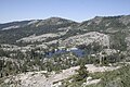 Beyers lakes.jpg 3,456 × 2,304; 4.23 MB
-
 Boca Reservoir from the Southwest on a Spring evening.jpg 3,264 × 2,448; 757 KB
-
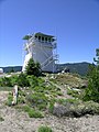 Calpine Lookout (5623078528).jpg 1,944 × 2,592; 932 KB
-
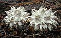 Calvatia sculpta (Harkn.) Lloyd 225947.jpg 3,072 × 1,912; 1.45 MB
-
 Cascading Waters - NARA - 543563.jpg 3,000 × 2,037; 1.34 MB
-
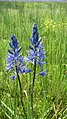
 Castillejatenuis.jpg 2,050 × 3,074; 1.14 MB
-
 Castle Valley near Lake Tahoe on Lake Tahoe National Forest (26255950620).jpg 5,478 × 2,903; 10.62 MB
-
 Clouds above Tahoe National Forest.jpg 4,032 × 3,024; 1.85 MB
-
 Construction Site On Coast Guard Shores Of Lake Tahoe - NARA - 543544.jpg 3,000 × 2,034; 1.35 MB
-
 Dark Canyon (14701750129).jpg 3,456 × 5,184; 6.13 MB
-
 Dark Canyon (14888375465).jpg 5,184 × 3,456; 6.68 MB
-
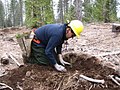
 Dipping roots of seedlings to be planted on the Tahoe NF (3820687747).jpg 2,592 × 1,944; 1.32 MB
-
 Dixon's Grillin' and Chillin' 7 (28374023102).jpg 3,264 × 2,448; 2.65 MB
-
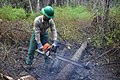
 Ecological Restoration (14701804389).jpg 4,000 × 3,000; 2.56 MB
-
 Ecological Restoration (14701840338).jpg 4,000 × 3,000; 2.54 MB
-
 Ecological Restoration (14865455676).jpg 4,000 × 3,000; 2.55 MB
-
 Ecological Restoration (14885392591).jpg 4,000 × 3,000; 2.64 MB
-
 Ecological Restoration (14888103202).jpg 4,000 × 3,000; 2.57 MB
-
 Ecological Restoration (14888104222).jpg 4,000 × 3,000; 2.64 MB
-
 Ecological Restoration (14888432455).jpg 4,000 × 3,000; 2.58 MB
-
 Floccularia albolanaripes (G.F. Atk.) Redhead 374682 crop.jpg 5,029 × 3,972; 7 MB
-
 Forest - NARA - 543615.jpg 2,051 × 3,000; 1.34 MB
-
 Frost - Touched Grass - NARA - 543562.jpg 2,018 × 3,000; 1.07 MB
-
 Frost - Touched Vegetation - NARA - 543560.jpg 3,000 × 2,028; 1.29 MB
-
 Frozen Lake Shore - NARA - 543619.jpg 2,031 × 3,000; 1.29 MB
-
 Glacial erratic in Tahoe National Forest 2.jpg 3,872 × 2,592; 4.45 MB
-
 Glacial erratic in Tahoe National Forest.jpg 3,872 × 2,592; 4.72 MB
-
-

-
 GraniteChiefRange-TahoeNF-DavidShield (36642073523).jpg 580 × 387; 147 KB
-
 Grouse Ridge Trailhead (14865313486).jpg 2,560 × 1,920; 994 KB
-
 Hadromyia pulchra 4167092.jpg 1,280 × 960; 483 KB
-
 Hadromyia pulchra 4167143.jpg 1,280 × 960; 470 KB
-
 Hampshire Rocks 1.jpg 4,048 × 3,036; 7.17 MB
-
 Hampshire Rocks 2.jpg 4,048 × 3,036; 5.44 MB
-
 Hampshire Rocks 3.jpg 4,048 × 3,036; 6.39 MB
-
Hampshire Rocks.webm 26 s, 1,920 × 1,080; 60.3 MB
-
 Harding Fire (14701733278).jpg 1,200 × 1,600; 391 KB
-
 Harding Fire (14701798647).jpg 1,200 × 1,600; 417 KB
-
 Harding Fire (14865343936).jpg 1,200 × 1,600; 513 KB
-
 Harding Fire (14885279571).jpg 1,200 × 1,600; 300 KB
-
 Harding Fire (14885279611).jpg 1,200 × 1,600; 392 KB
-
 Harding Fire (14885279881).jpg 1,200 × 1,600; 412 KB
-
 Harding Fire (14888323115).jpg 1,200 × 1,600; 642 KB
-
 Heavy Forest - panoramio.jpg 1,600 × 1,200; 828 KB
-
 Ho (37339226621).jpg 4,032 × 3,024; 2.34 MB
-
 Independence Lake The Hole Jan 1967 (26790382881).jpg 1,536 × 1,072; 226 KB
-
 Ing Fire - Mount Mildred (15228583867).jpg 1,600 × 1,200; 924 KB
-
 Instrumentation- Climatic - California - DPLA - 445914857f7f81569a65c778da157367.jpg 4,977 × 4,020; 2.4 MB
-
 King Fire - Mount Mildred Repeater Site (15414785142).jpg 1,600 × 1,200; 546 KB
-
 Lactarius rubrilacteus Hesler & A.H. Sm 183957.jpg 2,486 × 1,764; 1.41 MB
-
 Lake Tahoe At Dusk - NARA - 543613.jpg 3,000 × 2,027; 1.13 MB
-
 Mining - California - DPLA - 3b4af517a1bd056df23f7ef3357bf319.jpg 5,101 × 4,074; 2.5 MB
-
 Monument - panoramio (30).jpg 1,200 × 1,600; 545 KB
-
 Monument from Below - panoramio.jpg 1,600 × 1,200; 671 KB
-
 Mycetinis copelandii (Peck) A.W. Wilson and Desjardin 65835.jpg 3,510 × 2,435; 623 KB
-
 Nevada - Tahoe National Forest, California - NARA - 543561.jpg 3,000 × 2,046; 1.5 MB
-
 Nevada - Tahoe National Forest, California - NARA - 543569.jpg 3,000 × 2,039; 1.25 MB
-
 Planter working on the Tahoe NF (3820689677).jpg 2,000 × 3,008; 2.88 MB
-
 Planter working on the Tahoe NF (3821494544).jpg 2,592 × 1,944; 2.44 MB
-
 Planter working on the Tahoe NF (3821496968).jpg 2,592 × 1,944; 2.63 MB
-
 Reforestation - California - DPLA - 7f88111fe1f3aa0987de7f429df9065f.jpg 4,860 × 3,894; 2.41 MB
-
 Scramble - panoramio.jpg 1,600 × 1,200; 835 KB
-
 Snag on Texas Hill - panoramio.jpg 1,200 × 1,600; 607 KB
-

-
 South Yuba River Motor Vehicle Use Map, cropped.png 1,095 × 899; 625 KB
-
 Southwest of Boca Reservoir on Route 73 on a Spring evening.jpg 3,264 × 2,448; 940 KB
-
 Tahoe National Forest aerial.jpg 4,032 × 3,024; 1.62 MB
-
 Tahoe National Forest fire danger sign - 2021-10-17 - Sarah Stierch.jpg 4,032 × 3,024; 10.57 MB
-
 Tahoe National Forest sign.jpg 2,048 × 1,365; 352 KB
-
 Tahoe National Forest, Foresthill, United States Sep 16, 2017 024636 PM.jpeg 4,032 × 3,024; 3.99 MB
-
 Tahoe National Forest, Foresthill, United States Sep 17, 2017 113325 AM.jpeg 4,032 × 3,024; 3.7 MB
-
 Tahoe National Forest, Foresthill, United States Sep 17, 2017 113328 AM.jpeg 4,032 × 3,024; 4.74 MB
-
 Tahoe NF Meadow.jpg 500 × 338; 193 KB
-
 UNK-FS-Tahoe-UNK-001 (32905842535).jpg 2,048 × 1,532; 484 KB
-
 View Northeast - panoramio.jpg 1,600 × 1,200; 495 KB
-
 View of the Truckee River in Tahoe National Forest in Northern California LCCN2013633832.tif 7,360 × 4,912; 206.9 MB
-
 View of the Truckee River in Tahoe National Forest in Northern California LCCN2013633833.tif 4,912 × 7,360; 206.9 MB
-
 View of the Truckee River in Tahoe National Forest in Northern California LCCN2013633835.tif 7,360 × 4,912; 206.9 MB
-
 View of the Truckee River in Tahoe National Forest in Northern California LCCN2013633836.tif 7,360 × 4,912; 206.9 MB
-
 View of the Truckee River in Tahoe National Forest in Northern California LCCN2013633837.tif 7,360 × 4,912; 206.9 MB
-
 Water Drops On Grass - NARA - 543564.jpg 2,028 × 3,000; 933 KB
-
 Water Drops On Grass - NARA - 543565.jpg 3,000 × 2,023; 1.3 MB
-
 Water Drops On Grass - NARA - 543566.jpg 3,000 × 2,043; 1.18 MB
-
 Watson Creek at 16N49.jpg 4,032 × 3,024; 7.93 MB
-
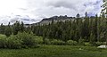
 Webber Lake-Lacy Meadow June 2010 (18749699780).jpg 1,944 × 2,592; 761 KB
-
 Wolverine (16095493887).jpg 960 × 720; 64 KB
-
 Yuba River.jpg 3,024 × 4,032; 5.9 MB
-
 Yuba waterfall.jpg 3,000 × 4,000; 4.89 MB
-
 Lewisiakelloggii.jpg 540 × 800; 129 KB

.jpg)
.jpg)
.jpg)
.jpg)
.jpg)
.jpg)
.jpg)
.jpg)
.jpg)
.jpg)
.jpg)
.jpg)
.jpg)
.jpg)
.jpg)
.jpg)
.jpg)
.jpg)
.jpg)
.jpg)
.jpg)
.jpg)
.jpg)
.jpg)
.jpg)
.jpg)
.jpg)
.jpg)
.jpg)
.jpg)


.jpg)
_Lloyd_225947.jpg)


.jpg)


.jpg)
.jpg)
.jpg)
.jpg)
.jpg)
.jpg)
.jpg)
.jpg)
.jpg)
.jpg)
.jpg)
_Redhead_374682_crop.jpg)


.jpg)
.jpg)


.jpg)
.jpg)
.jpg)
.jpg)
.jpg)
.jpg)
.jpg)

.jpg)
.jpg)
.jpg)

.jpg)


.jpg)

_A.W._Wilson_and_Desjardin_65835.jpg)


.jpg)
.jpg)
.jpg)


.jpg)


.jpg)
.jpg)


.jpg)
Categories:
- National Forests of California
- Protected areas of the Sierra Nevada (United States)
- Placer County, California
- Parks in Nevada County, California
- Yuba County, California
- Plumas County, California
- Parks in El Dorado County, California
- National Forests of the United States by name
- Sierra Nevada Forests Ecoregion