Category:Taken with Minolta Dimage 2300
Jump to navigation
Jump to search
Wikimedia category | |||||
| Upload media | |||||
| Instance of | |||||
|---|---|---|---|---|---|
| Category combines topics | |||||
| photographs by photographic equipment used | |||||
photographs which have been taken by a specific camera | |||||
| Instance of | |||||
| |||||
Media in category "Taken with Minolta Dimage 2300"
The following 101 files are in this category, out of 101 total.
-
 2 World Wars - 1 Village - geograph.org.uk - 266520.jpg 640 × 429; 116 KB
-
 A Brook in the Countryside - geograph.org.uk - 269782.jpg 640 × 429; 113 KB
-
 A Pub in the Countryside - geograph.org.uk - 269786.jpg 640 × 429; 81 KB
-
 Air Ambulance In Action - geograph.org.uk - 277653.jpg 640 × 429; 73 KB
-
 Chippenham to Calne Cycle Path - geograph.org.uk - 225610.jpg 640 × 429; 73 KB
-
 Cinergy Field 1.jpg 1,792 × 1,200; 302 KB
-
 Cinergy Field 2.jpg 1,792 × 1,200; 310 KB
-
 Cinergy Field 3.jpg 1,792 × 1,200; 307 KB
-
 Façades de Trouville - 07 mai 2005.JPG 1,729 × 513; 192 KB
-
 Fulufjället 1.JPG 1,792 × 1,200; 311 KB
-
 Fulufjället 10.JPG 1,200 × 1,792; 301 KB
-
 Fulufjället 11.JPG 1,200 × 1,792; 312 KB
-
 GRENZE BULGARIEN RUMÄNIEN - panoramio.jpg 500 × 335; 73 KB
-
 Horažďovice - Kostel sv Petra a Pavla.jpg 1,200 × 1,792; 182 KB
-
 Horažďovice - masné krámy.jpg 1,792 × 1,200; 232 KB
-
 Horažďovice - Radnice.jpg 1,792 × 1,200; 234 KB
-
 Horažďovice - zámek.jpg 1,792 × 1,200; 223 KB
-
 Horažďovice - Červená brána.jpg 1,200 × 1,792; 161 KB
-
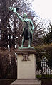 Kellermann statue Strasbourg.jpg 500 × 825; 340 KB
-
 Kolega Janusz z rodzina - panoramio.jpg 1,792 × 1,200; 308 KB
-
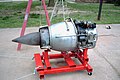 MarboreIIsideview.jpg 1,792 × 1,200; 891 KB
-
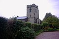 Milwich Church - geograph.org.uk - 269731.jpg 640 × 429; 64 KB
-
 Milwich Church - geograph.org.uk - 269734.jpg 640 × 429; 61 KB
-
 Milwich Church and Vicarage - geograph.org.uk - 269732.jpg 640 × 429; 78 KB
-
 Milwich Churchyard - geograph.org.uk - 269737.jpg 640 × 429; 87 KB
-
 No Through Road - geograph.org.uk - 466656.jpg 640 × 429; 69 KB
-
 Plage de Deauville - 07.05.05.JPG 1,792 × 1,200; 312 KB
-
 Planches de Deauville - 07.05.05.JPG 1,200 × 1,792; 306 KB
-
 River Trent, upstream - geograph.org.uk - 266352.jpg 640 × 429; 69 KB
-
 Schevelinger Talsperre.jpg 1,792 × 1,200; 311 KB
-
 Slalom Course, River Trent, Stone - geograph.org.uk - 263886.jpg 640 × 429; 79 KB
-
 SRN4 Hovercraft Mountbatten Class.jpg 1,756 × 1,128; 581 KB
-
 Sss-schein.jpg 341 × 487; 45 KB
-
 Standon Hall near Eccleshall - geograph.org.uk - 263878.jpg 640 × 429; 56 KB
-
 StoneFigureonTrinityBridgeCrowland1.JPG 1,792 × 1,200; 309 KB
-
 Superdome and Arena New Orleans 6.jpg 1,792 × 1,200; 306 KB
-
 Taking a break - geograph.org.uk - 226111.jpg 640 × 429; 71 KB
-
 The B5027 to Uttoxeter - geograph.org.uk - 269772.jpg 640 × 429; 81 KB
-
 The Old Walton Bridge, Stone - geograph.org.uk - 263870.jpg 640 × 429; 82 KB
-
 The River Trent, Weston - geograph.org.uk - 266341.jpg 640 × 429; 74 KB
-
 The School and the Pub - geograph.org.uk - 269755.jpg 640 × 429; 62 KB
-
 The Wheatsheaf, Coton - geograph.org.uk - 269771.jpg 640 × 429; 60 KB
-
 Tramway Strasbourg Broglie.jpg 600 × 402; 214 KB
-
 Vignes enneigées.JPG 1,792 × 1,200; 869 KB
-
 Wallbrook Lane, Coton - geograph.org.uk - 269769.jpg 640 × 429; 55 KB
-
 War Memorial, East Face - geograph.org.uk - 266527.jpg 429 × 640; 96 KB
-
 War Memorial, North Face - geograph.org.uk - 266529.jpg 429 × 640; 97 KB
-
 War Memorial, South Face - geograph.org.uk - 266525.jpg 429 × 640; 79 KB
-
 War Memorial, West Face - geograph.org.uk - 266533.jpg 429 × 640; 103 KB
-
 Wipperfürth Evangelische Kirche.jpg 1,200 × 1,792; 312 KB
-
 Wipperfürth Gaulstraße.jpg 1,792 × 1,200; 307 KB
-
 Wipperfürth Hochstraße.jpg 1,200 × 1,792; 303 KB
-
 Wipperfürth Klosterberg zum Mühlenberg.jpg 1,792 × 1,200; 309 KB
-
 Wipperfürth Marktplatz.jpg 1,792 × 1,200; 308 KB
-
 Wipperfürth Naturschutzgebiet Stauweier.jpg 1,792 × 1,200; 304 KB
-
 Wipperfürth Parkanlage Ohler Wiesen.jpg 1,792 × 1,200; 302 KB
-
 Wipperfürth Parkanlage Ohler Wiesen2.jpg 1,792 × 1,200; 310 KB
-
 Wipperfürth Rathaus.jpg 1,792 × 1,200; 308 KB
-
 Wipperfürth Rathaus2.jpg 1,792 × 1,200; 306 KB
-
 A Country Lane - geograph.org.uk - 269763.jpg 640 × 429; 72 KB
-
 A Country Lane, Butterhill - geograph.org.uk - 269640.jpg 640 × 429; 81 KB
-
 A Country Lane, Milwich - geograph.org.uk - 269717.jpg 640 × 429; 102 KB
-
 A Farm Track to Oulton House - geograph.org.uk - 269774.jpg 640 × 429; 59 KB
-
 A Farm Track to Several Farms - geograph.org.uk - 269713.jpg 640 × 429; 96 KB
-
 A Village Public House - geograph.org.uk - 269749.jpg 640 × 429; 62 KB
-
 A Village Stream - geograph.org.uk - 269740.jpg 429 × 640; 105 KB
-
 A518 Weston Bank - geograph.org.uk - 266330.jpg 640 × 429; 57 KB
-
 A518, Weston Bank - geograph.org.uk - 266294.jpg 640 × 429; 80 KB
-
 B5027 near to Milwich - geograph.org.uk - 269778.jpg 640 × 429; 69 KB
-
 Beautiful Staffordshire Countryside - geograph.org.uk - 266321.jpg 640 × 429; 69 KB
-
 Bridleway in a Field - geograph.org.uk - 266287.jpg 640 × 429; 100 KB
-
 Cottage, Weston - geograph.org.uk - 266368.jpg 640 × 429; 84 KB
-
 Cottages on Green Lane - geograph.org.uk - 266372.jpg 640 × 429; 73 KB
-
 Country Lane, Butterhill, Stafford - geograph.org.uk - 269643.jpg 640 × 429; 92 KB
-
 Countryside Public Footpath Gate - geograph.org.uk - 269687.jpg 640 × 429; 97 KB
-
 Countryside Track - geograph.org.uk - 269793.jpg 640 × 429; 59 KB
-
 Dead End Lane - geograph.org.uk - 269638.jpg 640 × 429; 97 KB
-
 Farm Road to Rooks Nest - geograph.org.uk - 266537.jpg 640 × 429; 68 KB
-
 Farm Track and Bridleway - geograph.org.uk - 266276.jpg 640 × 429; 127 KB
-
 Farm Track and Bridleway - geograph.org.uk - 266282.jpg 640 × 429; 85 KB
-
 Farm Track off Milwich Lane - geograph.org.uk - 269703.jpg 640 × 429; 64 KB
-
 Fields - geograph.org.uk - 269724.jpg 640 × 429; 69 KB
-
 Footpath Across Fields - geograph.org.uk - 269691.jpg 640 × 429; 91 KB
-
 Footpath over a Lane - geograph.org.uk - 269727.jpg 640 × 429; 99 KB
-
 Greystoke Cafe - geograph.org.uk - 257755.jpg 640 × 429; 79 KB
-
 Lane and Bridleway - geograph.org.uk - 266316.jpg 640 × 429; 94 KB
-
 Milwich Lane (2), Sandon - geograph.org.uk - 269680.jpg 640 × 429; 104 KB
-
 Milwich Lane - geograph.org.uk - 269696.jpg 640 × 429; 97 KB
-
 Milwich Lane to Sandon - geograph.org.uk - 269709.jpg 640 × 429; 103 KB
-
 Milwich Lane to Sandon - geograph.org.uk - 269716.jpg 640 × 429; 95 KB
-
 Milwich Lane towards Sandon - geograph.org.uk - 269721.jpg 640 × 429; 102 KB
-
 Milwich Lane, Milwich - geograph.org.uk - 269705.jpg 640 × 429; 82 KB
-
 Milwich Lane, Milwich - geograph.org.uk - 269722.jpg 640 × 429; 106 KB
-
 Milwich Lane, Sandon - geograph.org.uk - 269675.jpg 640 × 429; 105 KB
-

-
 Signpost near Renwick - geograph.org.uk - 257764.jpg 640 × 429; 110 KB
-
 The 'Old' School - geograph.org.uk - 269752.jpg 640 × 429; 80 KB
-
 The Road into Milwich - geograph.org.uk - 269745.jpg 640 × 429; 75 KB
-
 Tinkerborough Cottages - geograph.org.uk - 266305.jpg 640 × 429; 86 KB
-
 Track, Bridleway and Public Footpath - geograph.org.uk - 269718.jpg 640 × 429; 106 KB
-


,_Sandon_-_geograph.org.uk_-_269680.jpg)


