Category:Tamlaght, County Londonderry
Jump to navigation
Jump to search
English: Tamlaght is a small village in County Londonderry, Northern Ireland. In the 2001 Census it had a population of 123 people. It is situated in the Magherafelt District Council area.
village in County Londonderry, Northern Ireland, UK | |||||
| Upload media | |||||
| Instance of | |||||
|---|---|---|---|---|---|
| Location | Northern Ireland | ||||
 | |||||
Media in category "Tamlaght, County Londonderry"
The following 32 files are in this category, out of 32 total.
-
 Concrete road at Lisgorgan - geograph.org.uk - 582317.jpg 640 × 479; 48 KB
-
 Gortgole Road - geograph.org.uk - 5620664.jpg 2,928 × 1,856; 3.04 MB
-
 Headstone at Tamlaght O'Crilly COI - geograph.org.uk - 582347.jpg 640 × 529; 54 KB
-
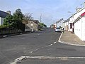
 House at the crossroads - geograph.org.uk - 5613641.jpg 3,200 × 1,808; 3.13 MB
-
 Killycon Road during Winter - geograph.org.uk - 1911770.jpg 640 × 480; 53 KB
-
 Near Rasharkin - geograph.org.uk - 5620648.jpg 2,660 × 1,732; 5.15 MB
-
 Road at Tamlaght - geograph.org.uk - 877056.jpg 640 × 479; 66 KB
-
-
 Tamlaght O'Crilly Church of Ireland - geograph.org.uk - 582343.jpg 640 × 480; 44 KB
-
 Tamlaght O'Crilly Orange Hall - geograph.org.uk - 582335.jpg 640 × 479; 45 KB
-
 Tamlaght O'Crilly Presbyterian Church - geograph.org.uk - 582337.jpg 640 × 479; 45 KB
-
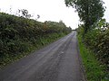
 Townhill Road - geograph.org.uk - 5613642.jpg 3,200 × 2,400; 3.61 MB
-
 Killygullib Orange Hall - geograph.org.uk - 582396.jpg 640 × 479; 34 KB
-
 Killymuck Townland - geograph.org.uk - 582327.jpg 640 × 479; 60 KB
-
 Lisgorgan Lane - geograph.org.uk - 582324.jpg 640 × 479; 61 KB
-
 Lisgorgan Townland - geograph.org.uk - 582318.jpg 640 × 479; 57 KB
-
 Lisgorgan Townland - geograph.org.uk - 582321.jpg 640 × 479; 62 KB
-
 Near Moran's Crossroads - geograph.org.uk - 582382.jpg 640 × 479; 56 KB
-
 Near Tamlaght O'Crilly - geograph.org.uk - 582331.jpg 640 × 479; 99 KB
-
 Road at Culnady - geograph.org.uk - 573767.jpg 640 × 479; 65 KB
-
 Road at Killygullib - geograph.org.uk - 582397.jpg 640 × 479; 64 KB
-
 Road at Middletown - geograph.org.uk - 582385.jpg 640 × 479; 64 KB
-
 Road at Tirnageeragh - geograph.org.uk - 573633.jpg 640 × 287; 35 KB
-
 Sheep at Old Town - geograph.org.uk - 582387.jpg 640 × 479; 53 KB
-
 Sheep at Turner's Town - geograph.org.uk - 582393.jpg 640 × 479; 70 KB
-
 Stone building near Tamlaght O'Crilly - geograph.org.uk - 582378.jpg 640 × 479; 65 KB
-
 Timaconway Orange Hall - geograph.org.uk - 582429.jpg 640 × 479; 71 KB
-
 Timaconway Townland - geograph.org.uk - 582427.jpg 640 × 479; 76 KB
-
 Timaconway Townland - geograph.org.uk - 582430.jpg 640 × 479; 59 KB
-
 Tirnageeragh Townland - geograph.org.uk - 573634.jpg 640 × 479; 62 KB
-
 Tirnageeragh Townland - geograph.org.uk - 582306.jpg 640 × 479; 55 KB
-
 Tirnageeragh Townland - geograph.org.uk - 582309.jpg 640 × 479; 57 KB


