Category:Tarrant Crawford
Jump to navigation
Jump to search
English: Tarrant Crawford is a small village at the end of the Tarrant Valley in Dorset, England. It is mainly a farm with a few houses. OS maps show it at the position of Tarrant Abbey, an even smaller village with only three houses. Although still part of the farm, it is referred to by the locals as a separate village. It is famous for its cross that reads -
village and civil parish in Dorset, United Kingdom  | |||||
| Upload media | |||||
| Instance of | |||||
|---|---|---|---|---|---|
| Location | Dorset, South West England, England | ||||
| Population |
| ||||
 | |||||
Subcategories
This category has the following 2 subcategories, out of 2 total.
M
T
- Tarrant Crawford Cross (5 F)
Media in category "Tarrant Crawford"
The following 35 files are in this category, out of 35 total.
-
 Border Collie, Tarrant Crawford - geograph.org.uk - 1148105.jpg 480 × 640; 192 KB
-
 Bridleway gate, Tarrant Crawford - geograph.org.uk - 1691904.jpg 640 × 480; 119 KB
-
 Bridleway near Tarrant Crawford - geograph.org.uk - 1148117.jpg 640 × 480; 204 KB
-
 Bridleway to Tarrant Crawford - geograph.org.uk - 1146593.jpg 479 × 640; 114 KB
-
 Bridleway towards Crawford Bridge and Spetisbury - geograph.org.uk - 5964026.jpg 1,024 × 768; 309 KB
-
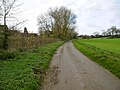
 Country lane - geograph.org.uk - 4309408.jpg 640 × 480; 88 KB
-
 Crawford Farm - geograph.org.uk - 3240254.jpg 640 × 480; 74 KB
-
 Finger post, Tarrant Crawford - geograph.org.uk - 1690773.jpg 640 × 480; 216 KB
-
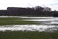 Flood plain of the River Stour - geograph.org.uk - 4832268.jpg 4,504 × 3,056; 3.12 MB
-
 Grazing swans near Tarrant Crawford - geograph.org.uk - 1691895.jpg 640 × 481; 162 KB
-
 Loading Bay, Crawford Farm - geograph.org.uk - 3240259.jpg 640 × 480; 98 KB
-
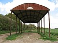 Lonely Dutch Barn - geograph.org.uk - 1281147.jpg 640 × 480; 64 KB
-
 Not quite Joseph - geograph.org.uk - 1690766.jpg 640 × 480; 182 KB
-
 Road from Shapwick towards Blandford Forum - geograph.org.uk - 5964057.jpg 1,024 × 684; 361 KB
-
 Root crops, Tarrant Crawford - geograph.org.uk - 1690779.jpg 640 × 481; 173 KB
-
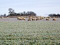
 Shire horses, Tarrant Crawford - geograph.org.uk - 1829240.jpg 481 × 640; 156 KB
-
 Spetisbury, swans - geograph.org.uk - 2778399.jpg 1,024 × 767; 126 KB
-
 Stour Valley Way, near Spetisbury - geograph.org.uk - 2398842.jpg 800 × 600; 143 KB
-
 Stour Valley Way, Spetisbury - geograph.org.uk - 2398904.jpg 800 × 600; 131 KB
-
 Tarrant Abbey Cottages - geograph.org.uk - 5964046.jpg 1,024 × 768; 360 KB
-
 Tarrant Abbey House, Tarrant Crawford ca 1980 - geograph.org.uk - 3826192.jpg 1,024 × 639; 859 KB
-
 Tarrant Crawford - geograph.org.uk - 3240249.jpg 640 × 480; 82 KB
-
 Tarrant Crawford, bridge - geograph.org.uk - 4754736.jpg 1,024 × 768; 338 KB
-
 Tarrant Crawford, bridleway junction - geograph.org.uk - 4754727.jpg 1,024 × 768; 219 KB
-
 Tarrant Crawford, farm road - geograph.org.uk - 4754780.jpg 1,024 × 768; 169 KB
-
 Tarrant Crawford, flooded road - geograph.org.uk - 2918863.jpg 1,024 × 768; 157 KB
-

-
 Tarrant Crawford, road sign - geograph.org.uk - 4754804.jpg 1,024 × 768; 242 KB
-
 Tarrant Crawford, stubble field - geograph.org.uk - 4754793.jpg 1,024 × 769; 121 KB
-
 Tarrant Crawford, the Tarrant - geograph.org.uk - 4754744.jpg 1,024 × 768; 324 KB
-

-
-
 Tree trunks near Tarrant Crawford - geograph.org.uk - 1690790.jpg 640 × 480; 156 KB
-
 Wooded Road - geograph.org.uk - 3239734.jpg 640 × 480; 164 KB
-
 Bridleway to Tarrant Crawford - geograph.org.uk - 452286.jpg 640 × 480; 150 KB


