Category:Tassinong, Indiana
Jump to navigation
Jump to search
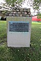
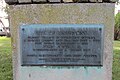
Historic Marker
| Object location | | View all coordinates using: OpenStreetMap |
|---|
Communities original center
| Object location | | View all coordinates using: OpenStreetMap |
|---|
Probable historic Indian village area
| Object location | | View all coordinates using: OpenStreetMap |
|---|
Media in category "Tassinong, Indiana"
The following 15 files are in this category, out of 15 total.
-
 Baum's Rd (NE) 0149.jpg 4,608 × 3,072; 3.8 MB
-
 Baum's Rd (SW) 0153.jpg 4,608 × 3,072; 3.23 MB
-
 Hst marker 19-09-13 128.jpg 4,608 × 3,072; 5.33 MB
-
 Hst marker 19-09-13 129.jpg 3,072 × 4,608; 4.94 MB
-
 Hst marker 19-09-13 130.jpg 4,608 × 3,072; 4.8 MB
-
 Northwards 19-09-13 131.jpg 4,608 × 3,072; 4.34 MB
-
 Porter County Indiana and Tassinong.PNG 2,000 × 1,833; 355 KB
-
 Southwards 19-09-13 132.jpg 4,608 × 3,072; 3.76 MB
-
 Tassinong 0247.jpg 4,608 × 3,072; 2.38 MB
-
 Tassinong 0248.jpg 4,608 × 3,072; 2.4 MB
-
 Tassinong 6381.jpg 4,608 × 3,072; 3.77 MB
-
 Tassinong 6382.jpg 4,608 × 3,072; 4.19 MB
-
 Tassinong area - Baums Bridge Rd, looking south.jpg 3,919 × 1,106; 445 KB
-
 Tassinong panorama (n to s) 2.jpg 7,038 × 2,333; 2.37 MB
-
 Tassinong panorama (nw to se) 2.jpg 7,971 × 2,425; 3.15 MB
_0149.jpg)
_0153.jpg)


_2.jpg)
_2.jpg)