Category:Temple Normanton
Jump to navigation
Jump to search
English: Temple Normanton is a village in Derbyshire, England. It is in the North East Derbyshire district of the county.
village in United Kingdom | |||||
| Upload media | |||||
| Instance of | |||||
|---|---|---|---|---|---|
| Location | North East Derbyshire, Derbyshire, East Midlands, England | ||||
 | |||||
Media in category "Temple Normanton"
The following 68 files are in this category, out of 68 total.
-
48 Birkin Lane Temple Normanton - geograph.org.uk - 3203163.jpg 2,592 × 1,944; 1.9 MB
-
A slip road off the A617 - geograph.org.uk - 5802086.jpg 2,000 × 1,244; 1.6 MB
-
A617 Eastbound, Temple Normanton - geograph.org.uk - 4205294.jpg 640 × 480; 298 KB
-
Another hand car wash business - geograph.org.uk - 3870942.jpg 5,184 × 3,888; 5.74 MB
-
B6039 towards Holmewood - geograph.org.uk - 2335522.jpg 1,600 × 1,200; 393 KB
-
B6039 towards Holmewood - geograph.org.uk - 2335526.jpg 1,600 × 1,200; 354 KB
-
B6039 towards Temple Normanton - geograph.org.uk - 2335515.jpg 1,600 × 1,200; 282 KB
-
Birkin Lane above Grassmoor Country Park - geograph.org.uk - 5416857.jpg 800 × 533; 141 KB
-
Bridge over the A617 - geograph.org.uk - 2425414.jpg 950 × 713; 302 KB
-
Bridleway west of Temple Normanton - geograph.org.uk - 4875816.jpg 1,600 × 1,200; 548 KB
-
Bus stop in Temple Normanton - geograph.org.uk - 3870945.jpg 4,857 × 3,470; 4.3 MB
-
Corbriggs Bus Stop - geograph.org.uk - 5416871.jpg 800 × 533; 162 KB
-
Derbyshire UK parish map highlighting Temple Normanton.svg 888 × 1,308; 2.35 MB
-
Drain - geograph.org.uk - 5710678.jpg 5,343 × 3,005; 6.04 MB
-
Eastbound A617, Last Lay-by Before M1 - geograph.org.uk - 4205305.jpg 640 × 480; 322 KB
-
Farmland off the B6039 - geograph.org.uk - 2335518.jpg 1,600 × 1,200; 637 KB
-
Fields west of Temple Normanton - geograph.org.uk - 2425702.jpg 950 × 591; 239 KB
-
Fishing pond in Grassmoor Country Park - geograph.org.uk - 4461399.jpg 1,280 × 953; 1.09 MB
-
Footpath off the B6039 - geograph.org.uk - 2335512.jpg 1,600 × 1,200; 857 KB
-
Footpath towards Calow Brook - geograph.org.uk - 4875826.jpg 1,600 × 1,200; 480 KB
-
Fountain (4081706006).jpg 2,684 × 1,232; 1.65 MB
-
Garage workshop and MOT test centre - geograph.org.uk - 2418802.jpg 950 × 629; 252 KB
-
Grassmoor Country Park - geograph.org.uk - 5675962.jpg 5,343 × 3,005; 3.87 MB
-
Grassmoor Country Park - geograph.org.uk - 5675963.jpg 5,315 × 2,990; 3.97 MB
-
Hassocky Lane, looking north - geograph.org.uk - 2425429.jpg 950 × 713; 284 KB
-
Headstock Wheel - geograph.org.uk - 861732.jpg 640 × 480; 89 KB
-
House on Chesterfield Road, Holmewood - geograph.org.uk - 3870938.jpg 4,641 × 3,713; 4.46 MB
-
Houses on Chesterfield Road, Holmewood - geograph.org.uk - 5156338.jpg 1,600 × 1,065; 415 KB
-
Industrial estate road - geograph.org.uk - 2335506.jpg 1,600 × 1,200; 434 KB
-
Industrial Trading Estate at Corbiggs - geograph.org.uk - 4461352.jpg 1,280 × 960; 1.13 MB
-
Industrial unit off the B6039 - geograph.org.uk - 2335509.jpg 1,600 × 1,200; 182 KB
-
Lake at Grassmoor Country Park - geograph.org.uk - 2425225.jpg 950 × 628; 254 KB
-
Lake in Grassmoor Country Park - geograph.org.uk - 5416861.jpg 800 × 533; 141 KB
-
Looking along Chesterfield Road - geograph.org.uk - 2418798.jpg 950 × 619; 258 KB
-
Mansfield Road near Grassmoor Country Park - geograph.org.uk - 3148908.jpg 4,000 × 3,000; 2.03 MB
-
Mansfield Road to Corbriggs - geograph.org.uk - 2425398.jpg 950 × 527; 229 KB
-
North East Derbyshire , Grassy Field - geograph.org.uk - 5952811.jpg 6,000 × 4,000; 6.11 MB
-
North East Derbyshire , The A617 - geograph.org.uk - 5951700.jpg 6,000 × 4,000; 6.8 MB
-
North East Derbyshire , The A617 - geograph.org.uk - 5951701.jpg 6,000 × 4,000; 5.47 MB
-
North East Derbyshire , The A617 - geograph.org.uk - 5951702.jpg 6,000 × 4,000; 7.3 MB
-
North East Derbyshire , The A617 - geograph.org.uk - 5952807.jpg 6,000 × 4,000; 7.7 MB
-
North East Derbyshire , The A617 - geograph.org.uk - 5952808.jpg 6,000 × 4,000; 6.78 MB
-
North East Derbyshire , The A617 - geograph.org.uk - 5952809.jpg 6,000 × 4,000; 6.6 MB
-
Pond beside car park, Grassmoor Country Park - geograph.org.uk - 4461370.jpg 1,280 × 960; 1.11 MB
-
Postman's Lane - geograph.org.uk - 2282380.jpg 3,648 × 2,736; 6.06 MB
-
Postman's Lane near Temple Normanton - geograph.org.uk - 4000119.jpg 4,000 × 3,000; 2.24 MB
-
Postman's Lane, Temple Normanton - geograph.org.uk - 3870950.jpg 4,876 × 3,483; 4.51 MB
-
Roundabout on the B6039 - geograph.org.uk - 2282388.jpg 3,648 × 2,736; 5.19 MB
-
Small pond next to Birkin Lane - geograph.org.uk - 5675700.jpg 5,343 × 3,005; 3.9 MB
-
Small wooden bridge - geograph.org.uk - 5710647.jpg 5,343 × 3,005; 4.6 MB
-
Soon be spring again (6385559839).jpg 1,591 × 2,148; 4.15 MB
-
Spray on the A617 - geograph.org.uk - 6173949.jpg 1,379 × 1,170; 929 KB
-
Still on the A617 - geograph.org.uk - 5802088.jpg 2,000 × 1,298; 1.73 MB
-
Sutton Spring Wood - Pigeon Lofts - geograph.org.uk - 596790.jpg 640 × 480; 99 KB
-
Telephone box, Temple Normanton - geograph.org.uk - 2425701.jpg 950 × 646; 264 KB
-
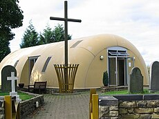
Temple Normanton - Cemetery Chapel - geograph.org.uk - 2217848.jpg 1,600 × 1,200; 518 KB
-
Temple Normanton - Primary School - geograph.org.uk - 2217840.jpg 1,600 × 1,200; 344 KB
-
The northern end of a fishing pond - geograph.org.uk - 5710720.jpg 5,343 × 3,005; 3.79 MB
-
View of Muster Brook - geograph.org.uk - 596798.jpg 640 × 480; 151 KB
-
Woodland beside the B6039 - geograph.org.uk - 2335525.jpg 1,600 × 1,200; 1.01 MB
-
Springwood Farm - geograph.org.uk - 259444.jpg 640 × 480; 91 KB
-
Sutton Spring Wood - Access Road - geograph.org.uk - 596787.jpg 640 × 480; 102 KB


