Category:Temple protestant de Collorgues
Jump to navigation
Jump to search
| Object location | | View all coordinates using: OpenStreetMap |
|---|
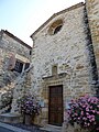
church located in Gard, in France  | |||||
| Upload media | |||||
| Instance of | |||||
|---|---|---|---|---|---|
| Location | Collorgues, canton of Saint-Chaptes | ||||
| Street address |
| ||||
 | |||||
Media in category "Temple protestant de Collorgues"
The following 9 files are in this category, out of 9 total.
-
 Saint-André de Collorgues.jpg 1,066 × 1,600; 476 KB
-
 Temple protestant de Collorgues (01).jpg 1,920 × 2,560; 788 KB
-
 Temple protestant de Collorgues (02).jpg 1,920 × 2,560; 902 KB
-
 Temple protestant de Collorgues (03).jpg 1,920 × 2,560; 693 KB
-
 Temple protestant de Collorgues (04).jpg 1,920 × 2,560; 771 KB
-
 Temple protestant de Collorgues (05).jpg 2,560 × 1,920; 1,000 KB
-
 Temple protestant de Collorgues (06).jpg 1,920 × 2,560; 2.02 MB
-
 Temple protestant de Collorgues (07).jpg 2,560 × 1,920; 2.97 MB
-
 Temple protestant et Château de Collorgues.jpg 2,305 × 1,813; 1.29 MB
.jpg)
.jpg)
.jpg)
.jpg)
.jpg)
.jpg)
.jpg)
