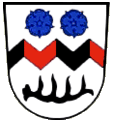
Category:Tettenweis

Từ Wikimedia Commons, kho lưu trữ phương tiện nội dung mở
Bước tới điều hướng Bước tới tìm kiếm
  Landkreis Passau: Aicha vorm Wald · Aidenbach · Aldersbach · Bad Füssing · Bad Griesbach im Rottal · Beutelsbach · Breitenberg · Büchlberg · Eging am See · Fürstenstein · Fürstenzell · Haarbach · Hauzenberg · Hofkirchen · Hutthurm · Kirchham · Kößlarn · Malching · Neuburg am Inn · Neuhaus am Inn · Neukirchen vorm Wald · Obernzell · Ortenburg · Pocking · Rotthalmünster · Ruderting · Ruhstorf an der Rott · Salzweg · Sonnen · Tettenweis · Thyrnau · Tiefenbach · Tittling · Untergriesbach · Vilshofen an der Donau · Wegscheid · Windorf · Witzmannsberg ·
<nowiki>Tettenweis; Tettenweis; Tettenweis; Tettenweis; Tettenweis; Tettenweis; Тэтэнвайс; Тетенвајс; 特滕魏斯; Tettenweis; Tettenweis; 特滕魏斯; Tettenweis; Теттенвайс; Теттенвайс; 特滕魏斯; Tettenweis; Теттенвайс; Tettenweis; Tettenweis; Tettenweis; Tettenweis; Tettenweis; Tettenweis; Теттенвайс; Tettenweis; Tettenweis; Tettenweis; Теттенвайс; Tettenweis; Tettenweis; Tettenvaýs; تەتتەنۆايس; Тетенвајс; Tettenweis; تتنوایس; Tettenweis; Tettenweis; Теттенвайс; Tettenweis; Tettenweis; Tettenweis; Թեթենվայս; Теттенвайс; Tetenvajs; Tettenweis (munisipyo); Tettenweis; تيتنفايس; 特滕魏斯; Tettenweis; chemun de la Germania; település Németországban; Gemeinde im niederbayerischen Landkreis Passau; municipality of Germany; komunë në Gjermani; Şaredariyeke Almanyayê; kumun alaman; kommune i Bayern i Tyskland; gemeente in Beieren; comune tedesco; commune allemande; بلدية ألمانية في ولاية بافاريا; gmejna w Bayerskej; municipality of Germany; komunumo en Bavario, Germanio; obec v zemském okresu Pasov v Německu; громада в Німеччині, федеральна земля Баварія; Теттенwеис; Теттенвайс; Tettenvays; Tettenweis</nowiki>
Tettenweis 
municipality of Germany
Tải lên phương tiện
Là một
  • non-urban municipality in Germany
Một phần của
  • Stimmkreis Passau-West (2018)
Vị tríPassau, Hạ Bayern, Bayern, Đức
Người đứng đầu chính quyền
  • Robert Stiglmayr
Dân số
  • 1.814 (2022)
Diện tích
  • 28,72 km² (1987)
  • 28,7 km² (2017)
Cao độ so với mực nước biển
  • 335 m
trang chủ chính thức
Map48° 26′ 00″ B, 13° 16′ 00″ Đ
Kiểm soát tính nhất quán
Wikidata Q506272
mã số VIAF: 244589063
định danh GND: 4119573-5
số quan hệ OpenStreetMap: 958098
Edit infobox data on Wikidata

Thể loại con

Thể loại này có 4 thể loại con sau, trên tổng số 4 thể loại con.

Tập tin trong thể loại “Tettenweis”

5 tập tin sau nằm trong thể loại này, trong tổng số 5 tập tin.