Category:Thame, Oxfordshire
Jump to navigation
Jump to search
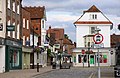
English: Thame (pronounced "Tame", with a silent "h") is a market town and civil parish in South Oxfordshire near the county boundary with Buckinghamshire. Its toponym is derived from the River Thame which flows past the north side of the town.
Deutsch: Thame ist eine Kleinstadt von rund 11.000 Einwohnern in Oxfordshire 20 Kilometer östlich von Oxford in South East England.
Español: Thame es una localidad británica perteneciente al Condado de Oxon, en el margen del Río Thame, 20 km al este de Oxford. Tenía una población de 10.886 habitantes en 2001.
Français : Thame est une ville à côté du fleuve la Thame dans l'Oxfordshire, en Angleterre. Elle se trouve 20 kilometres a l'est de Oxford.
Nederlands: Thame is een plaats in het bestuurlijke gebied South Oxfordshire, in het Engelse graafschap Oxfordshire, ongeveer 20 km ten oosten van Oxford. De plaats telt 10.886 inwoners.
Polski: Thame - miasto w Wielkiej Brytanii, w Anglii, w regionie South East England, w hrabstwie Oxfordshire.
Română: Thame este un oraş în comitatul Oxfordshire, regiunea South East, Anglia. Oraşul se află în districtul South Oxfordshire.
market town and civil parish in South Oxfordshire district, Oxfordshire, England  | |||||
| Upload media | |||||
| Instance of | |||||
|---|---|---|---|---|---|
| Location | South Oxfordshire, Oxfordshire, South East England, England | ||||
| Area |
| ||||
| official website | |||||
 | |||||
Subcategories
This category has the following 16 subcategories, out of 16 total.
B
- Benchmarks in Thame (34 F)
- Buses in Thame (32 F)
H
M
P
T
- Thame abbey (3 F)
- Thame Museum (2 F)
- Thame Park House (3 F)
- Thame railway station (4 F)
- Thame war memorial (18 F)
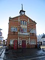
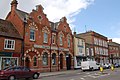
- Thame Town Hall (28 F)
- The Two Brewers, Thame (2 F)
V
Media in category "Thame, Oxfordshire"
The following 200 files are in this category, out of 408 total.
(previous page) (next page)-
 'Holly Bank', ^2 Elms Road - geograph.org.uk - 3691263.jpg 1,024 × 683; 156 KB
-
 'Regency Cottage', ^14 Aylesbury Road - geograph.org.uk - 3691219.jpg 1,024 × 683; 169 KB
-

-
 A harvested field by Kingsey Road - geograph.org.uk - 2537884.jpg 1,500 × 1,000; 330 KB
-
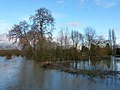
 A Small Flood by the Thame - geograph.org.uk - 4861690.jpg 4,000 × 3,000; 3.28 MB
-
 A tributary of Cuttle Brook - geograph.org.uk - 2666203.jpg 3,872 × 2,592; 6.72 MB
-
 A4129 Tythrop Way, Thame - geograph.org.uk - 5947463.jpg 1,024 × 684; 160 KB
-
 A4129 Tythrop Way, Thame - geograph.org.uk - 5947468.jpg 1,024 × 684; 219 KB
-

-
 Above the Door - geograph.org.uk - 3922113.jpg 1,024 × 768; 89 KB
-
 Acorns and oak leaves, near Thame - geograph.org.uk - 228229.jpg 638 × 640; 140 KB
-
 Allotments on the edge of Thame - geograph.org.uk - 1740083.jpg 3,872 × 2,592; 5.37 MB
-
 Allotments outside Thame - geograph.org.uk - 43174.jpg 640 × 480; 151 KB
-
 Approaching the roundabout on the A418, Thame - geograph.org.uk - 2522126.jpg 1,600 × 1,200; 516 KB
-
 Approaching the roundabout on the A418, Thame - geograph.org.uk - 2525022.jpg 1,600 × 1,200; 493 KB
-
 Approaching the Thame western roundabout - geograph.org.uk - 2678449.jpg 3,872 × 2,592; 3.63 MB
-
 Architectural evolution - geograph.org.uk - 1740153.jpg 3,872 × 2,592; 5.75 MB
-
 ASM of Thame - geograph.org.uk - 3021395.jpg 640 × 480; 66 KB
-
 Autumn morning south of Thame - geograph.org.uk - 2666200.jpg 3,872 × 2,592; 5.16 MB
-
 Autumn on An English Farm- Agriculture in Britain, 1941 D5074.jpg 800 × 537; 76 KB
-
 Aylesbury Road, Thame - geograph.org.uk - 5678326.jpg 1,974 × 1,432; 1.29 MB
-
 Aylesbury Road, Thame - geograph.org.uk - 5682685.jpg 2,048 × 1,536; 982 KB
-
 B4011 Island - geograph.org.uk - 2102963.jpg 800 × 600; 127 KB
-

-
 B4012 Howland Road, Thame - geograph.org.uk - 5947458.jpg 1,024 × 684; 191 KB
-
 B4012 Near Fanshawe Road - geograph.org.uk - 1449174.jpg 640 × 480; 77 KB
-
 B4445 approaching roundabout on Thame by-pass - geograph.org.uk - 5947451.jpg 1,024 × 684; 226 KB
-

-
 B4445 Garden City leaving Thame - geograph.org.uk - 4857098.jpg 640 × 480; 54 KB
-
 Barn by the by pass - geograph.org.uk - 4861674.jpg 3,479 × 2,519; 2.19 MB
-
 Bay of Bengal - geograph.org.uk - 6216558.jpg 5,577 × 3,718; 2.7 MB
-
 Bell Lane Mini-Roundabouts, Thame - geograph.org.uk - 1449231.jpg 640 × 480; 167 KB
-
 Bell Lane, Thame - geograph.org.uk - 1841393.jpg 3,008 × 2,000; 1.26 MB
-
 Bikes, buses and cars - geograph.org.uk - 1516362.jpg 640 × 427; 102 KB
-
 Black Horse Hotel - geograph.org.uk - 2787215.jpg 800 × 600; 118 KB
-
 Black Horse hotel, Thame - geograph.org.uk - 3927201.jpg 4,320 × 3,240; 3.83 MB
-
 Boundary Post in the Snow - geograph.org.uk - 6036612.jpg 3,456 × 5,184; 2.82 MB
-
 Bridleway past Kingsey Road Allotments - geograph.org.uk - 6211956.jpg 6,000 × 4,000; 3.94 MB
-
 Bring on the hounds - geograph.org.uk - 1520165.jpg 640 × 427; 98 KB
-
 Building in the Carpark - geograph.org.uk - 3924746.jpg 1,024 × 768; 125 KB
-
 Building site on southwest side of Southern Road - geograph.org.uk - 3691250.jpg 1,024 × 683; 108 KB
-
 Buildings of Moorend Lane Farm - geograph.org.uk - 4177949.jpg 3,648 × 2,736; 2.33 MB
-
 Buttermarket in Thame - geograph.org.uk - 1414299.jpg 640 × 416; 78 KB
-
 Buttermarket, Thame - geograph.org.uk - 1146737.jpg 640 × 426; 115 KB
-
 Buttermarket, Thame - geograph.org.uk - 3877450.jpg 4,320 × 3,240; 2.87 MB
-
 Chapel, Thame-geograph.jpg 572 × 366; 188 KB
-
 Chinnor Road roundabout, Thame - geograph.org.uk - 6075495.jpg 1,024 × 768; 128 KB
-
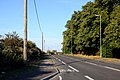
 Chinnor Road south of Thame - geograph.org.uk - 5501025.jpg 2,048 × 1,536; 1.61 MB
-
 Chinnor Road, Thame - geograph.org.uk - 4126068.jpg 1,024 × 815; 165 KB
-
 Chinnor Road, Thame - geograph.org.uk - 5678855.jpg 2,048 × 1,536; 1.4 MB
-
 Chinnor Road, Thame - geograph.org.uk - 5947456.jpg 1,024 × 684; 224 KB
-
 Chinnor Rugby Club - geograph.org.uk - 1740103.jpg 3,872 × 2,592; 3.24 MB
-
 Chinnor Rugby Club buildings - geograph.org.uk - 3230787.jpg 2,560 × 1,920; 1.07 MB
-
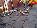
 Christmas street decorations being hung - geograph.org.uk - 3230840.jpg 2,560 × 1,920; 1.11 MB
-
 Church Road and Williams Almshouses, Thame - geograph.org.uk - 4126494.jpg 728 × 1,024; 149 KB
-
 A row of cottages on Churchill Crescent - geograph.org.uk - 1740112.jpg 3,872 × 2,592; 4.4 MB
-
 Churchill Crescent houses - geograph.org.uk - 3691660.jpg 1,024 × 683; 188 KB
-
 Classics on show - geograph.org.uk - 1516266.jpg 640 × 427; 68 KB
-
 Clock Repairs, Park Street - geograph.org.uk - 3435175.jpg 2,334 × 1,818; 972 KB
-

-
 Coombe Hill Crescent, Thame - geograph.org.uk - 2813725.jpg 640 × 480; 122 KB
-
 Cornmarket at the junction of Aylesbury Road - geograph.org.uk - 5682687.jpg 2,048 × 1,536; 836 KB
-
 Cornmarket Thame - geograph.org.uk - 3923323.jpg 1,024 × 768; 151 KB
-
 Cornmarket, Thame - geograph.org.uk - 1146649.jpg 640 × 410; 97 KB
-
 Cornmarket, Thame - geograph.org.uk - 3877445.jpg 4,320 × 3,240; 2.92 MB
-
 Cotmore Wells Farm - geograph.org.uk - 6216527.jpg 5,799 × 3,866; 3.31 MB
-
 Cottages on North Street - geograph.org.uk - 3924937.jpg 1,024 × 768; 156 KB
-
 County boundary marker - geograph.org.uk - 3852252.jpg 1,000 × 1,364; 1.19 MB
-
 Cows near Keepers Cottage - geograph.org.uk - 6212731.jpg 5,502 × 3,668; 4.63 MB
-
-
 Cromwell Avenue in Thame - geograph.org.uk - 2537891.jpg 1,500 × 1,000; 156 KB
-
 Cromwell Avenue junction with A4129, Thame - geograph.org.uk - 4177865.jpg 3,648 × 2,736; 2.49 MB
-
 Cromwell Avenue, Thame - geograph.org.uk - 1740094.jpg 3,872 × 2,592; 3.37 MB
-
 Cromwell Avenue, Thame - geograph.org.uk - 4177850.jpg 3,648 × 2,736; 1.96 MB
-

-
 Cut through in Thame - geograph.org.uk - 6216546.jpg 6,000 × 4,000; 4.38 MB
-
 Cuttle Brook - geograph.org.uk - 5747449.jpg 6,000 × 4,000; 6.69 MB
-
 Daf offices on Howland Road - geograph.org.uk - 4875541.jpg 2,048 × 1,536; 1.09 MB
-
 Dilapidated Gatehouse - geograph.org.uk - 1146762.jpg 640 × 426; 143 KB
-
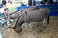 Donkeys at the show - geograph.org.uk - 1516368.jpg 640 × 427; 114 KB
-
 Double bend on Thame Park Road - geograph.org.uk - 5492829.jpg 2,048 × 1,536; 1.51 MB
-
 Drainage channel near Thame - geograph.org.uk - 6211964.jpg 6,000 × 4,000; 5.08 MB
-
 Driveway to Thame Park House - geograph.org.uk - 3434785.jpg 2,454 × 1,806; 1.66 MB
-
 Driveway to Thame Park House - geograph.org.uk - 5492826.jpg 2,048 × 1,536; 1.46 MB
-
 East end of Wenman Road, Thame - geograph.org.uk - 6075494.jpg 1,024 × 768; 105 KB
-

-
 Entrance to Thame Business Park - geograph.org.uk - 952220.jpg 640 × 427; 248 KB
-

-
 Evening in Church Road, Thame - geograph.org.uk - 4137872.jpg 758 × 1,024; 160 KB
-
 Evening sunshine on the Town Hall - geograph.org.uk - 2130175.jpg 800 × 600; 92 KB
-
 Factory in Thame - geograph.org.uk - 39180.jpg 640 × 481; 203 KB
-
 Faded allotment sign - geograph.org.uk - 3230775.jpg 2,560 × 1,920; 949 KB
-
 Family day out - geograph.org.uk - 1516398.jpg 640 × 427; 123 KB
-
 Farmland and track, Thame - geograph.org.uk - 2813716.jpg 640 × 480; 141 KB
-
 Farmland, Thame - geograph.org.uk - 2813639.jpg 640 × 480; 146 KB
-
 Farmland, Thame - geograph.org.uk - 2813677.jpg 640 × 480; 138 KB
-
 Farmland, Thame - geograph.org.uk - 2813682.jpg 640 × 480; 154 KB
-
 Field between New Park and Thame Park - geograph.org.uk - 5512799.jpg 3,648 × 2,736; 4.01 MB
-
 Field by Town Farm Lane - geograph.org.uk - 5747491.jpg 6,000 × 4,000; 5.11 MB
-
 Field entrance near Thame - geograph.org.uk - 2678461.jpg 3,872 × 2,592; 5.72 MB
-
 Fields By Wenman Road - geograph.org.uk - 1449212.jpg 640 × 480; 73 KB
-
 Fields East Of Thame - geograph.org.uk - 1449181.jpg 640 × 480; 207 KB
-
 Fields Off Town Farm Lane - geograph.org.uk - 1449242.jpg 640 × 480; 200 KB
-
 Figaro's Barber, Thame - geograph.org.uk - 5678327.jpg 1,968 × 1,422; 899 KB
-
 Filling Station Scene - geograph.org.uk - 6152761.jpg 800 × 600; 120 KB
-
 Fire Mark on the Cottage - geograph.org.uk - 3924742.jpg 1,024 × 768; 168 KB
-
 First pond in Oxfordshire - geograph.org.uk - 6058785.jpg 5,152 × 3,864; 3.59 MB
-
 Flag on the Town Hall - geograph.org.uk - 3921944.jpg 600 × 800; 85 KB
-
 Footbridge and gate on path out of New Park, Thame - geograph.org.uk - 5512791.jpg 3,648 × 2,736; 3.89 MB
-
 Footbridge in Thame Park - geograph.org.uk - 3434779.jpg 2,560 × 1,920; 2.26 MB
-
 Footbridge on path from Thame Park to Sydenham - geograph.org.uk - 5512889.jpg 2,545 × 3,394; 2.2 MB
-
 Footpath in Thame Park - geograph.org.uk - 5791167.jpg 6,000 × 4,000; 7.31 MB
-

-
 Footpath to Haddenham - geograph.org.uk - 3230771.jpg 2,560 × 1,920; 958 KB
-
 Red leather seats - geograph.org.uk - 1516350.jpg 640 × 427; 84 KB
-
 Former Pub on North Street - geograph.org.uk - 3924925.jpg 1,024 × 768; 138 KB
-
 Fountain at the Memorial - geograph.org.uk - 3923385.jpg 1,024 × 768; 195 KB
-
 Frosty Field by Wenman Road - geograph.org.uk - 1146596.jpg 640 × 426; 172 KB
-
 Gas Depot near Thame - geograph.org.uk - 4044943.jpg 1,600 × 1,277; 697 KB
-
 Gas works at Thame - geograph.org.uk - 32927.jpg 640 × 480; 112 KB
-
 Gate and footbridge on footpath to Scotsgrove Mill - geograph.org.uk - 4178193.jpg 3,648 × 2,736; 4.61 MB
-
 Gate and Grid - geograph.org.uk - 4377178.jpg 4,000 × 3,000; 2.35 MB
-
 Gate stile - geograph.org.uk - 3230743.jpg 2,560 × 1,920; 989 KB
-
 Gate with stile - geograph.org.uk - 3230756.jpg 2,560 × 1,920; 996 KB
-
 Gateway to farmland east of Thame - geograph.org.uk - 6075512.jpg 1,024 × 768; 218 KB
-
 Ghost sign over the shop - geograph.org.uk - 3921934.jpg 1,024 × 768; 189 KB
-
 Great Taste Award - geograph.org.uk - 3922121.jpg 1,024 × 768; 120 KB
-
 Groves - geograph.org.uk - 6216532.jpg 6,000 × 4,000; 6.8 MB
-
 Hairdresser on the corner - geograph.org.uk - 3924929.jpg 1,024 × 768; 174 KB
-
 Ham Wood, Thame - geograph.org.uk - 4177930.jpg 3,648 × 2,736; 3.74 MB
-
 He's a big boy - geograph.org.uk - 1516391.jpg 640 × 427; 81 KB
-
 Here come the hounds - geograph.org.uk - 1520183.jpg 640 × 427; 65 KB
-
 Horse delivery - geograph.org.uk - 1516255.jpg 640 × 427; 81 KB
-
 House Construction On Oxford Road, Thame - geograph.org.uk - 1449247.jpg 640 × 480; 192 KB
-
 House on Aylesbury Road, Thame - geograph.org.uk - 5682686.jpg 2,048 × 1,536; 912 KB
-
 House on the Corner - geograph.org.uk - 3924735.jpg 600 × 800; 92 KB
-
 Houses and Memorial, Moreton - geograph.org.uk - 3175684.jpg 1,600 × 1,065; 408 KB
-
 Houses backing on to Tythrop Way, Thame - geograph.org.uk - 4873095.jpg 2,048 × 1,536; 1.47 MB
-
 Houses in Astley Road, Thame - geograph.org.uk - 43173.jpg 640 × 480; 103 KB
-
 Houses in the Snow, Aylesbury Road - geograph.org.uk - 6036644.jpg 4,841 × 2,908; 2.02 MB
-
 Houses in Vane Road, Thame - geograph.org.uk - 43172.jpg 640 × 480; 119 KB
-
 Houses on Cotmore Gardens, Thame - geograph.org.uk - 5501026.jpg 2,048 × 1,536; 1.51 MB
-
 Houses on Garden City, Thame - geograph.org.uk - 5492907.jpg 2,048 × 1,536; 1.5 MB
-
 Houses on Kingsey Road, Thame - geograph.org.uk - 4878375.jpg 1,994 × 1,460; 916 KB
-
 Houses on North Street - geograph.org.uk - 3690266.jpg 1,024 × 683; 155 KB
-
 Houses on Thame Park Road - geograph.org.uk - 5492840.jpg 2,040 × 1,526; 662 KB
-
 Howland Road at the junction of Chinnor Road - geograph.org.uk - 4875534.jpg 2,048 × 1,536; 945 KB
-
 Howland Road, Thame - geograph.org.uk - 6075516.jpg 1,024 × 768; 163 KB
-
 Island Approach - geograph.org.uk - 2787201.jpg 800 × 600; 102 KB
-
 It's the sheep show - geograph.org.uk - 1516277.jpg 640 × 427; 74 KB
-
 Jewellers at the 6 1-2d Bazaar - geograph.org.uk - 3738428.jpg 1,600 × 967; 324 KB
-
 John Fothergill - geograph.org.uk - 3923320.jpg 600 × 800; 110 KB
-
 Judd's Lane - geograph.org.uk - 3155440.jpg 3,072 × 2,304; 1.26 MB
-
 Junction of Bull Lane and North Street - geograph.org.uk - 3691771.jpg 1,024 × 683; 168 KB
-
 Junction of Chinnor Road and Queens Road - geograph.org.uk - 3691312.jpg 1,024 × 683; 145 KB
-
-
 Kingsey Road - geograph.org.uk - 1449194.jpg 640 × 480; 90 KB
-
 Kingsey Road Allotments - geograph.org.uk - 6211954.jpg 6,000 × 4,000; 5.35 MB
-
 Kingsey Road entering Thame - geograph.org.uk - 4878374.jpg 2,020 × 1,498; 844 KB
-
 Kingsey Road in Thame - geograph.org.uk - 2537870.jpg 1,500 × 1,000; 202 KB
-
 Kingsey Road in Thame - geograph.org.uk - 2537880.jpg 1,500 × 1,000; 159 KB
-

-
 Kingsey Road, Thame - geograph.org.uk - 1740099.jpg 3,872 × 2,592; 3.06 MB
-
 Lacey Drive, Thame - geograph.org.uk - 6078251.jpg 1,024 × 768; 153 KB
-
 LloydsTSB and the Spread Eagle in Cornmarket, Thame - geograph.org.uk - 1841383.jpg 3,008 × 2,000; 1.53 MB
-
 Loft Lights or Solar Panels^ - geograph.org.uk - 4376679.jpg 1,600 × 1,029; 294 KB
-
 Lombardy poplars reflected - geograph.org.uk - 3852267.jpg 1,000 × 1,195; 967 KB
-
 Managers' dugouts at the ASM Stadium - geograph.org.uk - 2237370.jpg 1,500 × 968; 115 KB
-
 Marooned trees, Thame - geograph.org.uk - 3852269.jpg 1,333 × 1,000; 1.19 MB
-
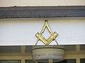
 Masons' Hall - geograph.org.uk - 3922110.jpg 600 × 800; 75 KB
-
 Minion on an island, Aylesbury Road, Thame - geograph.org.uk - 5496936.jpg 1,220 × 1,858; 761 KB
-
 Mix96 radio - geograph.org.uk - 1516283.jpg 640 × 427; 65 KB
-
 Moo, Kick, Ouch - geograph.org.uk - 3168990.jpg 1,600 × 1,007; 383 KB
-
 Moorend Lane Farm, Thame - geograph.org.uk - 4177945.jpg 3,648 × 2,736; 2.91 MB
-
 Moorend Lane Restoration Facility, Thame - geograph.org.uk - 4177906.jpg 3,648 × 2,736; 2 MB
-
 Moorend Lane, Thame - geograph.org.uk - 4177967.jpg 3,648 × 2,736; 3.96 MB
-
 Moorend Lane, Thame - geograph.org.uk - 6034385.jpg 5,184 × 3,456; 4.46 MB
-
 Moreton Road junction, A329 - geograph.org.uk - 3021421.jpg 640 × 480; 93 KB
-
 Nelson Street, Thame - geograph.org.uk - 4878380.jpg 1,982 × 1,444; 914 KB
-
 Newitt and Sons - geograph.org.uk - 1970415.jpg 800 × 600; 120 KB
-
 No Sitting Out Today - geograph.org.uk - 6036648.jpg 5,184 × 3,456; 3.29 MB
-
 North Gate, Thame Park - geograph.org.uk - 3434794.jpg 2,501 × 1,809; 1.79 MB
-
 North Street, Thame - geograph.org.uk - 1146731.jpg 640 × 426; 98 KB
-
 Northern End Of Town Farm Lane - geograph.org.uk - 1449238.jpg 640 × 480; 269 KB
-
 Not so big - geograph.org.uk - 1516395.jpg 640 × 427; 86 KB
-
 Office on the edge of Thame - geograph.org.uk - 3988399.jpg 4,000 × 3,000; 2.66 MB
-
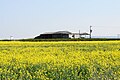 Oil seed rape by Kingsey Road - geograph.org.uk - 6211961.jpg 6,000 × 4,000; 5.71 MB
-
 Old house, Priestend, Thame, Oxon - geograph.org.uk - 5612138.jpg 1,024 × 683; 224 KB
-
 Old Milepost (geograph 6098164).jpg 480 × 640; 130 KB
-
 On the Run - geograph.org.uk - 2102968.jpg 800 × 600; 120 KB
-
 One of the entrances to Thame Park - geograph.org.uk - 2666207.jpg 3,872 × 2,592; 6.66 MB
-
 Open Space among the Houses - geograph.org.uk - 2246293.jpg 3,648 × 2,736; 1,007 KB
-
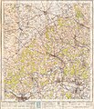 Ordnance Survey One-Inch Sheet 159 The Chilterns, Published 1945.jpg 8,187 × 9,575; 12.08 MB
-
 Ordnance Survey One-Inch Sheet 159 The Chilterns, Published 1959.jpg 8,360 × 9,976; 12.12 MB
-
 Ordnance Survey One-Inch Sheet 159 The Chilterns, Published 1968.jpg 8,355 × 9,915; 11.81 MB
-
 Ornamental gate to Thame Park House - geograph.org.uk - 5513017.jpg 3,648 × 2,736; 3.03 MB
-
 Over sized baubles - geograph.org.uk - 3230842.jpg 2,560 × 1,920; 1.07 MB
-
 Oxford Road at Thame boundary - geograph.org.uk - 4853208.jpg 640 × 480; 47 KB
-
 Oxford Road to Thame - geograph.org.uk - 2537864.jpg 1,500 × 1,000; 260 KB
-
 Oxford Road, Thame - geograph.org.uk - 4853209.jpg 640 × 480; 54 KB


.jpg)


