Category:The Cheviot
Jump to navigation
Jump to search
highest summit in the Cheviot Hills, England  | |||||
| Upload media | |||||
| Instance of | |||||
|---|---|---|---|---|---|
| Made from material | |||||
| Located in protected area | |||||
| Location | Northumberland, North East England, England | ||||
| Mountain range | |||||
| Elevation above sea level |
| ||||
| Parent peak |
| ||||
 | |||||

Subcategories
This category has the following 7 subcategories, out of 7 total.
Media in category "The Cheviot"
The following 43 files are in this category, out of 43 total.
-
 B17 Undercarriage The Cheviot.jpg 3,648 × 2,736; 2.4 MB
-
 Causeway across the Cheviot plateau - geograph.org.uk - 1421280.jpg 640 × 480; 62 KB
-
 South East from Madam Law - geograph.org.uk - 150700.jpg 640 × 405; 107 KB
-
 Cheviot summit - geograph.org.uk - 14254.jpg 383 × 550; 29 KB
-
 Cheviot0410a.jpg 720 × 398; 82 KB
-
 Elsdonburn - geograph.org.uk - 160818.jpg 640 × 418; 85 KB
-
 Hare Law - geograph.org.uk - 146936.jpg 640 × 480; 148 KB
-
 Hedgehope from summit of Cheviot - geograph.org.uk - 1475909.jpg 640 × 333; 45 KB
-
 On the Pennine Way, White Law - geograph.org.uk - 1740351.jpg 4,000 × 3,000; 2.58 MB
-
 Ordnance Survey One-Inch Sheet 71 Alnwick, Published 1947.jpg 10,849 × 12,736; 16.19 MB
-
 Ordnance Survey One-inch Sheet 71 Alnwick, Published 1965.jpg 8,193 × 9,887; 10.43 MB
-
 Ordnance Survey One-Inch Sheet 81 Kelso, Published 1926.jpg 9,898 × 7,756; 9.62 MB
-
 Ordnance Survey Sheet NT 92 Wooler, Published 1954.jpg 7,392 × 7,498; 4.79 MB
-
 Path crossing summit of The Cheviot - geograph.org.uk - 209093.jpg 640 × 481; 126 KB
-
 Pennine Way at Cairn Hill - geograph.org.uk - 4244677.jpg 800 × 670; 187 KB
-
 Ring Chesters hill fort - geograph.org.uk - 1726429.jpg 1,024 × 768; 191 KB
-

-
 Stile on The Cheviot - geograph.org.uk - 3798573.jpg 480 × 640; 86 KB
-
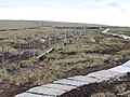
 Stone-laid path at summit of The Cheviot - geograph.org.uk - 5061051.jpg 1,500 × 771; 939 KB
-
 The Border Fence on the Pennine Way - geograph.org.uk - 1049381.jpg 640 × 427; 133 KB
-
 The Cheviot - geograph.org.uk - 1041136.jpg 640 × 480; 47 KB
-
 The Cheviot - geograph.org.uk - 17172.jpg 640 × 480; 123 KB
-
 The Cheviot - geograph.org.uk - 17193.jpg 640 × 480; 199 KB
-
 The Cheviot - geograph.org.uk - 18375.jpg 640 × 480; 106 KB
-
 The Cheviot - geograph.org.uk - 246415.jpg 640 × 486; 65 KB
-
 The Cheviot - geograph.org.uk - 3377908.jpg 2,592 × 1,944; 1.37 MB
-
 The Cheviot - geograph.org.uk - 4722412.jpg 4,896 × 3,264; 2.69 MB
-
 The Cheviot - geograph.org.uk - 5219897.jpg 1,600 × 1,067; 120 KB
-
 The Cheviot capped by cloud - geograph.org.uk - 1814250.jpg 3,872 × 2,592; 1.85 MB
-
 The Cheviot from Broadhope Hill.jpg 2,848 × 2,136; 1.7 MB
-
 The Cheviot Hills - geograph.org.uk - 756937.jpg 640 × 480; 41 KB
-
 The Cheviot Summit - geograph.org.uk - 3154872.jpg 1,198 × 735; 166 KB
-
 The Cheviot Summit.jpg 640 × 480; 275 KB
-
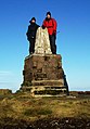
 The Cheviot triangulation pillar - geograph.org.uk - 1999838.jpg 436 × 639; 159 KB
-
 The Cheviot trig point - geograph.org.uk - 279853.jpg 640 × 480; 55 KB
-
 The Cheviot under snow - geograph.org.uk - 1270727.jpg 640 × 359; 37 KB
-
 The Cheviot, north-west from Comb Fell - geograph.org.uk - 2877578.jpg 3,000 × 1,324; 1.43 MB
-
 The Cheviot, Summit 815m - geograph.org.uk - 268115.jpg 640 × 480; 104 KB
-
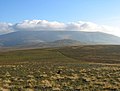
 The Cheviots - geograph.org.uk - 677485.jpg 640 × 374; 70 KB
-
 Trig pillar on Cheviot summit - geograph.org.uk - 2879122.jpg 1,024 × 768; 235 KB
-
 Trig pillar on the Cheviot - geograph.org.uk - 2680664.jpg 480 × 640; 55 KB
-
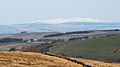
 View from Longknowe Hill - geograph.org.uk - 165359.jpg 640 × 401; 69 KB
-


