Category:Thelveton
Jump to navigation
Jump to search
English: Thelveton (historically Thelton, earlier Telvetun) is a village in the district of South Norfolk in the county of Norfolk, England. Its post town is Diss.
| Object location | | View all coordinates using: OpenStreetMap |
|---|
village in United Kingdom  | |||||
| Upload media | |||||
| Instance of |
| ||||
|---|---|---|---|---|---|
| Location | Scole, South Norfolk, Norfolk, East of England, England | ||||
 | |||||
Subcategories
This category has the following 2 subcategories, out of 2 total.
A
T
- Thelveton Hall, Norfolk (7 F)
Media in category "Thelveton"
The following 20 files are in this category, out of 20 total.
-
 A stile in the hedge - geograph.org.uk - 1764739.jpg 480 × 640; 162 KB
-
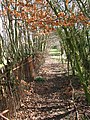 An alleyway of trees - geograph.org.uk - 1764756.jpg 480 × 640; 220 KB
-
 Barn conversion at Grange Farm - geograph.org.uk - 1765298.jpg 640 × 480; 133 KB
-

-
 Cattle pasture south of Church Road - geograph.org.uk - 1764769.jpg 640 × 480; 118 KB
-

-
 Driveway to St Andrew's church - geograph.org.uk - 1764804.jpg 640 × 480; 117 KB
-

-
 Norwich Road, Thelveton - geograph.org.uk - 4248626.jpg 3,072 × 2,268; 2.02 MB
-
 Old Milestone - geograph.org.uk - 1207456.jpg 480 × 640; 145 KB
-

-
 The farmhouse at Grange Farm - geograph.org.uk - 1765293.jpg 640 × 480; 147 KB
-
 To Frenze on Boudica's Way - geograph.org.uk - 1764734.jpg 640 × 471; 120 KB
-
 To Norwich 18 - geograph.org.uk - 1207452.jpg 640 × 480; 124 KB
-
 To Thelveton on Boudica's Way - geograph.org.uk - 1764746.jpg 640 × 480; 155 KB
-

-
 View across the pond by Grange Farm - geograph.org.uk - 1765303.jpg 640 × 480; 167 KB
-
 View north along Church Road - geograph.org.uk - 1764741.jpg 640 × 480; 110 KB
-
 Looking North - geograph.org.uk - 344123.jpg 640 × 480; 95 KB
-
 Roundabout Ahead - geograph.org.uk - 344216.jpg 640 × 480; 87 KB


