Category:Tide Mills, East Sussex
Jump to navigation
Jump to search
derelict village in East Sussex, United Kingdom  | |||||
| Upload media | |||||
| Instance of | |||||
|---|---|---|---|---|---|
| Location | Seaford, Lewes, East Sussex, South East England, England | ||||
 | |||||
Cymraeg: Pentref a chymuned yn Nwyrain Sussex, Lloegr, ydy Tide Mills, Dwyrain Sussex; saif yn Ne-ddwyrain Lloegr. (→Tide Mills, Dwyrain Sussex)
English: Tide Mills is a derelict village in East Sussex, England. It lies about two kilometres (1.2 miles) south east of Newhaven and four kilometres (2.5 miles) north west of Seaford and is near both Bishopstone and East Blatchington. The village was abandoned in 1939. (→Tide Mills, East Sussex)
Polski: Tide Mills – wieś w Anglii, w hrabstwie East Sussex, w dystrykcie Lewes. Leży 82 km na południe od Londynu. (→Tide Mills (East Sussex))

Subcategories
This category has only the following subcategory.
B
Media in category "Tide Mills, East Sussex"
The following 40 files are in this category, out of 40 total.
-

-
 Beach, Bishopstone - geograph.org.uk - 4441040.jpg 640 × 428; 133 KB
-
 Breakwater outside West Pier, Newhaven - geograph.org.uk - 2622008.jpg 2,558 × 2,309; 2.19 MB
-
-
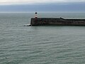
 East Pier Lighthouse - geograph.org.uk - 3798851.jpg 2,048 × 3,072; 984 KB
-
 Eastern breakwater, Newhaven Harbour - geograph.org.uk - 3447672.jpg 1,024 × 664; 119 KB
-
 Former Railway Line, Tide Mills - geograph.org.uk - 592511.jpg 640 × 479; 160 KB
-
 Head of East Pier, Newhaven Harbour - geograph.org.uk - 2622017.jpg 3,648 × 2,736; 2.26 MB
-
 Looking towards Newhaven from Seaford - geograph.org.uk - 4558723.jpg 1,024 × 768; 170 KB
-
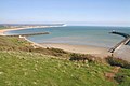
 Newhaven Bay - geograph.org.uk - 3572410.jpg 1,600 × 625; 222 KB
-
 Newhaven East Pier - geograph.org.uk - 1963234.jpg 640 × 428; 95 KB
-
 Newhaven East Pier - towards the end - geograph.org.uk - 1964132.jpg 640 × 428; 75 KB
-
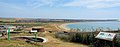
 Newhaven Harbour and breakwater, from Bishopstone, 1996 - geograph.org.uk - 4201244.jpg 2,382 × 1,460; 2.97 MB
-
 Newhaven Harbour, end of West Pier - geograph.org.uk - 2621982.jpg 3,648 × 2,736; 1.96 MB
-
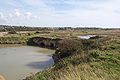
 Newhaven tidemills - geograph.org.uk - 1094177.jpg 600 × 450; 161 KB
-
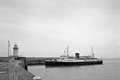
 Newhaven to Dieppe ferry - geograph.org.uk - 6414635.jpg 5,202 × 3,465; 2.32 MB
-
 Outward Bound - geograph.org.uk - 4781585.jpg 2,399 × 1,599; 544 KB
-
 Remains of Tide Mills mill race sluice - millpond side.jpg 2,160 × 1,440; 1.2 MB
-
 Remains of Tide Mills mill race sluice - seaward side.jpg 2,160 × 1,440; 814 KB
-
-

-
 Sailing in Seaford Bay - geograph.org.uk - 3581319.jpg 1,181 × 801; 163 KB
-
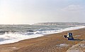
 Seaford Bay - geograph.org.uk - 3555188.jpg 1,180 × 785; 163 KB
-
 Seaford Bay - geograph.org.uk - 4781575.jpg 2,399 × 1,599; 530 KB
-
 Seaford bay, looking towards Newhaven breakwater - geograph.org.uk - 6414441.jpg 5,202 × 3,465; 2.95 MB
-
 Ships and breakwater from Newhaven beach - geograph.org.uk - 6414643.jpg 5,202 × 3,465; 2.6 MB
-
 Southern End of Mill Drove - geograph.org.uk - 718354.jpg 640 × 479; 87 KB
-
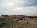
 Tide Mills Village - geograph.org.uk - 592541.jpg 640 × 479; 138 KB
-
 Vanguard Way, Tidemills - geograph.org.uk - 718335.jpg 479 × 640; 90 KB
-
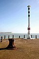
 Western Breakwater and lighthouse - geograph.org.uk - 4663901.jpg 1,152 × 864; 263 KB
-
 Collapsed Wall, Tide Mills - geograph.org.uk - 592442.jpg 479 × 640; 151 KB
-
 Fields near Tide Mills site - geograph.org.uk - 1410221.jpg 640 × 480; 50 KB
-
 Former Slipway, Tide Mills - geograph.org.uk - 592383.jpg 479 × 640; 163 KB
-
 Former Sluice Gates, Tide Mills - geograph.org.uk - 592397.jpg 640 × 479; 116 KB
-
 Level Crossing at Tide Mills - geograph.org.uk - 723239.jpg 640 × 417; 77 KB
-
 Mill Pond - geograph.org.uk - 592477.jpg 640 × 450; 153 KB
-
 Remains of Chailey Marine Hospital - geograph.org.uk - 592496.jpg 640 × 479; 181 KB
-
 Ruins, Tide Mills - geograph.org.uk - 592458.jpg 640 × 479; 162 KB
-
 Site of Former Mill, Tide Mills - geograph.org.uk - 592519.jpg 640 × 479; 138 KB
-
 Tide Mills Village - geograph.org.uk - 592375.jpg 640 × 479; 124 KB


