Category:Tiefenbach (near Landshut)
Jump to navigation
Jump to search
municipality in the district of Landshut in Upper Bavaria, Germany    | |||||
| Upload media | |||||
| Instance of |
| ||||
|---|---|---|---|---|---|
| Part of |
| ||||
| Location | Landshut, Lower Bavaria, Bavaria, Germany | ||||
| Head of government |
| ||||
| Population |
| ||||
| Area |
| ||||
| Elevation above sea level |
| ||||
| Different from | |||||
| official website | |||||
 | |||||
Subcategories
This category has the following 4 subcategories, out of 4 total.
Media in category "Tiefenbach (near Landshut)"
The following 6 files are in this category, out of 6 total.
-
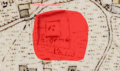
 Burgstall Schloßberg (Tiefenbach).PNG 706 × 446; 776 KB
-
 Gemeindewappen Tiefenbach bei Landshut.svg 459 × 492; 82 KB
-
 Gemeindewappen Tiefenbach Lkr. Landshut.svg 522 × 567; 184 KB
-
 Tiefenbach - Lage im Landkreis.png 169 × 185; 24 KB
-
 Tiefenbach in LA.svg 1,425 × 1,538; 3.24 MB
-
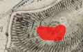
 Turmhügel Heidenkam.PNG 656 × 388; 595 KB
.PNG)


