Category:Tino Island lighthouse
Jump to navigation
Jump to search
| Object location | | View all coordinates using: OpenStreetMap |
|---|
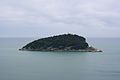
English: Tino Island lighthouse
lighthouse in Italy  | |||||
| Upload media | |||||
| Instance of | |||||
|---|---|---|---|---|---|
| Location | Porto Venere, Province of La Spezia, Liguria, Italy | ||||
| Located in or next to body of water | |||||
| Service entry |
| ||||
| Inception |
| ||||
| Significant event |
| ||||
| Source of energy | |||||
| Height |
| ||||
 | |||||
Media in category "Tino Island lighthouse"
The following 2 files are in this category, out of 2 total.
-
 Faro dell'isola del Tino-Flickr.jpg 1,810 × 1,282; 1.28 MB
-
 Isola del Tino - Panorama.jpg 2,896 × 1,936; 653 KB
