Category:Toke Atoll
Jump to navigation
Jump to search
atoll in the Marshall Islands | |||||
| Upload media | |||||
| Instance of | |||||
|---|---|---|---|---|---|
| Part of | |||||
| Location | MH | ||||
| Located in or next to body of water | |||||
| Area |
| ||||
| Elevation above sea level |
| ||||
| Different from | |||||
 | |||||
Media in category "Toke Atoll"
The following 6 files are in this category, out of 6 total.
-
Bravo Fallout.jpg 813 × 639; 116 KB
-
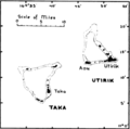
Map of Utrik and Taka Atoll.png 384 × 381; 36 KB
-
Taka Atoll - EVS Precision Map (1-100,000).jpg 1,276 × 885; 61 KB
-
Taka Atoll - Landsat N-59-10 2000 Image (1-100,000).jpg 1,276 × 885; 46 KB
-
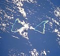
Toke.jpg 4,112 × 4,088; 2.24 MB
-
Toke2.jpg 2,776 × 2,584; 995 KB


