Category:Tolhuis (Wapenveld)
Jump to navigation
Jump to search
| Object location | | View all coordinates using: OpenStreetMap |
|---|
 | |||||
| Upload media | |||||
| Instance of | |||||
|---|---|---|---|---|---|
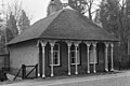
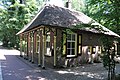
| Location | Wapenveld, Heerde, Gelderland, Netherlands | ||||
| Street address |
| ||||
| Located on street |
| ||||
| Heritage designation |
| ||||
 | |||||
|
This is a category about rijksmonument number 21140
|
| Address |
|
Media in category "Tolhuis (Wapenveld)"
The following 2 files are in this category, out of 2 total.
-
 Aanzicht - Wapenveld - 20105597 - RCE.jpg 1,200 × 799; 282 KB
-
 Wapenveld21140.jpg 4,288 × 2,848; 6.23 MB
